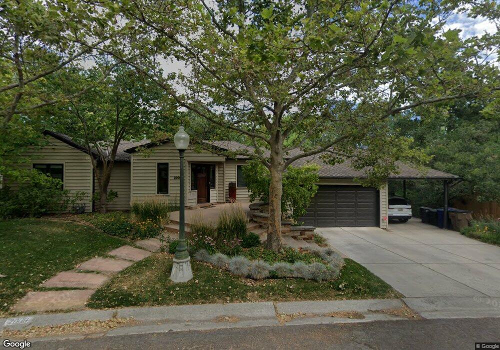
2006 Sheridan Rd Salt Lake City, UT 84108
Bonneville Hills NeighborhoodEstimated Value: $1,002,000 - $1,138,304
4
Beds
3
Baths
1,361
Sq Ft
$796/Sq Ft
Est. Value
About This Home
This home is located at 2006 Sheridan Rd, Salt Lake City, UT 84108 and is currently estimated at $1,083,076, approximately $795 per square foot. 2006 Sheridan Rd is a home located in Salt Lake County with nearby schools including Bonneville School, Clayton Middle School, and East High School.
Ownership History
Date
Name
Owned For
Owner Type
Purchase Details
Closed on
Aug 5, 2002
Sold by
Thomas John R and Lawton Jennifer
Bought by
Thomas John Robert and Lawton Jennifer Cook
Current Estimated Value
Home Financials for this Owner
Home Financials are based on the most recent Mortgage that was taken out on this home.
Original Mortgage
$152,589
Outstanding Balance
$17,168
Interest Rate
3.62%
Estimated Equity
$1,065,908
Purchase Details
Closed on
Aug 13, 1999
Sold by
Hunt Verl F and Hunt Janet Graham
Bought by
Thomas John R and Lawton Jennifer
Purchase Details
Closed on
Apr 16, 1998
Sold by
Hunt Verl F and Graham Jan
Bought by
Hunt Verl F and Hunt Janet Graham
Home Financials for this Owner
Home Financials are based on the most recent Mortgage that was taken out on this home.
Original Mortgage
$195,000
Interest Rate
7.18%
Create a Home Valuation Report for This Property
The Home Valuation Report is an in-depth analysis detailing your home's value as well as a comparison with similar homes in the area
Home Values in the Area
Average Home Value in this Area
Purchase History
| Date | Buyer | Sale Price | Title Company |
|---|---|---|---|
| Thomas John Robert | -- | First American Title | |
| Thomas John R | -- | First American Title | |
| Thomas John R | -- | Landmark Title | |
| Hunt Verl F | -- | Superior Title Company |
Source: Public Records
Mortgage History
| Date | Status | Borrower | Loan Amount |
|---|---|---|---|
| Open | Thomas John R | $152,589 | |
| Previous Owner | Hunt Verl F | $195,000 | |
| Closed | Thomas John R | $50,000 |
Source: Public Records
Tax History Compared to Growth
Tax History
| Year | Tax Paid | Tax Assessment Tax Assessment Total Assessment is a certain percentage of the fair market value that is determined by local assessors to be the total taxable value of land and additions on the property. | Land | Improvement |
|---|---|---|---|---|
| 2025 | -- | $1,073,200 | $302,100 | $771,100 |
| 2024 | -- | $1,006,600 | $288,400 | $718,200 |
| 2023 | $1,210 | $982,700 | $277,300 | $705,400 |
| 2022 | $1,210 | $951,700 | $271,900 | $679,800 |
| 2021 | $420 | $865,600 | $221,400 | $644,200 |
| 2020 | $41 | $762,200 | $242,900 | $519,300 |
| 2019 | $376 | $703,500 | $221,300 | $482,200 |
| 2018 | $0 | $634,800 | $221,300 | $413,500 |
| 2017 | $996 | $627,600 | $221,300 | $406,300 |
| 2016 | $996 | $629,100 | $205,300 | $423,800 |
| 2015 | $335 | $482,100 | $197,000 | $285,100 |
| 2014 | $22 | $440,500 | $184,300 | $256,200 |
Source: Public Records
Map
Nearby Homes
- 2008 E Laird Dr
- 1929 Laird Dr
- 1170 S Foothill Dr Unit 311
- 1182 S Foothill Dr Unit 511
- 1219 S 1800 E
- 1540 Preston St
- 1972 E Yalecrest Ave
- 1962 E Janet Kay Ln S
- 1775 E Rosecrest Dr
- 1583 S 1900 E
- 2125 Logan Ave S
- 1845 E Yalecrest Ave
- 1970 Logan Ave S
- 2266 E Kensington Ave
- 1444 Beacon Dr
- 1368 S 1700 E
- 1769 Herbert Ave S
- 1662 E Browning Ave
- 1644 E Princeton Ave
- 2366 Logan Ave S
- 2008 E Sheridan Rd
- 2008 Sheridan Rd
- 2024 Royal Cir
- 2004 Sheridan Rd
- 2025 E Royal Cir
- 2004 E Sheridan Rd
- 2005 E Sheridan Rd
- 2005 Sheridan Rd
- 2025 Royal Cir
- 2019 Aldo Cir
- 2019 E Aldo Cir
- 2001 Sheridan Rd
- 2001 E Sheridan Rd
- 2010 E Sheridan Rd
- 2007 E Sheridan Rd
- 2007 Sheridan Rd
- 2010 Sheridan Rd
- 2029 Aldo Cir
- 2029 E Aldo Cir
- 2002 Sheridan Rd