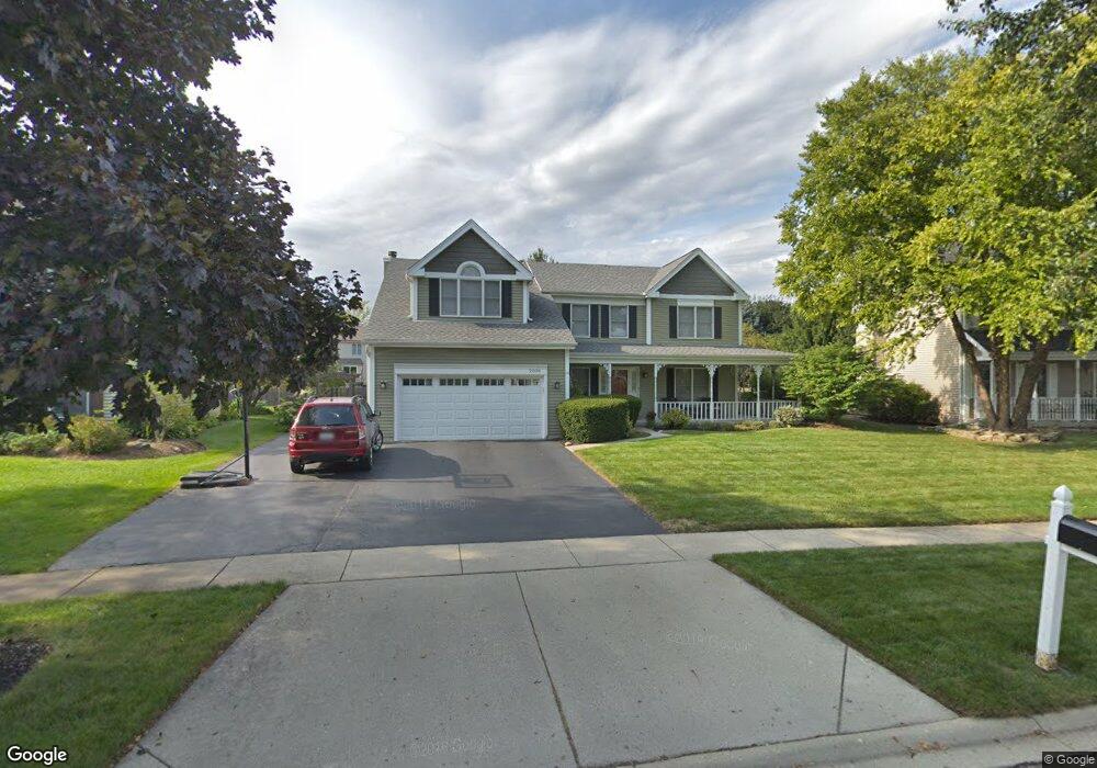
2006 Spaulding Ave West Dundee, IL 60118
Estimated Value: $462,299 - $499,000
4
Beds
3
Baths
2,683
Sq Ft
$180/Sq Ft
Est. Value
About This Home
This home is located at 2006 Spaulding Ave, West Dundee, IL 60118 and is currently estimated at $482,825, approximately $179 per square foot. 2006 Spaulding Ave is a home located in Kane County with nearby schools including Dundee Highlands Elementary School, Dundee Middle School, and Harry D Jacobs High School.
Ownership History
Date
Name
Owned For
Owner Type
Purchase Details
Closed on
Nov 3, 2009
Sold by
Cavanaugh Gerald B and Cavanaugh Deanna M
Bought by
Chatterton Michael and Chatterton Renee A
Current Estimated Value
Home Financials for this Owner
Home Financials are based on the most recent Mortgage that was taken out on this home.
Original Mortgage
$150,000
Outstanding Balance
$97,693
Interest Rate
4.95%
Mortgage Type
New Conventional
Estimated Equity
$385,132
Create a Home Valuation Report for This Property
The Home Valuation Report is an in-depth analysis detailing your home's value as well as a comparison with similar homes in the area
Home Values in the Area
Average Home Value in this Area
Purchase History
| Date | Buyer | Sale Price | Title Company |
|---|---|---|---|
| Chatterton Michael | $300,000 | Heritage Title Company |
Source: Public Records
Mortgage History
| Date | Status | Borrower | Loan Amount |
|---|---|---|---|
| Open | Chatterton Michael | $150,000 |
Source: Public Records
Tax History
| Year | Tax Paid | Tax Assessment Tax Assessment Total Assessment is a certain percentage of the fair market value that is determined by local assessors to be the total taxable value of land and additions on the property. | Land | Improvement |
|---|---|---|---|---|
| 2024 | $9,206 | $128,941 | $25,730 | $103,211 |
| 2023 | $8,559 | $116,017 | $23,151 | $92,866 |
| 2022 | $8,691 | $109,653 | $23,151 | $86,502 |
| 2021 | $8,361 | $103,534 | $21,859 | $81,675 |
| 2020 | $8,196 | $101,207 | $21,368 | $79,839 |
| 2019 | $7,909 | $96,077 | $20,285 | $75,792 |
| 2018 | $8,333 | $98,370 | $19,883 | $78,487 |
| 2017 | $7,904 | $92,021 | $18,600 | $73,421 |
| 2016 | $7,942 | $88,148 | $23,811 | $64,337 |
| 2015 | -- | $82,598 | $22,312 | $60,286 |
| 2014 | -- | $80,317 | $21,696 | $58,621 |
| 2013 | -- | $82,775 | $22,360 | $60,415 |
Source: Public Records
Map
Nearby Homes
- 850 Tartans Dr
- 1107 Pember Cir Unit 2
- 817 Lindsay Ln
- 809 Lindsay Ln
- 815 Lindsay Ln
- 822 Lindsay Ln
- 816 Lindsay Ln
- 818 Lindsay Ln
- 801 Lindsay Ln
- 1146 Pember Cir Unit 2
- 1023 Shagbark Ln
- 1031 Shagbark Ln
- 821 Lindsay Ln
- 805 Lindsay Ln
- 811 Lindsay Ln
- 1011 Shagbark Ln
- 820 Lindsay Ln
- 804 Lindsay Ln
- 808 Lindsay Ln
- 810 Lindsay Ln
- 2014 Spaulding Ave
- 2000 Spaulding Ave Unit 2
- 904 Pember Cir
- 2024 Spaulding Ave
- 2005 Kittridge Dr
- 2001 Kittridge Dr
- 860 Tartans Dr
- 912 Pember Cir
- 2015 Spaulding Ct Unit 2
- 2011 Kittridge Dr
- 2038 Spaulding Ave
- 918 Pember Cir Unit 2
- 2019 Spaulding Ct
- 2046 Spaulding Ave
- 922 Pember Cir
- 838 Tartans Dr
- 913 Pember Cir Unit 2
- 2008 Kittridge Dr Unit 2
- 2047 Spaulding Ct
- 2002 Kittridge Dr
Your Personal Tour Guide
Ask me questions while you tour the home.