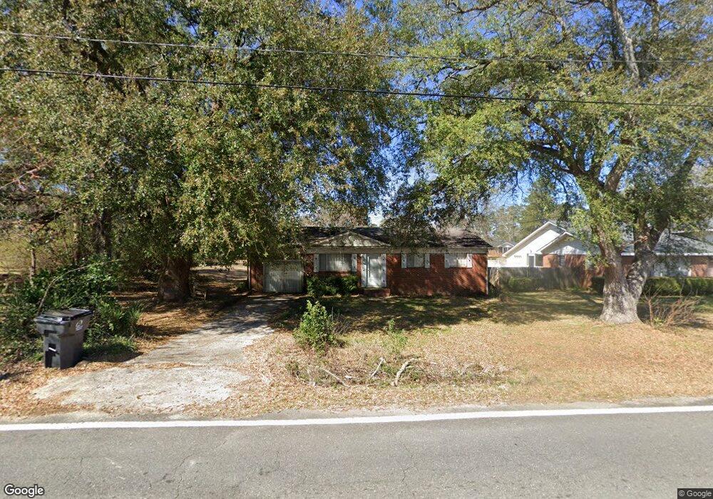
2006 State University Dr Fort Valley, GA 31030
Estimated Value: $117,000 - $152,631
3
Beds
3
Baths
1,677
Sq Ft
$84/Sq Ft
Est. Value
About This Home
This home is located at 2006 State University Dr, Fort Valley, GA 31030 and is currently estimated at $141,658, approximately $84 per square foot. 2006 State University Dr is a home located in Peach County with nearby schools including Hunt Elementary School, Fort Valley Middle School, and Peach County High School.
Ownership History
Date
Name
Owned For
Owner Type
Purchase Details
Closed on
Sep 25, 2024
Sold by
Wilson Frankie J
Bought by
Markham Cynthia W
Current Estimated Value
Purchase Details
Closed on
Jul 18, 2003
Sold by
Gilbert J Carl
Bought by
Appling Solomon Mose
Purchase Details
Closed on
Jun 6, 1988
Bought by
Wilson Frankie J and Wilson Carrie M
Purchase Details
Closed on
Jun 3, 1988
Bought by
Wilson Frankie J and Wilson Carrie M
Purchase Details
Closed on
Jun 8, 1963
Bought by
Appling Mose
Create a Home Valuation Report for This Property
The Home Valuation Report is an in-depth analysis detailing your home's value as well as a comparison with similar homes in the area
Home Values in the Area
Average Home Value in this Area
Purchase History
| Date | Buyer | Sale Price | Title Company |
|---|---|---|---|
| Markham Cynthia W | -- | -- | |
| Appling Solomon Mose | -- | -- | |
| Wilson Frankie J | $49,900 | -- | |
| Wilson Frankie J | -- | -- | |
| Appling Mose | -- | -- |
Source: Public Records
Tax History Compared to Growth
Tax History
| Year | Tax Paid | Tax Assessment Tax Assessment Total Assessment is a certain percentage of the fair market value that is determined by local assessors to be the total taxable value of land and additions on the property. | Land | Improvement |
|---|---|---|---|---|
| 2024 | $942 | $27,640 | $3,240 | $24,400 |
| 2023 | $877 | $25,000 | $3,160 | $21,840 |
| 2022 | $837 | $23,520 | $3,160 | $20,360 |
| 2021 | $806 | $19,280 | $3,120 | $16,160 |
| 2020 | $1,020 | $26,120 | $4,800 | $21,320 |
| 2019 | $1,024 | $26,120 | $4,800 | $21,320 |
| 2018 | $1,028 | $26,120 | $4,800 | $21,320 |
| 2017 | $1,032 | $26,120 | $4,800 | $21,320 |
| 2016 | $1,120 | $29,040 | $4,800 | $24,240 |
| 2015 | $1,122 | $29,040 | $4,800 | $24,240 |
| 2014 | $1,232 | $32,480 | $4,800 | $27,680 |
| 2013 | -- | $32,480 | $4,800 | $27,680 |
Source: Public Records
Map
Nearby Homes
- 177 S Jones St
- 57 Kemp St
- 47 King St
- 404 Benjamin St
- 108 Benjamin St
- 191 Daniel Dr
- 202 Charlevoix St
- 302 Fagan Cir
- 207 Carver Dr
- 735 River Rd
- 1011 Pine St
- 1105 River Rd
- 712 Courtland Ave
- 34 Rosewood Dr
- 705 Princess Ave
- 710 Pine St
- 210 Perry Railroad St
- 708 Princess Ave
- 0 Spillers St Unit 254475
- 0 Spillers St Unit 10560049
- 1980 State University Dr
- 2030 State University Dr
- 147 Wood St
- 1975 State University Dr
- 409 S Jones St
- 1966 State University Dr
- 182 Mathews St
- 1949 State University Dr
- 383 S Jones St
- 477 S Jones St
- 477 S Jones St
- 113 Wood St
- 110 Wood St
- 427 S Jones St
- 1939 State University Dr
- 150 Mathews St
- 406 S Jones St
- 430 S Jones St
- 79 Duncan St
- 392 S Jones St