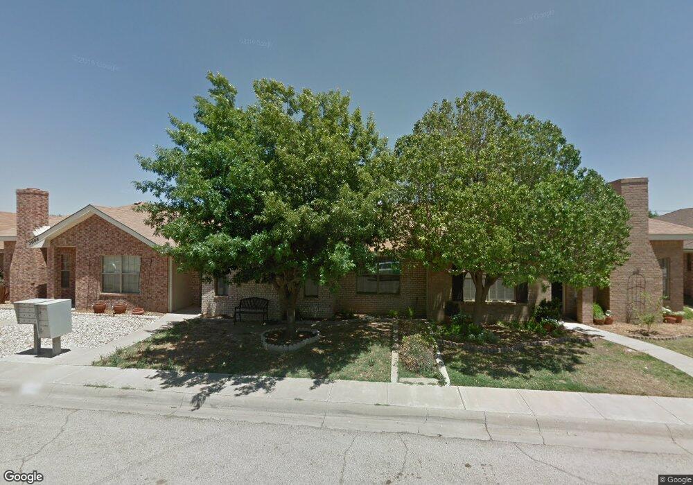
2006 Westwind Dr Midland, TX 79707
Wedgewood Park NeighborhoodEstimated Value: $256,000 - $260,295
Studio
--
Bath
1,500
Sq Ft
$173/Sq Ft
Est. Value
About This Home
This home is located at 2006 Westwind Dr, Midland, TX 79707 and is currently estimated at $258,824, approximately $172 per square foot. 2006 Westwind Dr is a home located in Midland County with nearby schools including Rusk Elementary School, Legacy Senior High School, and Alamo Junior High School.
Ownership History
Date
Name
Owned For
Owner Type
Purchase Details
Closed on
Jun 29, 2022
Sold by
Cj & M Properties Llc
Bought by
Becerra Ivan
Current Estimated Value
Home Financials for this Owner
Home Financials are based on the most recent Mortgage that was taken out on this home.
Original Mortgage
$196,000
Outstanding Balance
$185,926
Interest Rate
5.09%
Mortgage Type
New Conventional
Estimated Equity
$72,898
Purchase Details
Closed on
Aug 21, 2019
Sold by
Woods Rita R and Robertson Clifford H
Bought by
Cj & M Properties Llc
Purchase Details
Closed on
Feb 15, 1996
Bought by
Robertson Mary B
Purchase Details
Closed on
Oct 15, 1995
Bought by
Robertson Mary B
Purchase Details
Closed on
Jan 1, 1901
Bought by
Robertson Mary B
Create a Home Valuation Report for This Property
The Home Valuation Report is an in-depth analysis detailing your home's value as well as a comparison with similar homes in the area
Home Values in the Area
Average Home Value in this Area
Purchase History
| Date | Buyer | Sale Price | Title Company |
|---|---|---|---|
| Becerra Ivan | -- | West Texas Abstract & Title | |
| Cj & M Properties Llc | -- | Stewart Title Company | |
| Robertson Mary B | -- | -- | |
| Robertson Mary B | -- | -- | |
| Robertson Mary B | -- | -- |
Source: Public Records
Mortgage History
| Date | Status | Borrower | Loan Amount |
|---|---|---|---|
| Open | Becerra Ivan | $196,000 |
Source: Public Records
Tax History
| Year | Tax Paid | Tax Assessment Tax Assessment Total Assessment is a certain percentage of the fair market value that is determined by local assessors to be the total taxable value of land and additions on the property. | Land | Improvement |
|---|---|---|---|---|
| 2025 | $3,118 | $205,340 | $8,150 | $197,190 |
| 2024 | $2,129 | $210,670 | $8,150 | $202,520 |
| 2023 | $2,088 | $210,670 | $8,150 | $202,520 |
| 2022 | $3,185 | $203,870 | $8,150 | $195,720 |
| 2021 | $3,426 | $196,630 | $8,150 | $188,480 |
| 2019 | $3,641 | $192,330 | $8,150 | $184,180 |
| 2018 | $3,494 | $179,710 | $8,150 | $171,560 |
| 2017 | $3,337 | $171,630 | $8,150 | $163,480 |
| 2016 | $3,064 | $165,280 | $8,150 | $157,130 |
| 2015 | -- | $160,600 | $8,150 | $152,450 |
| 2014 | -- | $158,340 | $8,150 | $150,190 |
Source: Public Records
Map
Nearby Homes
- 1907 McDonald St
- 3713 Humble Ave
- 2503 Geraldine St
- 2206 Bear Dr
- 3703 Stanolind Ave
- 3622 Boyd Ave
- 2600 N N St
- 3609 Neely Ave
- 4423 Gulf Ave
- 3600 Godfrey Ct
- 3802 Suncrest Ave
- 2906 Aurora Ln
- 4310 Douglas Ave
- 4342 W Dengar Ave
- 3523 Lonoke Ave
- 3517 Seaboard Ave
- 3521 Lonoke Ave
- 3511 Stanolind Ave
- 1502 Alcove Ct
- 4301 Greenbriar Dr
- 2004 Westwind Dr
- 2008 Westwind Dr
- 2002 Westwind Dr
- 2100 Westwind Dr
- 2102 Westwind Dr
- 2000 Westwind Dr
- 2007 Freeport Ln
- 2009 Freeport Ln
- 2005 Freeport Ln
- 2007 Westwind Dr
- 2003 Freeport Ln
- 2104 Westwind Dr
- 2101 Freeport Ln
- 2009 Westwind Dr
- 2005 Westwind Dr
- 2101 Westwind Dr
- 2003 Westwind Dr
- 2103 Freeport Ln
- 2001 Freeport Ln
- 2103 Westwind Dr
Your Personal Tour Guide
Ask me questions while you tour the home.