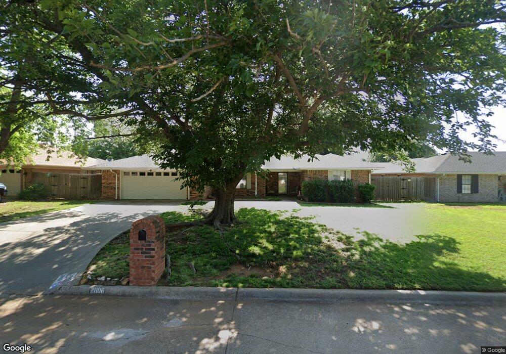
2006 Woodrock Dr Duncan, OK 73533
Estimated Value: $184,000 - $230,527
3
Beds
2
Baths
2,220
Sq Ft
$95/Sq Ft
Est. Value
About This Home
This home is located at 2006 Woodrock Dr, Duncan, OK 73533 and is currently estimated at $211,632, approximately $95 per square foot. 2006 Woodrock Dr is a home located in Stephens County with nearby schools including Horace Mann Elementary School, Duncan Middle School, and Duncan High School.
Ownership History
Date
Name
Owned For
Owner Type
Purchase Details
Closed on
Sep 12, 2011
Sold by
Skinner Jacquelyn
Bought by
Armor Robert Brent and Armor Tammy Leigh
Current Estimated Value
Home Financials for this Owner
Home Financials are based on the most recent Mortgage that was taken out on this home.
Original Mortgage
$111,110
Outstanding Balance
$75,737
Interest Rate
4.24%
Mortgage Type
FHA
Estimated Equity
$135,895
Purchase Details
Closed on
Jun 15, 1990
Create a Home Valuation Report for This Property
The Home Valuation Report is an in-depth analysis detailing your home's value as well as a comparison with similar homes in the area
Home Values in the Area
Average Home Value in this Area
Purchase History
| Date | Buyer | Sale Price | Title Company |
|---|---|---|---|
| Armor Robert Brent | $114,000 | None Available | |
| -- | $3,500 | -- |
Source: Public Records
Mortgage History
| Date | Status | Borrower | Loan Amount |
|---|---|---|---|
| Open | Armor Robert Brent | $111,110 |
Source: Public Records
Tax History Compared to Growth
Tax History
| Year | Tax Paid | Tax Assessment Tax Assessment Total Assessment is a certain percentage of the fair market value that is determined by local assessors to be the total taxable value of land and additions on the property. | Land | Improvement |
|---|---|---|---|---|
| 2025 | $1,247 | $16,114 | $1,351 | $14,763 |
| 2024 | $1,247 | $15,644 | $1,351 | $14,293 |
| 2023 | $1,247 | $15,645 | $1,351 | $14,294 |
| 2022 | $1,169 | $15,189 | $1,351 | $13,838 |
| 2021 | $1,134 | $14,317 | $1,351 | $12,966 |
| 2020 | $1,169 | $14,537 | $1,351 | $13,186 |
| 2019 | $1,134 | $14,113 | $1,351 | $12,762 |
| 2018 | $1,223 | $15,169 | $1,351 | $13,818 |
| 2017 | $1,143 | $14,298 | $1,351 | $12,947 |
| 2016 | $1,102 | $13,968 | $1,234 | $12,734 |
| 2015 | $1,002 | $13,562 | $1,205 | $12,357 |
| 2014 | $1,002 | $13,166 | $1,176 | $11,990 |
Source: Public Records
Map
Nearby Homes
- 1706 Windsor Dr
- 1927 High Meadow Dr
- 1829 1829 Terrace Dr
- 2403 Meadow View Dr
- 2360 Rockwell Dr
- 2321 Rockwell Dr
- 1601 1601 Pearl
- 2201 W Club Rd
- 2108 W Club Rd
- 2110 W Club Rd
- 3990 N Ridgeview Dr
- 2120 2120 Flamingo Ln
- 1404 1404 Ne Aspen
- 28 Canterbury Ln
- 30 Canterbury Ln
- 1527 1527 N 13th
- 2202 W Canary Ave
- 1405 Evergreen Dr
- 2814 2814 Springdale Ln
- 1402 1402 W Elk Ave
- 2006 Woodrock Dr
- 2002 2002 Woodrock
- 2010 Woodrock Dr
- 2002 Woodrock Dr
- 1817 Windsor Dr
- 2005 Woodrock Dr
- 2014 2014 Woodrock Dr
- 2014 Woodrock Dr
- 1813 Windsor Dr
- 2009 Woodrock Dr
- 2001 Woodrock Dr
- 2001 Woodrock Dr
- 2013 Woodrock Dr
- 2018 2018 N Woodrock Dr
- 1906 Windsor Dr
- 2013 2013 Woodrock
- 1902 Windsor Dr
- 1809 Windsor Dr
- 1818 Windsor Dr
- 1915 Windsor Dr