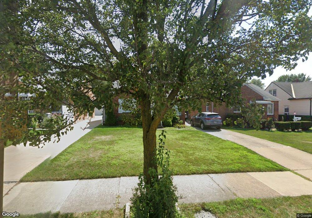
20060 Mccracken Rd Maple Heights, OH 44137
Estimated Value: $116,000 - $131,237
3
Beds
2
Baths
1,374
Sq Ft
$91/Sq Ft
Est. Value
About This Home
This home is located at 20060 Mccracken Rd, Maple Heights, OH 44137 and is currently estimated at $125,059, approximately $91 per square foot. 20060 Mccracken Rd is a home located in Cuyahoga County with nearby schools including Abraham Lincoln Elementary School, Rockside/ J.F. Kennedy School, and Italy High School.
Ownership History
Date
Name
Owned For
Owner Type
Purchase Details
Closed on
Feb 23, 2015
Sold by
Gelliarth Betty J
Bought by
Bertal Enterprises Iii Llc
Current Estimated Value
Purchase Details
Closed on
May 12, 1982
Sold by
Gelliarth Wm J and Gelliarth Betty J
Bought by
Gelliarth William J
Purchase Details
Closed on
Jan 1, 1975
Bought by
Gelliarth Wm J and Gelliarth Betty J
Create a Home Valuation Report for This Property
The Home Valuation Report is an in-depth analysis detailing your home's value as well as a comparison with similar homes in the area
Home Values in the Area
Average Home Value in this Area
Purchase History
| Date | Buyer | Sale Price | Title Company |
|---|---|---|---|
| Bertal Enterprises Iii Llc | $10,000 | Innovative | |
| Gelliarth William J | -- | -- | |
| Gelliarth Wm J | -- | -- |
Source: Public Records
Tax History Compared to Growth
Tax History
| Year | Tax Paid | Tax Assessment Tax Assessment Total Assessment is a certain percentage of the fair market value that is determined by local assessors to be the total taxable value of land and additions on the property. | Land | Improvement |
|---|---|---|---|---|
| 2024 | $3,541 | $38,745 | $7,210 | $31,535 |
| 2023 | $2,285 | $20,730 | $4,380 | $16,350 |
| 2022 | $2,278 | $20,720 | $4,380 | $16,350 |
| 2021 | $2,428 | $20,720 | $4,380 | $16,350 |
| 2020 | $2,078 | $15,720 | $3,330 | $12,390 |
| 2019 | $2,068 | $44,900 | $9,500 | $35,400 |
| 2018 | $2,057 | $15,720 | $3,330 | $12,390 |
| 2017 | $1,243 | $8,050 | $3,080 | $4,970 |
| 2016 | $1,203 | $8,050 | $3,080 | $4,970 |
| 2015 | $2,297 | $12,600 | $3,080 | $9,520 |
| 2014 | $2,297 | $15,690 | $3,400 | $12,290 |
Source: Public Records
Map
Nearby Homes
- 20120 Mccracken Rd
- 20715 Watson Rd
- 20814 Watson Rd
- 20907 Watson Rd
- 19807 Gardenview Dr
- 19309 Nitra Ave
- 21102 Raymond St
- 5165 Camden Rd
- 19520 Maple Heights Blvd
- 19806 Mountville Dr
- 20510 Mountville Dr
- 20107 Libby Rd
- 21207 Franklin Rd
- 20701 Kenyon Dr
- 20814 Kenyon Dr
- 19812 Stockton Ave
- 19289 Stafford Ave
- 5265 Bellview St
- 21416 Gardenview Dr
- 19221 Stafford Ave
- 20040 Mccracken Rd
- 20080 Mccracken Rd
- 20020 Mccracken Rd
- 20100 Mccracken Rd
- 20000 Mccracken Rd
- 19980 Mccracken Rd
- 20140 Mccracken Rd
- 19960 Mccracken Rd
- 20160 Mccracken Rd
- 20011 Maple Heights Blvd
- 19909 Fairway Ave
- 19940 Mccracken Rd
- 20180 Mccracken Rd
- 19905 Fairway Ave
- 19917 Fairway Ave
- 20109 Maple Heights Blvd
- 19913 Fairway Ave
- 20015 Maple Heights Blvd
- 20200 Mccracken Rd
- 19920 Mccracken Rd