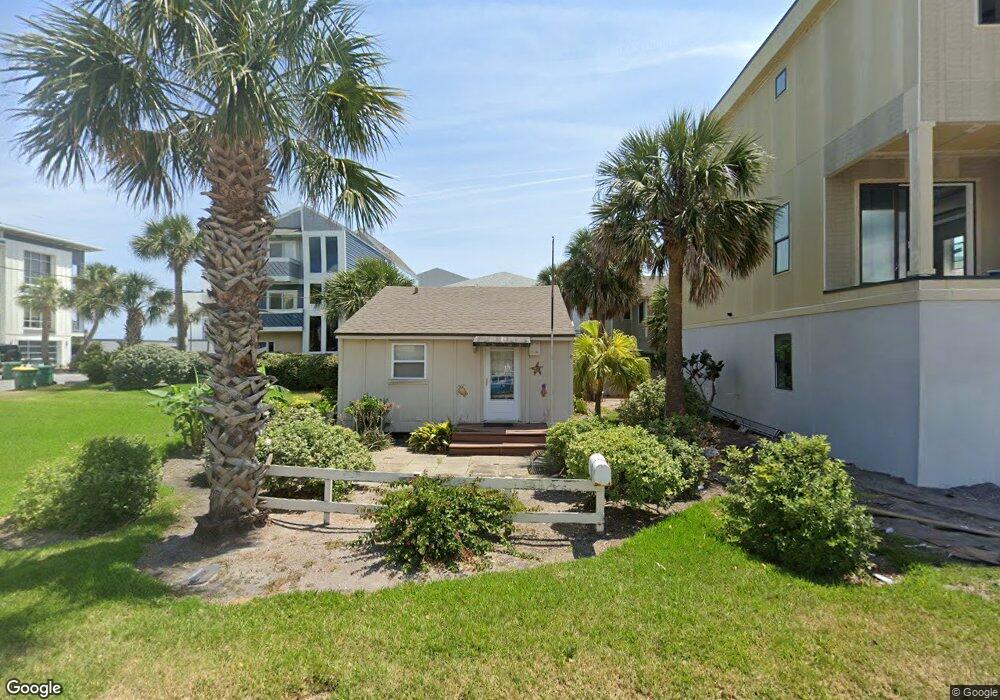
2007 1st St S Jacksonville Beach, FL 32250
Estimated Value: $756,000 - $1,041,000
1
Bed
1
Bath
640
Sq Ft
$1,416/Sq Ft
Est. Value
About This Home
This home is located at 2007 1st St S, Jacksonville Beach, FL 32250 and is currently estimated at $905,964, approximately $1,415 per square foot. 2007 1st St S is a home located in Duval County with nearby schools including Seabreeze Elementary School, Duncan U. Fletcher Middle School, and Duncan U. Fletcher High School.
Ownership History
Date
Name
Owned For
Owner Type
Purchase Details
Closed on
Nov 26, 2024
Sold by
Jaroll Kathy
Bought by
2007 1St Street Llc
Current Estimated Value
Purchase Details
Closed on
May 31, 2024
Sold by
Roy T Pound Revocable Living Trust and Pound Roy T
Bought by
Jaroll Kathy
Purchase Details
Closed on
Jul 21, 1998
Sold by
Pound Roy T and Pound Roy T
Bought by
Pound Roy T
Create a Home Valuation Report for This Property
The Home Valuation Report is an in-depth analysis detailing your home's value as well as a comparison with similar homes in the area
Home Values in the Area
Average Home Value in this Area
Purchase History
| Date | Buyer | Sale Price | Title Company |
|---|---|---|---|
| 2007 1St Street Llc | $807,000 | None Listed On Document | |
| Jaroll Kathy | $740,000 | Thomas C Santoro Title Service | |
| Pound Roy T | $100 | -- |
Source: Public Records
Tax History Compared to Growth
Tax History
| Year | Tax Paid | Tax Assessment Tax Assessment Total Assessment is a certain percentage of the fair market value that is determined by local assessors to be the total taxable value of land and additions on the property. | Land | Improvement |
|---|---|---|---|---|
| 2025 | $16,614 | $1,064,118 | $1,064,001 | $117 |
| 2024 | $16,614 | $1,064,117 | $1,064,000 | $117 |
| 2023 | $13,806 | $751,810 | $668,800 | $83,010 |
| 2022 | $12,223 | $739,058 | $668,800 | $70,258 |
| 2021 | $11,037 | $606,261 | $547,200 | $59,061 |
| 2020 | $9,150 | $541,605 | $0 | $0 |
| 2019 | $9,056 | $529,429 | $0 | $0 |
| 2018 | $8,951 | $519,558 | $0 | $0 |
| 2017 | $8,851 | $508,872 | $0 | $0 |
| 2016 | $7,643 | $505,966 | $0 | $0 |
| 2015 | $6,805 | $414,532 | $0 | $0 |
| 2014 | $6,097 | $350,367 | $0 | $0 |
Source: Public Records
Map
Nearby Homes
- 2002 1st St S
- 1827 1st St S
- 2149 2nd St S
- 2200 Ocean Dr S Unit 5C
- 2211 1st St S
- 2088 Gail Ave
- 2223 2225 1st St S Unit 1 2 3 4
- 1819 Ocean Dr S
- 2272 2nd St S
- 1717 2nd St S
- 1601 Ocean Dr S Unit 1003
- 1601 Ocean Dr S Unit 401
- 1601 Ocean Dr S Unit 104
- 1601 Ocean Dr S Unit 408
- 1601 Ocean Dr S Unit 505
- 1601 Ocean Dr S Unit 701
- 1601 Ocean Dr S Unit 805
- 1601 Ocean Dr S Unit 807
- 1601 Ocean Dr S Unit 1010
- 1601 Ocean Dr S Unit 607
- 26 20th Ave S
- 18 20th Ave S (Reduced)
- 18 20th Ave S
- 12 20th Ave S
- 105 21st Ave S
- 1975 1st St S
- 29 20th Ave S
- 2103 1st St S
- 8 20th Ave S
- 2076 1st St S
- 7 21st Ave S
- 2107 1st St S
- 1908 Ocean Dr S
- 6 20th Ave S
- 2104 Ocean Dr S
- 5 21st Ave S
- 2043-B S 2nd St
- 2043A 2nd St S
- 2104 1st St S
- 4 20th Ave S Unit LOWER UNIT