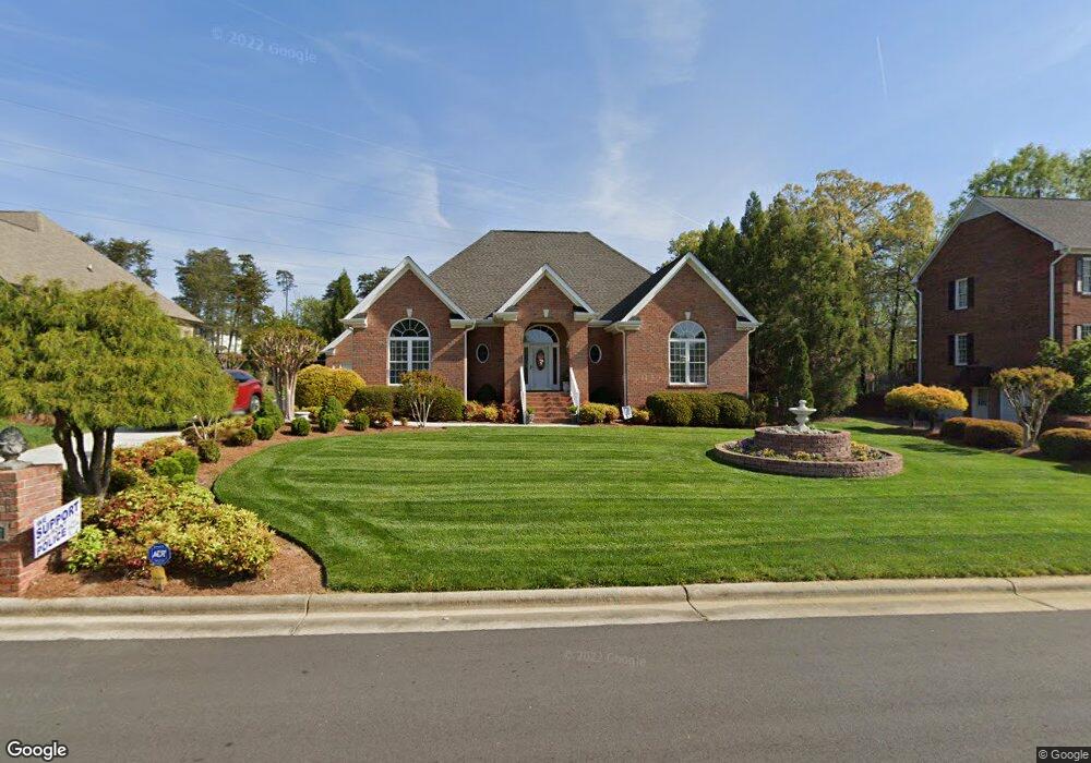
2007 Anchoridge Ave High Point, NC 27265
Johnson Street Park NeighborhoodEstimated Value: $443,000 - $545,000
3
Beds
3
Baths
2,499
Sq Ft
$194/Sq Ft
Est. Value
About This Home
This home is located at 2007 Anchoridge Ave, High Point, NC 27265 and is currently estimated at $484,703, approximately $193 per square foot. 2007 Anchoridge Ave is a home located in Guilford County with nearby schools including Shadybrook Elementary School, Ferndale Middle School, and High Point Central High School.
Ownership History
Date
Name
Owned For
Owner Type
Purchase Details
Closed on
Feb 11, 2002
Bought by
Mill Pointe Homeowners Association Inc
Current Estimated Value
Purchase Details
Closed on
Jul 17, 2000
Sold by
Huntley Mitchell S and Huntley Kathey L
Bought by
Brown Joseph Ronald and Brown Debra Steed
Home Financials for this Owner
Home Financials are based on the most recent Mortgage that was taken out on this home.
Original Mortgage
$195,500
Interest Rate
8.54%
Create a Home Valuation Report for This Property
The Home Valuation Report is an in-depth analysis detailing your home's value as well as a comparison with similar homes in the area
Home Values in the Area
Average Home Value in this Area
Purchase History
| Date | Buyer | Sale Price | Title Company |
|---|---|---|---|
| Mill Pointe Homeowners Association Inc | -- | -- | |
| Brown Joseph Ronald | $244,500 | -- |
Source: Public Records
Mortgage History
| Date | Status | Borrower | Loan Amount |
|---|---|---|---|
| Previous Owner | Brown Joseph Ronald | $195,500 |
Source: Public Records
Tax History
| Year | Tax Paid | Tax Assessment Tax Assessment Total Assessment is a certain percentage of the fair market value that is determined by local assessors to be the total taxable value of land and additions on the property. | Land | Improvement |
|---|---|---|---|---|
| 2025 | $5,060 | $367,200 | $65,000 | $302,200 |
| 2024 | $5,060 | $367,200 | $65,000 | $302,200 |
| 2023 | $5,060 | $367,200 | $65,000 | $302,200 |
| 2022 | $4,950 | $367,200 | $65,000 | $302,200 |
| 2021 | $4,341 | $315,000 | $40,000 | $275,000 |
| 2020 | $4,341 | $315,000 | $40,000 | $275,000 |
| 2019 | $4,341 | $315,000 | $0 | $0 |
| 2018 | $4,319 | $315,000 | $0 | $0 |
| 2017 | $4,319 | $315,000 | $0 | $0 |
| 2016 | $4,208 | $300,000 | $0 | $0 |
| 2015 | $4,230 | $300,000 | $0 | $0 |
| 2014 | $4,302 | $300,000 | $0 | $0 |
Source: Public Records
Map
Nearby Homes
- 3827 Edgewater St
- 1846 Runner Stone Dr
- 1014 Shamrock Ct
- 1835 Morgans Mill Way
- 3912 Wesseck Rd
- 905 Northshore Ct
- 712 Vinebury Ln
- 2512 Burch Point
- 629 Sonoma Ln
- 2501 White Fence Way
- 2170 Glen Cove Way
- 2435 Lake Oak
- 1108 Elmwood Ave
- 3908 Sandlewood Rd
- 3806 Bentbrook Dr
- 3519 Woodview Dr
- 2431 Tweedmore Ct
- 3500 Westfield St
- 4001 Tesa Ct
- 3216 Wellingford Dr
- 2009 Anchoridge Ave
- 2001 Anchoridge Ave
- 2010 Anchoridge Ave
- 2101 Anchoridge Ave
- 2006 Anchoridge Ave
- 2100 Anchoridge Ave
- 2000 Anchoridge Ave
- 1810 Runner Stone Dr
- 1806 Runner Stone Dr
- 1814 Runner Stone Dr
- 3901 Hidden Cove Point
- 1818 Runner Stone Dr
- 3900 La Port Ct
- 1802 Runner Stone Dr
- 2105 Anchoridge Ave
- 3901 La Port Ct
- 3901 Laport Ct
- 3900 Hidden Cove Point
- 1822 Runner Stone Dr
- 2109 Anchoridge Ave
Your Personal Tour Guide
Ask me questions while you tour the home.