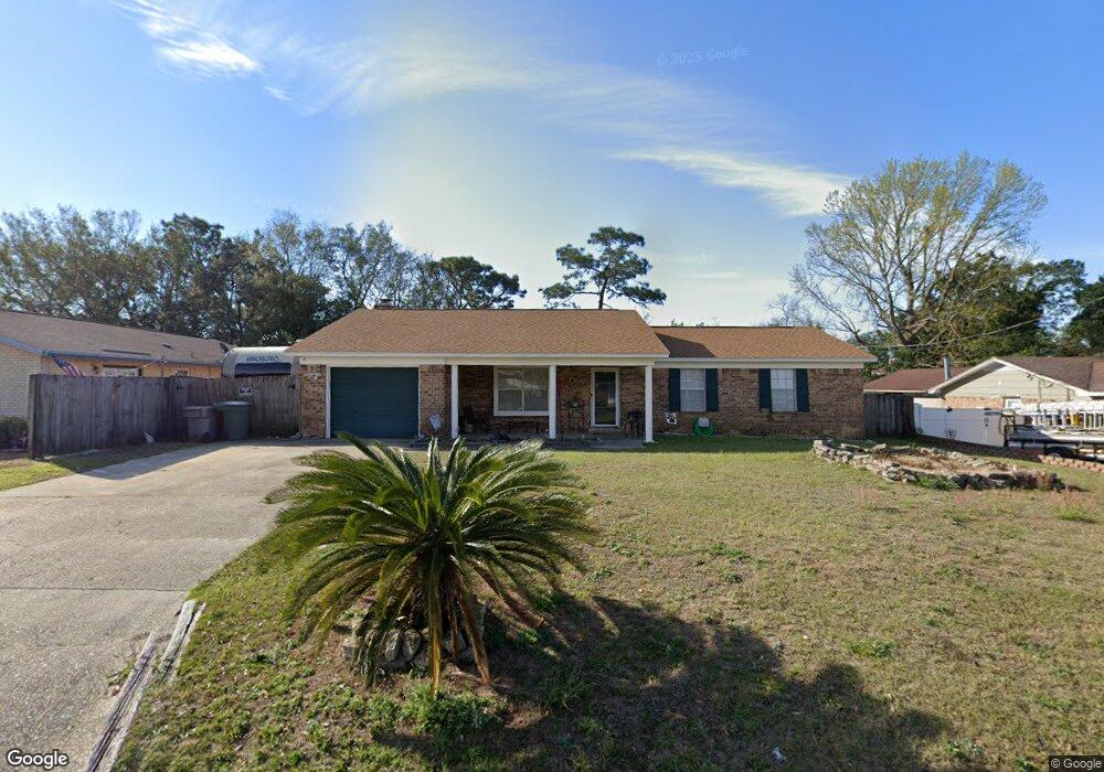
2007 Colony Rd Pensacola, FL 32526
Estimated Value: $220,786 - $256,000
--
Bed
2
Baths
1,484
Sq Ft
$156/Sq Ft
Est. Value
About This Home
This home is located at 2007 Colony Rd, Pensacola, FL 32526 and is currently estimated at $231,697, approximately $156 per square foot. 2007 Colony Rd is a home located in Escambia County with nearby schools including Bellview Elementary School, Bellview Middle School, and Pine Forest High School.
Ownership History
Date
Name
Owned For
Owner Type
Purchase Details
Closed on
Apr 4, 2003
Sold by
Mrmosh Lida M
Bought by
Evans Barry L
Current Estimated Value
Home Financials for this Owner
Home Financials are based on the most recent Mortgage that was taken out on this home.
Original Mortgage
$58,500
Outstanding Balance
$25,205
Interest Rate
5.79%
Mortgage Type
Purchase Money Mortgage
Estimated Equity
$206,492
Purchase Details
Closed on
Mar 6, 1998
Sold by
Chancellor Sherry Fowler and Johnson Paul E
Bought by
Mrmosh Lida M
Home Financials for this Owner
Home Financials are based on the most recent Mortgage that was taken out on this home.
Original Mortgage
$57,200
Interest Rate
7.07%
Create a Home Valuation Report for This Property
The Home Valuation Report is an in-depth analysis detailing your home's value as well as a comparison with similar homes in the area
Home Values in the Area
Average Home Value in this Area
Purchase History
| Date | Buyer | Sale Price | Title Company |
|---|---|---|---|
| Evans Barry L | -- | -- | |
| Mrmosh Lida M | -- | -- | |
| Mrmosh Lida M | $71,500 | -- |
Source: Public Records
Mortgage History
| Date | Status | Borrower | Loan Amount |
|---|---|---|---|
| Open | Evans Barry L | $58,500 | |
| Previous Owner | Mrmosh Lida M | $57,200 |
Source: Public Records
Tax History Compared to Growth
Tax History
| Year | Tax Paid | Tax Assessment Tax Assessment Total Assessment is a certain percentage of the fair market value that is determined by local assessors to be the total taxable value of land and additions on the property. | Land | Improvement |
|---|---|---|---|---|
| 2024 | $1,009 | $106,952 | -- | -- |
| 2023 | $1,009 | $103,837 | $0 | $0 |
| 2022 | $978 | $100,813 | $0 | $0 |
| 2021 | $967 | $97,877 | $0 | $0 |
| 2020 | $944 | $96,526 | $0 | $0 |
| 2019 | $923 | $94,356 | $0 | $0 |
| 2018 | $915 | $92,597 | $0 | $0 |
| 2017 | $909 | $90,693 | $0 | $0 |
| 2016 | $895 | $88,828 | $0 | $0 |
| 2015 | $875 | $88,211 | $0 | $0 |
| 2014 | $863 | $87,511 | $0 | $0 |
Source: Public Records
Map
Nearby Homes
- 2004 Rowe Ln
- 5496 Wales Ave
- 2400 BLK Michigan Ave
- 2310 Buckingham Rd
- 5844 Providence Loop
- 9663 Angel Oak Dr
- 9632 Angel Oak Dr
- 7036 Rampart Way
- 6027 Dallas Ave
- 3163 Two Sisters Way
- 3351 Two Sisters Way
- 6110 Nashville Ave
- 220 Sand Trap Ln
- 6214 Montgomery Ave
- 2600 W Michigan Ave Unit B82
- 2004 Pin High Dr
- 2016 Pin High Dr
- 6209 Dallas Ave
- 6211 Dallas Ave
- 6177 Native Dancer Way
- 2005 Colony Rd
- 2009 Colony Rd
- 2010 Broyhill Ln
- 2006 Broyhill Ln
- 2014 Broyhill Ln
- 2039 Colony Rd
- 2010 Colony Rd
- 2012 Colony Rd
- 2003 Colony Rd
- 2006 Colony Rd
- 2030 Colony Rd
- 5525 Charbar Dr
- 5521 Charbar Dr
- 2026 Broyhill Ln
- 2047 Colony Rd
- 2013 Broyhill Ln
- 5529 Charbar Dr
- 2038 Colony Rd
- 2004 Colony Rd
- 2009 Tomlinson Rd