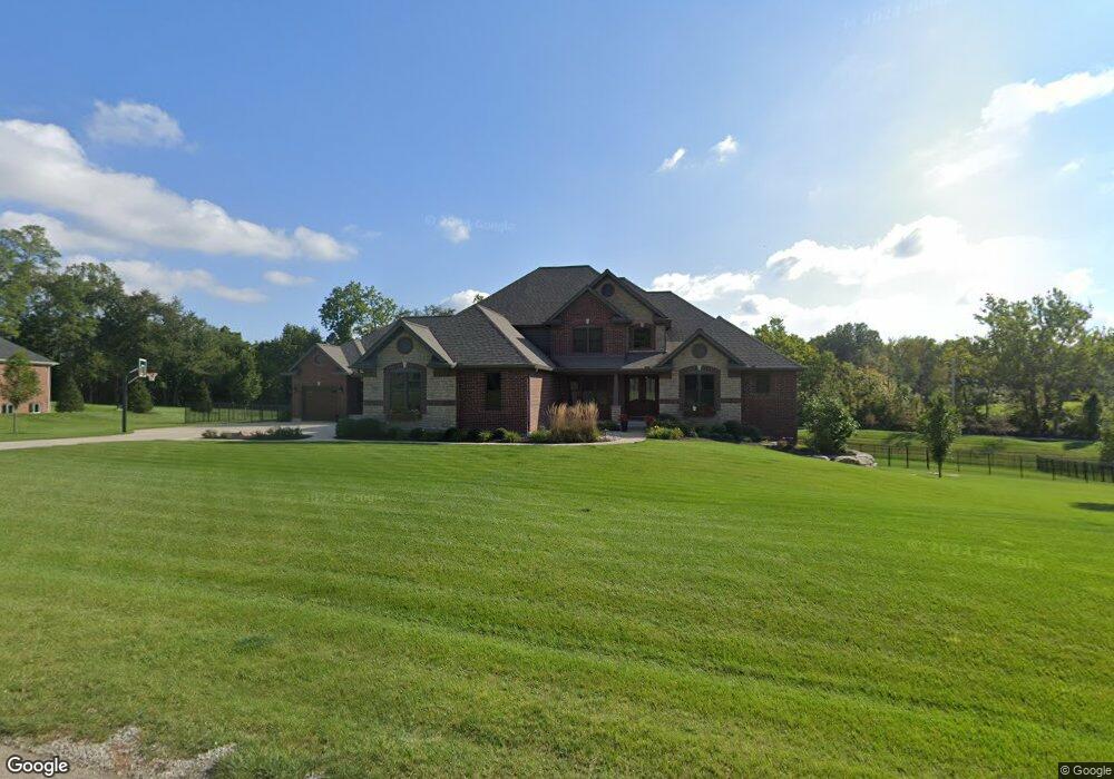
Estimated Value: $1,063,000 - $1,285,295
5
Beds
6
Baths
5,075
Sq Ft
$234/Sq Ft
Est. Value
About This Home
This home is located at 2007 Forest Bend Dr, Xenia, OH 45385 and is currently estimated at $1,187,432, approximately $233 per square foot. 2007 Forest Bend Dr is a home with nearby schools including Trebein Elementary School, Jacob Coy Middle School, and Beavercreek High School.
Ownership History
Date
Name
Owned For
Owner Type
Purchase Details
Closed on
May 24, 2016
Sold by
Ritsh Llc
Bought by
Wood Ridge Estates Llc
Current Estimated Value
Home Financials for this Owner
Home Financials are based on the most recent Mortgage that was taken out on this home.
Original Mortgage
$649,768
Outstanding Balance
$516,078
Interest Rate
3.59%
Mortgage Type
New Conventional
Estimated Equity
$671,354
Purchase Details
Closed on
May 20, 2016
Sold by
Sheriff Of Greene County
Bought by
Woods Kevin S and Klingbeil Ann P
Home Financials for this Owner
Home Financials are based on the most recent Mortgage that was taken out on this home.
Original Mortgage
$649,768
Outstanding Balance
$516,078
Interest Rate
3.59%
Mortgage Type
New Conventional
Estimated Equity
$671,354
Purchase Details
Closed on
Dec 29, 2010
Sold by
Sims James E and Sims Nancy J
Bought by
Sims Nancy J
Create a Home Valuation Report for This Property
The Home Valuation Report is an in-depth analysis detailing your home's value as well as a comparison with similar homes in the area
Home Values in the Area
Average Home Value in this Area
Purchase History
| Date | Buyer | Sale Price | Title Company |
|---|---|---|---|
| Wood Ridge Estates Llc | -- | None Available | |
| Woods Kevin S | $74,900 | Attorney | |
| Sims Nancy J | -- | None Available |
Source: Public Records
Mortgage History
| Date | Status | Borrower | Loan Amount |
|---|---|---|---|
| Open | Woods Kevin S | $649,768 |
Source: Public Records
Tax History Compared to Growth
Tax History
| Year | Tax Paid | Tax Assessment Tax Assessment Total Assessment is a certain percentage of the fair market value that is determined by local assessors to be the total taxable value of land and additions on the property. | Land | Improvement |
|---|---|---|---|---|
| 2024 | $17,472 | $310,550 | $35,480 | $275,070 |
| 2023 | $17,472 | $310,550 | $35,480 | $275,070 |
| 2022 | $16,908 | $263,410 | $35,480 | $227,930 |
| 2021 | $17,077 | $263,410 | $35,480 | $227,930 |
| 2020 | $17,159 | $263,410 | $35,480 | $227,930 |
| 2019 | $18,044 | $254,350 | $31,460 | $222,890 |
| 2018 | $15,728 | $26,220 | $26,220 | $0 |
| 2017 | $1,726 | $26,220 | $26,220 | $0 |
| 2016 | $3,143 | $48,980 | $48,980 | $0 |
| 2015 | -- | $0 | $0 | $0 |
Source: Public Records
Map
Nearby Homes
- 295 Stratford Ln
- 2178 Annandale Place
- 2436 Sherbourne Way
- 2353 Sherwood Ct
- 2284 Annandale Place
- 29 Governors Club Dr
- 33 Governors Club Dr
- 463 Valhalla Ct
- 139 Signature Dr S
- Congressional Plan at Country Club of the North - Luxury Series
- Somerset Plan at Country Club of the North - Signature Series
- Addington Plan at Country Club of the North - Luxury Series
- Heatherwood Plan at Country Club of the North - Signature Series
- Savannah Plan at Country Club of the North - Luxury Series
- Crooked Stick Plan at Country Club of the North - Signature Series
- Breton Plan at Country Club of the North - Luxury Series
- Oakmont Plan at Country Club of the North - Signature Series
- Arcadia Plan at Country Club of the North - Luxury Series
- Shadow Creek Plan at Country Club of the North - Signature Series
- Rubicon Plan at Country Club of the North - Signature Series
- 1977 Forest Bend Dr
- 2009 Forest Bend Dr
- 2000 Forest Bend Dr
- 1925 Hickory Knoll Dr
- 2040 Forest Bend Dr
- 1955 Forest Bend Dr
- 1951 Hickory Knoll Dr
- 360 Wood Ridge Blvd
- 1940 Forest Bend Dr
- 1944 Hickory Knoll Dr
- 1961 Indian Ripple Rd
- 2052 Forest Bend Dr
- 1931 Forest Bend Dr
- 1955 Indian Ripple Rd
- 1991 Hickory Knoll Dr
- 1958 Hickory Knoll Dr
- 1978 Hickory Knoll Dr
- 2021 Hickory Knoll Dr
- 2039 Hickory Knoll Dr
- 1917 Forest Bend Dr
