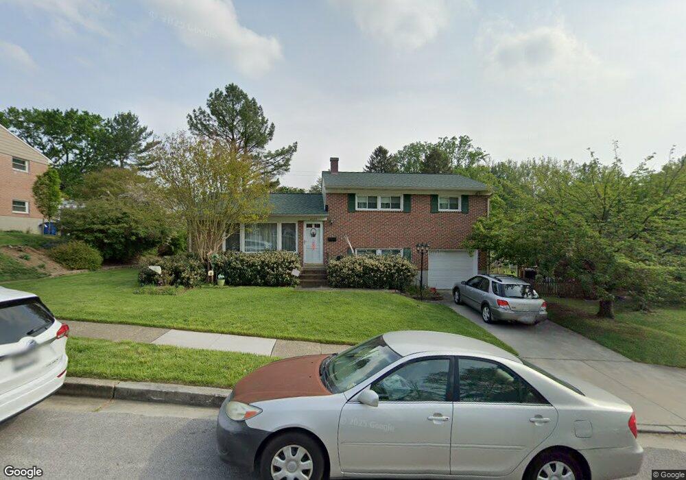
2007 Helmsby Rd Catonsville, MD 21228
Estimated Value: $485,000 - $545,000
--
Bed
3
Baths
1,998
Sq Ft
$256/Sq Ft
Est. Value
About This Home
This home is located at 2007 Helmsby Rd, Catonsville, MD 21228 and is currently estimated at $511,966, approximately $256 per square foot. 2007 Helmsby Rd is a home located in Baltimore County with nearby schools including Westchester Elementary School, Catonsville Middle School, and Catonsville High School.
Ownership History
Date
Name
Owned For
Owner Type
Purchase Details
Closed on
Sep 29, 2006
Sold by
Stonecipher Ernest P
Bought by
2007 Helmsby Road Llc
Current Estimated Value
Purchase Details
Closed on
Sep 15, 2006
Sold by
Stonecipher Ernest P
Bought by
2007 Helmsby Road Llc
Purchase Details
Closed on
Aug 21, 2001
Sold by
Tussing John A
Bought by
Stonecipher Ernest P and Stonecipher Belinda M
Purchase Details
Closed on
Jun 20, 1975
Sold by
Mason Clyde M
Bought by
Tussing John A
Create a Home Valuation Report for This Property
The Home Valuation Report is an in-depth analysis detailing your home's value as well as a comparison with similar homes in the area
Home Values in the Area
Average Home Value in this Area
Purchase History
| Date | Buyer | Sale Price | Title Company |
|---|---|---|---|
| 2007 Helmsby Road Llc | $375,000 | -- | |
| 2007 Helmsby Road Llc | $375,000 | -- | |
| Stonecipher Ernest P | $175,000 | -- | |
| Tussing John A | $28,000 | -- |
Source: Public Records
Tax History Compared to Growth
Tax History
| Year | Tax Paid | Tax Assessment Tax Assessment Total Assessment is a certain percentage of the fair market value that is determined by local assessors to be the total taxable value of land and additions on the property. | Land | Improvement |
|---|---|---|---|---|
| 2025 | $4,952 | $378,767 | -- | -- |
| 2024 | $4,952 | $358,800 | $128,000 | $230,800 |
| 2023 | $4,817 | $346,700 | $0 | $0 |
| 2022 | $4,565 | $334,600 | $0 | $0 |
| 2021 | $4,169 | $322,500 | $128,000 | $194,500 |
| 2020 | $4,169 | $310,767 | $0 | $0 |
| 2019 | $4,012 | $299,033 | $0 | $0 |
| 2018 | $3,879 | $287,300 | $92,000 | $195,300 |
| 2017 | $3,770 | $282,333 | $0 | $0 |
| 2016 | $3,957 | $277,367 | $0 | $0 |
| 2015 | $3,957 | $272,400 | $0 | $0 |
| 2014 | $3,957 | $272,400 | $0 | $0 |
Source: Public Records
Map
Nearby Homes
- 11 Clay Lodge Ln Unit 204
- 19 Clay Lodge Ln Unit 104
- 231 Gralan Rd
- 1900 Lismore Ln
- 8 Seminole Ave
- 2110 Edmondson Ave
- 302 Wessling Cir
- 311 Radstock Rd
- 4476 Ilchester Rd
- 409 Oak Ct
- 4496 Ilchester Rd
- 2310 Rockwell Ave
- 2 Park Dr
- 2305 Rockwell Ave
- 1300 Rice Ave
- 627 Meyers Dr
- 627 Meyers Dr Unit PARCEL 108
- 121 Forest Dr
- 230 N Beaumont Ave
- 4425 Prancing Deer Dr
- 2009 Helmsby Rd
- 2005 Helmsby Rd
- 2004 Tadcaster Rd
- 2006 Tadcaster Rd
- 2006 Helmsby Rd
- 2003 Helmsby Rd
- 2008 Helmsby Rd
- 2004 Helmsby Rd
- 2002 Tadcaster Rd
- 2010 Helmsby Rd
- 2002 Helmsby Rd
- 2001 Helmsby Rd
- 2000 Tadcaster Rd
- 2007 Tadcaster Rd
- 2005 Tadcaster Rd
- 2000 Helmsby Rd
- 2003 Tadcaster Rd
- 20 S Morerick Ave
- 2001 Tadcaster Rd
- 18 S Morerick Ave