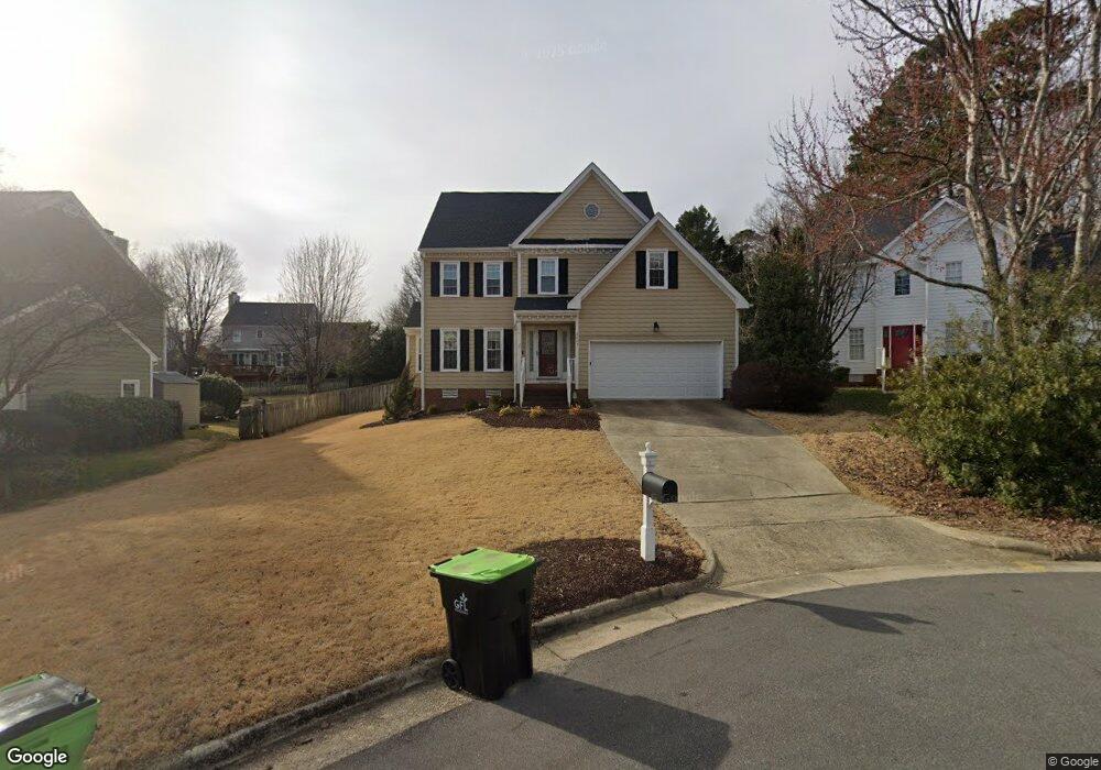
2007 Ironsides Ln Apex, NC 27523
West Cary NeighborhoodEstimated Value: $521,000 - $546,114
About This Home
This home is located at 2007 Ironsides Ln, Apex, NC 27523 and is currently estimated at $529,529, approximately $268 per square foot. 2007 Ironsides Ln is a home located in Wake County with nearby schools including Salem Elementary, Salem Middle, and Green Hope High.
Ownership History
We collect this data history from publicly available records. To have your information removed, we recommend requesting removal directly through your county’s website.
Purchase Details
Home Financials for this Owner
Home Financials are based on the most recent Mortgage that was taken out on this home.Purchase Details
Home Financials for this Owner
Home Financials are based on the most recent Mortgage that was taken out on this home.Purchase Details
Home Financials for this Owner
Home Financials are based on the most recent Mortgage that was taken out on this home.Home Values in the Area
Average Home Value in this Area
Purchase History
We collect this data history from publicly available records. To have your information removed, we recommend requesting removal directly through your county’s website.
| Date | Buyer | Sale Price | Title Company |
|---|---|---|---|
| $241,000 | None Available | ||
| $235,000 | None Available | ||
| $178,000 | -- |
Mortgage History
We collect this data history from publicly available records. To have your information removed, we recommend requesting removal directly through your county’s website.
| Date | Status | Borrower | Loan Amount |
|---|---|---|---|
| Open | $216,900 | ||
| Previous Owner | $23,500 | ||
| Previous Owner | $188,000 | ||
| Previous Owner | $169,000 |
Tax History
We collect this data history from publicly available records. To have your information removed, we recommend requesting removal directly through your county’s website.
| Year | Tax Paid | Tax Assessment Tax Assessment Total Assessment is a certain percentage of the fair market value that is determined by local assessors to be the total taxable value of land and additions on the property. | Land | Improvement |
|---|---|---|---|---|
| 2025 | $4,407 | $502,437 | $200,000 | $302,437 |
| 2024 | $4,308 | $502,437 | $200,000 | $302,437 |
| 2023 | $3,661 | $331,921 | $120,000 | $211,921 |
| 2022 | $3,437 | $331,921 | $120,000 | $211,921 |
| 2021 | $3,306 | $331,921 | $120,000 | $211,921 |
| 2020 | $3,273 | $331,921 | $120,000 | $211,921 |
| 2019 | $2,816 | $246,148 | $84,000 | $162,148 |
| 2018 | $2,652 | $246,148 | $84,000 | $162,148 |
| 2017 | $2,469 | $246,148 | $84,000 | $162,148 |
| 2016 | $2,433 | $246,148 | $84,000 | $162,148 |
| 2015 | $2,410 | $237,884 | $74,000 | $163,884 |
| 2014 | $2,323 | $237,884 | $74,000 | $163,884 |
Map
- 2004 Battlewood Rd
- 1645 Wilde Bend
- 1662 Wilde Bend
- 1665 Wilde Bend
- 2033 Patapsco Dr
- 305 Jeter Grove Rd
- 721 Oak Ridge Dr
- 1201 Hill Hollow Way
- 107 Del Rio Dr
- 102 Dumont Ct
- 700 Orange Oak Ln
- 412 Hopwood Way
- 6716 Valley Woods Ln
- 100 Wentbridge Rd
- 107 Walmsley Ct
- 552 Rowanwood Way
- 524 Rowanwood Way
- 701 Mildred Oaks Ct
- 105 Warson Ct
- 705 Mildred Oaks Ct
- 2005 Ironsides Ln
- 2009 Ironsides Ln
- 1805 Keokuk Ct
- 2011 Ironsides Ln
- 1803 Keokuk Ct
- 2003 Ironsides Ln
- 1807 Keokuk Ct
- 2012 Ironsides Ln
- 1809 Keokuk Ct
- 2006 Ironsides Ln
- 2001 Ironsides Ln
- 1917 Castleburg Dr
- 1801 Keokuk Ct
- 2008 Ironsides Ln
- 2010 Ironsides Ln
- 2002 Ironsides Ln
- 1915 Castleburg Dr
- 1811 Keokuk Ct
- 1800 Keokuk Ct
- 1806 Keokuk Ct
Ask me questions while you tour the home.