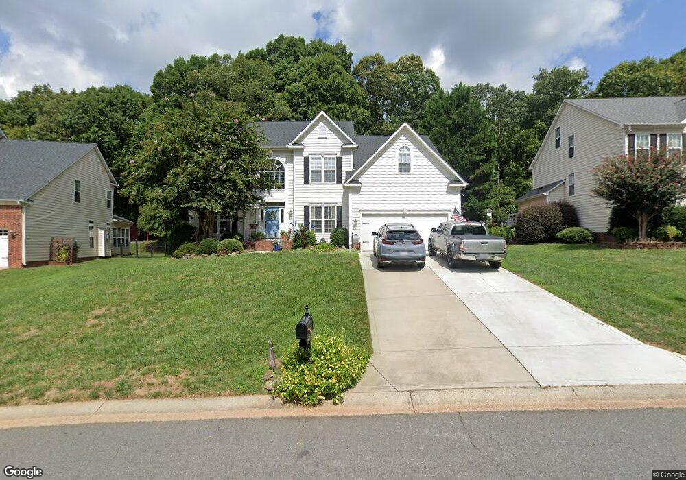
2007 Linstead Dr Indian Trail, NC 28079
Estimated Value: $512,855 - $518,000
3
Beds
3
Baths
3,124
Sq Ft
$165/Sq Ft
Est. Value
About This Home
This home is located at 2007 Linstead Dr, Indian Trail, NC 28079 and is currently estimated at $515,464, approximately $165 per square foot. 2007 Linstead Dr is a home located in Union County with nearby schools including Shiloh Valley Primary School, Shiloh Valley Elementary School, and Sun Valley Middle School.
Ownership History
Date
Name
Owned For
Owner Type
Purchase Details
Closed on
Feb 15, 2001
Sold by
Nvr Inc
Bought by
Price Johnny R and Price Melody L
Current Estimated Value
Home Financials for this Owner
Home Financials are based on the most recent Mortgage that was taken out on this home.
Original Mortgage
$178,412
Outstanding Balance
$62,570
Interest Rate
7.03%
Estimated Equity
$452,894
Create a Home Valuation Report for This Property
The Home Valuation Report is an in-depth analysis detailing your home's value as well as a comparison with similar homes in the area
Purchase History
| Date | Buyer | Sale Price | Title Company |
|---|---|---|---|
| Price Johnny R | $223,500 | -- |
Source: Public Records
Mortgage History
| Date | Status | Borrower | Loan Amount |
|---|---|---|---|
| Open | Price Johnny R | $178,412 | |
| Closed | Price Johnny R | $33,452 |
Source: Public Records
Tax History
| Year | Tax Paid | Tax Assessment Tax Assessment Total Assessment is a certain percentage of the fair market value that is determined by local assessors to be the total taxable value of land and additions on the property. | Land | Improvement |
|---|---|---|---|---|
| 2025 | $3,288 | $497,700 | $0 | $0 |
| 2024 | $2,888 | $341,700 | $52,900 | $288,800 |
| 2023 | $2,868 | $341,700 | $52,900 | $288,800 |
| 2022 | $2,868 | $341,700 | $52,900 | $288,800 |
| 2021 | $2,866 | $341,700 | $52,900 | $288,800 |
| 2020 | $1,870 | $238,000 | $36,000 | $202,000 |
| 2019 | $2,363 | $238,000 | $36,000 | $202,000 |
| 2018 | $1,859 | $238,000 | $36,000 | $202,000 |
| 2017 | $2,482 | $238,000 | $36,000 | $202,000 |
| 2016 | $1,944 | $238,000 | $36,000 | $202,000 |
| 2015 | $1,969 | $238,000 | $36,000 | $202,000 |
| 2014 | $1,923 | $271,730 | $32,000 | $239,730 |
Source: Public Records
Map
Nearby Homes
- 2000 Linstead Dr
- 3007 Linstead Dr
- 5535 Whispering Wind Ln
- 5226 Courtfield Dr
- 1002 Lavenham Place
- 4297 Canewood Ln
- 227 Edenshire Ct
- 1116 Alyssum Ln
- 1002 Dataw Ln
- 411 Carlisle Dr
- 1022 Fountainbrook Dr
- 217 Edenshire Ct
- 705 Sagecroft Ln
- 1022 Canopy Dr
- 418 Kenwood View
- 2018 Bridleside Dr
- 2022 Bridleside Dr
- 333 Kennerly Dr
- 5008 Rosewater Ln
- 217 Grover Moore Place
- 2009 Linstead Dr
- 2005 Linstead Dr
- 2011 Linstead Dr
- 2003 Linstead Dr
- 2004 Linstead Dr
- 2006 Linstead Dr
- 2008 Linstead Dr
- 2013 Linstead Dr
- 2002 Linstead Dr
- 1002 Aldridge Ct
- 1004 Aldridge Ct
- 1000 Aldridge Ct
- 2010 Linstead Dr
- 2015 Linstead Dr
- 2012 Linstead Dr
- 1004 Hollyhedge Ln
- 3001 Linstead Dr
- 1006 Linstead Dr
- 1006 Hollyhedge Ln
- 1003 Aldridge Ct
Your Personal Tour Guide
Ask me questions while you tour the home.