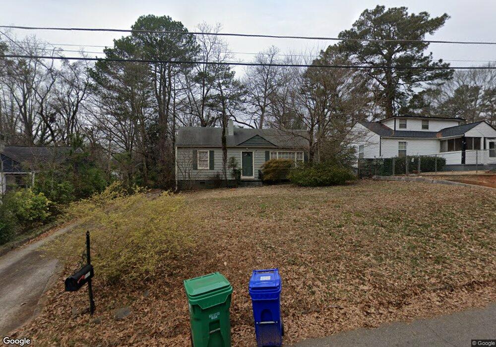
2007 Mcafee Place Decatur, GA 30032
East Lake NeighborhoodEstimated Value: $333,007 - $375,000
3
Beds
2
Baths
1,224
Sq Ft
$283/Sq Ft
Est. Value
About This Home
This home is located at 2007 Mcafee Place, Decatur, GA 30032 and is currently estimated at $346,252, approximately $282 per square foot. 2007 Mcafee Place is a home located in DeKalb County with nearby schools including McNair Middle School, McNair High School, and Charles Drew Charter School.
Ownership History
Date
Name
Owned For
Owner Type
Purchase Details
Closed on
Feb 20, 2019
Sold by
Feng Eric
Bought by
Niles Bowen Properties Llc
Current Estimated Value
Purchase Details
Closed on
Jul 20, 2016
Sold by
Lindy Property Co Llc
Bought by
Feng Eric
Home Financials for this Owner
Home Financials are based on the most recent Mortgage that was taken out on this home.
Original Mortgage
$98,000
Interest Rate
3.56%
Mortgage Type
New Conventional
Purchase Details
Closed on
Jan 28, 2009
Sold by
Linderman Christopher
Bought by
Lindy Property Co Llc
Purchase Details
Closed on
Dec 31, 2007
Sold by
Deutsche Bk Trust Co Americas
Bought by
Linderman Christopher
Purchase Details
Closed on
Sep 4, 2007
Sold by
Wallace Clarence
Bought by
Deutsche Bank Trust Co America
Create a Home Valuation Report for This Property
The Home Valuation Report is an in-depth analysis detailing your home's value as well as a comparison with similar homes in the area
Home Values in the Area
Average Home Value in this Area
Purchase History
| Date | Buyer | Sale Price | Title Company |
|---|---|---|---|
| Niles Bowen Properties Llc | -- | -- | |
| Feng Eric | $122,500 | -- | |
| Lindy Property Co Llc | -- | -- | |
| Linderman Christopher | $70,000 | -- | |
| Deutsche Bank Trust Co America | $85,000 | -- |
Source: Public Records
Mortgage History
| Date | Status | Borrower | Loan Amount |
|---|---|---|---|
| Previous Owner | Feng Eric | $98,000 |
Source: Public Records
Tax History Compared to Growth
Tax History
| Year | Tax Paid | Tax Assessment Tax Assessment Total Assessment is a certain percentage of the fair market value that is determined by local assessors to be the total taxable value of land and additions on the property. | Land | Improvement |
|---|---|---|---|---|
| 2025 | $6,387 | $136,000 | $63,600 | $72,400 |
| 2024 | $6,398 | $136,200 | $63,600 | $72,600 |
| 2023 | $6,398 | $92,000 | $32,000 | $60,000 |
| 2022 | $5,225 | $92,000 | $32,000 | $60,000 |
| 2021 | $4,059 | $99,760 | $32,000 | $67,760 |
| 2020 | $4,247 | $89,080 | $32,000 | $57,080 |
| 2019 | $1,614 | $48,968 | $2,448 | $46,520 |
| 2018 | $1,557 | $48,967 | $2,448 | $46,519 |
| 2017 | $2,496 | $48,968 | $2,448 | $46,520 |
| 2016 | $1,636 | $29,400 | $3,080 | $26,320 |
| 2014 | $1,054 | $15,840 | $1,920 | $13,920 |
Source: Public Records
Map
Nearby Homes
- 2007 Mcafee Place
- 2003 Mcafee Place
- 2011 Mcafee Place
- 1997 Mcafee Place
- 2012 E Starmount Way
- 2004 E Starmount Way
- 1985 Mcafee Place
- 2141 Garden Cir
- 2006 Mcafee Place
- 1994 E Starmount Way
- 2010 Mcafee Place
- 2002 Mcafee Place
- 2002 Mcafee Place Unit 2002
- 1996 Mcafee Place
- 1988 E Starmount Way
- 1979 Mcafee Place
- 2149 Mcafee Rd
- 2137 Mcafee Rd
- 1990 Mcafee Place
- 2137 Garden Cir