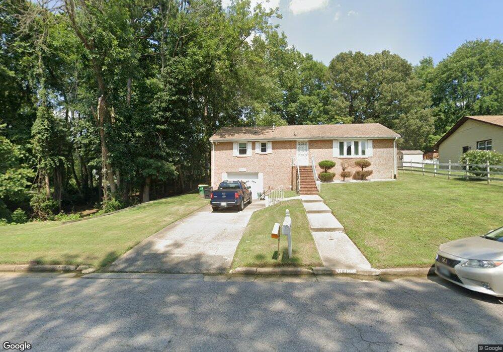
2007 Sunnyside Ave Hopewell, VA 23860
Estimated Value: $259,000 - $288,000
3
Beds
2
Baths
1,350
Sq Ft
$203/Sq Ft
Est. Value
About This Home
This home is located at 2007 Sunnyside Ave, Hopewell, VA 23860 and is currently estimated at $273,451, approximately $202 per square foot. 2007 Sunnyside Ave is a home located in Hopewell City with nearby schools including Carter G. Woodson Middle School, Hopewell High School, and West End Christian School.
Ownership History
Date
Name
Owned For
Owner Type
Purchase Details
Closed on
Aug 4, 2025
Sold by
Crockett Dorothy L and Wheat Herbert L
Bought by
Wheat Malik D
Current Estimated Value
Home Financials for this Owner
Home Financials are based on the most recent Mortgage that was taken out on this home.
Original Mortgage
$220,000
Outstanding Balance
$219,811
Interest Rate
6.75%
Mortgage Type
New Conventional
Estimated Equity
$53,640
Purchase Details
Closed on
Jun 7, 2017
Sold by
Wheat Anna L
Bought by
Wheat Valeria P and Crockett Dorothy L
Create a Home Valuation Report for This Property
The Home Valuation Report is an in-depth analysis detailing your home's value as well as a comparison with similar homes in the area
Home Values in the Area
Average Home Value in this Area
Purchase History
| Date | Buyer | Sale Price | Title Company |
|---|---|---|---|
| Wheat Malik D | $275,000 | Old Republic National Title In | |
| Wheat Valeria P | -- | None Available |
Source: Public Records
Mortgage History
| Date | Status | Borrower | Loan Amount |
|---|---|---|---|
| Open | Wheat Malik D | $220,000 |
Source: Public Records
Tax History Compared to Growth
Tax History
| Year | Tax Paid | Tax Assessment Tax Assessment Total Assessment is a certain percentage of the fair market value that is determined by local assessors to be the total taxable value of land and additions on the property. | Land | Improvement |
|---|---|---|---|---|
| 2025 | $3,034 | $259,300 | $22,900 | $236,400 |
| 2023 | $2,472 | $218,800 | $22,000 | $196,800 |
| 2022 | $1,976 | $174,900 | $20,000 | $154,900 |
| 2021 | $1,976 | $174,900 | $20,000 | $154,900 |
| 2020 | $1,871 | $165,600 | $20,000 | $145,600 |
| 2019 | $1,871 | $165,600 | $20,000 | $145,600 |
| 2018 | $1,385 | $122,600 | $18,600 | $104,000 |
| 2017 | $1,385 | $122,600 | $18,600 | $104,000 |
| 2016 | $1,400 | $123,900 | $18,600 | $105,300 |
| 2015 | $700 | $123,900 | $18,600 | $105,300 |
| 2014 | $2,085 | $125,200 | $18,600 | $106,600 |
Source: Public Records
Map
Nearby Homes
- 1904 Arlington Rd
- 1702 Tabb Ave
- 000 Prince George Dr
- 3011 Davison Ave
- 2505 Wakefield St
- 1701 Arlington Rd
- 1506 Stewart Ave
- 1501 Central Ave
- 1308 Lee Ln
- 1304 Lee Ln
- 00 Stewart Ave
- 3203 Courthouse Rd
- 0 Arlington Rd
- 1902 Dellrose Dr
- 1308 Tabb Ave
- 3307 Freeman St
- 2404 Trenton St
- 1304 Arlington Rd
- 3317 Trenton St
- 1108 Terrace Ave
- 2011 Sunnyside Ave
- 2711 Bassett St
- 2000 Sunnyside Ave
- 2006 Liberty Ave
- 2008 Liberty Ave
- 1909 Sunnyside Ave
- 2008 Sunnyside Ave
- 1910 Liberty Ave
- 2012 Liberty Ave
- 2012 Sunnyside Ave
- 1910 Sunnyside Ave
- 1907 Sunnyside Ave
- 2005 Liberty Ave
- 2007 Liberty Ave
- 2001 Warren Ave
- 2005 Warren Ave
- 2001 Liberty Ave
- 2009 Liberty Ave
- 1908 Liberty Ave
- 2009 Warren Ave