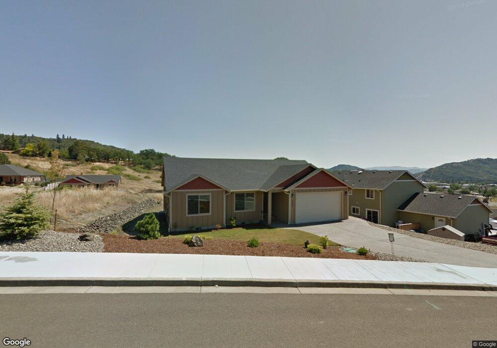
2007 Sunset Loop Dr Roseburg, OR 97470
Estimated Value: $400,000 - $441,000
3
Beds
2
Baths
1,553
Sq Ft
$271/Sq Ft
Est. Value
About This Home
This home is located at 2007 Sunset Loop Dr, Roseburg, OR 97470 and is currently estimated at $420,487, approximately $270 per square foot. 2007 Sunset Loop Dr is a home located in Douglas County with nearby schools including Joseph Lane Middle School, Roseburg High School, and Grace Family Child Center.
Ownership History
Date
Name
Owned For
Owner Type
Purchase Details
Closed on
Jul 14, 2023
Sold by
Ellis Robert L
Bought by
Robert L Elllis Revocable Trust and Ellis
Current Estimated Value
Purchase Details
Closed on
Oct 27, 2022
Sold by
Rude Leslie H
Bought by
Ellis Robert
Purchase Details
Closed on
Sep 25, 2014
Sold by
Ray Sara M and Martin Sara M
Bought by
Rude Dennis C and Rude Leslie H
Home Financials for this Owner
Home Financials are based on the most recent Mortgage that was taken out on this home.
Original Mortgage
$175,600
Interest Rate
4.07%
Mortgage Type
New Conventional
Purchase Details
Closed on
Sep 25, 2012
Sold by
Jerry L Tabor Building Inc
Bought by
Martin Sara M
Home Financials for this Owner
Home Financials are based on the most recent Mortgage that was taken out on this home.
Original Mortgage
$198,979
Interest Rate
3.59%
Mortgage Type
New Conventional
Create a Home Valuation Report for This Property
The Home Valuation Report is an in-depth analysis detailing your home's value as well as a comparison with similar homes in the area
Home Values in the Area
Average Home Value in this Area
Purchase History
| Date | Buyer | Sale Price | Title Company |
|---|---|---|---|
| Robert L Elllis Revocable Trust | -- | None Listed On Document | |
| Ellis Robert | $369,500 | Western Title | |
| Rude Dennis C | $219,500 | First American Title | |
| Martin Sara M | $195,000 | Ticor Title Company Oregon |
Source: Public Records
Mortgage History
| Date | Status | Borrower | Loan Amount |
|---|---|---|---|
| Previous Owner | Rude Dennis C | $175,600 | |
| Previous Owner | Martin Sara M | $198,979 |
Source: Public Records
Tax History Compared to Growth
Tax History
| Year | Tax Paid | Tax Assessment Tax Assessment Total Assessment is a certain percentage of the fair market value that is determined by local assessors to be the total taxable value of land and additions on the property. | Land | Improvement |
|---|---|---|---|---|
| 2024 | $3,444 | $234,831 | -- | -- |
| 2023 | $3,344 | $227,992 | $0 | $0 |
| 2022 | $3,247 | $221,352 | $0 | $0 |
| 2021 | $3,152 | $214,905 | $0 | $0 |
| 2020 | $3,138 | $208,646 | $0 | $0 |
| 2019 | $3,069 | $202,569 | $0 | $0 |
| 2018 | $2,991 | $196,669 | $0 | $0 |
| 2017 | $2,903 | $190,941 | $0 | $0 |
| 2016 | $2,806 | $185,380 | $0 | $0 |
| 2015 | $2,746 | $179,981 | $0 | $0 |
| 2014 | $2,668 | $174,739 | $0 | $0 |
| 2013 | -- | $169,650 | $0 | $0 |
Source: Public Records
Map
Nearby Homes
- 1884 NE Sunset St
- 2071 NE Stephens St Unit M8
- 1783 NE Todd St
- 0 NE Sunset St Unit 423475298
- 0 NE Alameda Ave
- 1628 NE Taylor St
- 1542 NE Hollis St
- 0 NE Barager Ave
- 1448 NE Rocky Ridge Dr
- 885 NE Sunset St Unit 22
- 885 NE Sunset St Unit 2
- 885 NE Sunset St Unit 26
- 1452 NE Rocky Ridge Dr
- 797 NE Garden Valley Blvd
- 1489 Four Seasons Dr Unit 17
- 201 NE Peggy Ave Unit 6
- 201 NE Peggy Ave Unit 7
- 201 NE Peggy Ave Unit 11
- 201 NE Peggy Ave Unit 10
- 1497 NE Rocky Ridge Dr
- 2007 NE Sunset Loop Dr
- 1957 Sunset Loop Dr
- 2037 Sunset Loop Dr
- 1924 NE Sunset St
- 1970 NE Sunset St
- 1907 Sunset Loop Dr
- 2010 NE Sunset St
- 1944 Sunset Loop Dr
- 1904 NE Sunset St
- 2024 NE Sunset St
- 1924 Sunset Loop Dr
- 2004 NE Sunset Loop Dr
- 1904 Sunset Loop Dr
- 2014 NE Sunset Loop Dr
- 1894 NE Sunset St
- 1984 NE Sunset Loop Dr
- 2040 NE Sunset St
- 1984 NE Sunset St
- 2024 Sunset Loop Dr
- 1887 Sunset Loop Dr