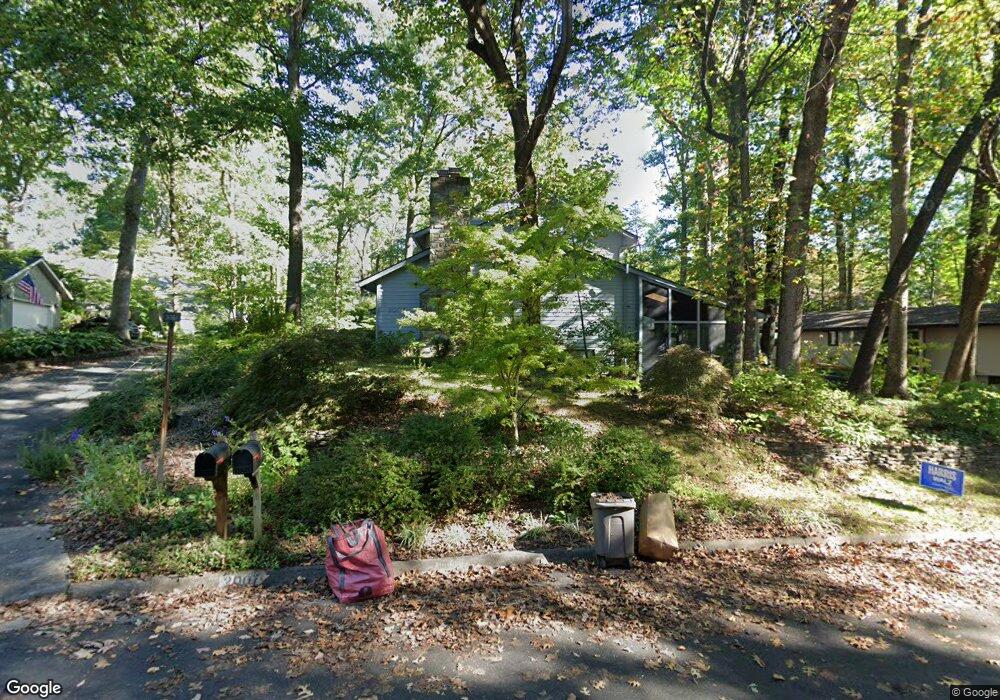
2007 Upper Lake Dr Reston, VA 20191
Estimated Value: $998,000 - $1,283,858
3
Beds
4
Baths
2,262
Sq Ft
$505/Sq Ft
Est. Value
About This Home
This home is located at 2007 Upper Lake Dr, Reston, VA 20191 and is currently estimated at $1,141,465, approximately $504 per square foot. 2007 Upper Lake Dr is a home located in Fairfax County with nearby schools including Sunrise Valley Elementary, Langston Hughes Middle School, and South Lakes High School.
Ownership History
Date
Name
Owned For
Owner Type
Purchase Details
Closed on
Aug 28, 2025
Sold by
Penniman William Howard and Penniman Judith Moreland
Bought by
William H Penniman Trust and Judith M Penniman Trust
Current Estimated Value
Purchase Details
Closed on
Jun 23, 2004
Sold by
Wyzkoski Joseph F
Bought by
Penniman William H
Create a Home Valuation Report for This Property
The Home Valuation Report is an in-depth analysis detailing your home's value as well as a comparison with similar homes in the area
Home Values in the Area
Average Home Value in this Area
Purchase History
| Date | Buyer | Sale Price | Title Company |
|---|---|---|---|
| William H Penniman Trust | -- | None Listed On Document | |
| William H Penniman Trust | -- | None Listed On Document | |
| Penniman William H | $650,000 | -- |
Source: Public Records
Tax History
| Year | Tax Paid | Tax Assessment Tax Assessment Total Assessment is a certain percentage of the fair market value that is determined by local assessors to be the total taxable value of land and additions on the property. | Land | Improvement |
|---|---|---|---|---|
| 2025 | $12,087 | $1,177,040 | $390,000 | $787,040 |
| 2024 | $12,087 | $1,002,680 | $330,000 | $672,680 |
| 2023 | $10,869 | $924,590 | $330,000 | $594,590 |
| 2022 | $10,342 | $868,750 | $330,000 | $538,750 |
| 2021 | $8,952 | $733,440 | $300,000 | $433,440 |
| 2020 | $9,025 | $733,440 | $300,000 | $433,440 |
| 2019 | $9,365 | $761,110 | $300,000 | $461,110 |
| 2018 | $8,304 | $722,070 | $270,000 | $452,070 |
| 2017 | $8,723 | $722,070 | $270,000 | $452,070 |
| 2016 | $8,873 | $736,050 | $270,000 | $466,050 |
Source: Public Records
Map
Nearby Homes
- 2009 Headlands Cir
- 2006 Headlands Cir
- 11240 Harbor Ct Unit 11240
- 1953 Lakeport Way
- 1926 Lakeport Way
- 11123 Lakespray Way
- 1951 Sagewood Ln Unit 619
- 11117 Little Compton Dr
- 2028 Beacon Place
- 11236 Faraday Park Dr
- 1878 Easterly Rd
- 11226 Beaker St
- 11168 Beaver Trail Ct
- 2118 Owls Cove Ln
- 11200 Reston Station Blvd Unit 208
- 11142 Beaver Trail Ct
- 11144 Beaver Trail Ct Unit 11144
- 11116 Beaver Trail Ct Unit 11116
- 10921 Harpers Square Ct
- 11566 Rolling Green Ct Unit 12/200A
- 2009 Upper Lake Dr
- 2005 Upper Lake Dr
- 2001 Upper Lake Dr
- 2003 Upper Lake Dr
- 2001 Halyard Ln
- 1949 Upper Lake Dr
- 1968 Winterport Cluster
- 1968 Winterport Cluster
- 2010 Upper Lake Dr
- 1970 Winterport Cluster
- 1970 Winterport Cluster
- 1966 Winterport Cluster
- 1966 Winterport Cluster
- 1966 Winterport Cluster
- 1964 Winterport Cluster
- 1972 Winterport Cluster
- 1972 Winterport Cluster
- 1974 Winterport Cluster
- 2000 Halyard Ln
- 1974 Winterport Cluster
Your Personal Tour Guide
Ask me questions while you tour the home.