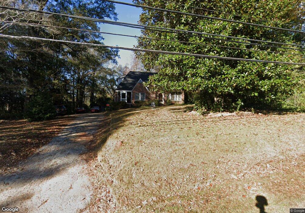
2007 Us Highway 29 West Point, GA 31833
Estimated Value: $220,595 - $275,000
3
Beds
2
Baths
1,913
Sq Ft
$126/Sq Ft
Est. Value
About This Home
This home is located at 2007 Us Highway 29, West Point, GA 31833 and is currently estimated at $240,399, approximately $125 per square foot. 2007 Us Highway 29 is a home with nearby schools including West Point Elementary School, Long Cane Elementary School, and Berta Weathersbee Elementary School.
Ownership History
Date
Name
Owned For
Owner Type
Purchase Details
Closed on
Jun 30, 2006
Sold by
Matthews Shelia A
Bought by
Matthews Shelia A and Matthews Johnny
Current Estimated Value
Purchase Details
Closed on
Aug 5, 1998
Sold by
Burdette Steven
Bought by
Shelia A Matthews
Purchase Details
Closed on
Aug 26, 1994
Sold by
Robert Weldon Wilkinson
Bought by
Burdette Steven
Purchase Details
Closed on
Aug 2, 1988
Bought by
Robert Weldon Wilkinson
Purchase Details
Closed on
Mar 10, 1980
Purchase Details
Closed on
Feb 6, 1979
Purchase Details
Closed on
Jan 1, 1954
Create a Home Valuation Report for This Property
The Home Valuation Report is an in-depth analysis detailing your home's value as well as a comparison with similar homes in the area
Home Values in the Area
Average Home Value in this Area
Purchase History
| Date | Buyer | Sale Price | Title Company |
|---|---|---|---|
| Matthews Shelia A | -- | -- | |
| Shelia A Matthews | $72,000 | -- | |
| Burdette Steven | $55,000 | -- | |
| Robert Weldon Wilkinson | $14,300 | -- | |
| -- | -- | -- | |
| -- | -- | -- | |
| -- | -- | -- |
Source: Public Records
Tax History Compared to Growth
Tax History
| Year | Tax Paid | Tax Assessment Tax Assessment Total Assessment is a certain percentage of the fair market value that is determined by local assessors to be the total taxable value of land and additions on the property. | Land | Improvement |
|---|---|---|---|---|
| 2024 | $2,064 | $59,880 | $6,200 | $53,680 |
| 2023 | $1,051 | $58,440 | $6,200 | $52,240 |
| 2022 | $1,475 | $54,840 | $6,200 | $48,640 |
| 2021 | $1,249 | $43,400 | $6,200 | $37,200 |
| 2020 | $1,249 | $43,400 | $6,200 | $37,200 |
| 2019 | $1,071 | $37,486 | $5,126 | $32,360 |
| 2018 | $1,025 | $35,966 | $5,126 | $30,840 |
| 2017 | $1,025 | $35,966 | $5,126 | $30,840 |
| 2016 | $996 | $34,994 | $5,126 | $29,867 |
| 2015 | $1,031 | $36,104 | $6,237 | $29,867 |
| 2014 | $985 | $34,532 | $6,237 | $28,295 |
| 2013 | -- | $36,502 | $6,237 | $30,265 |
Source: Public Records
Map
Nearby Homes
- 1903 Ridgewood Dr
- 508 Pine St
- 0 Ga Highway 0116 Unit 10619139
- 1599 Highway 29
- 1505 Wisteria Dr
- 1008 E 12th St
- 0 Sunset Dr Unit 10451831
- 1410 Roper Ave
- 1314 4th Ave
- 0 Arrowhead Dr Unit 10451860
- 713 Avenue H
- 1007 4th Ave
- 804 E 6th St
- 509 Cleveland St
- 4517 Georgia 18
- 4509 Georgia 18
- 4523 Georgia 18
- 4527 Georgia 18
- 712 4th Ave
- 1508 N 4th Ave
- 2009 Us Highway 29
- 2009 U S 29
- 203 Rabern St
- 2006 Us Highway 29
- 1810 Us Highway 29
- 0 US Highway 29 Unit 7509884
- 2004 Us Highway 29
- 2008 Us Highway 29
- 2013 Us Highway 29
- 2013 Us Highway 29
- 2013 U S 29
- 1804 Malco Dr
- 201 Rabern St
- 503 Pine St
- 1803 Malco Dr
- 1908 Ridgewood Dr
- 505 Pine St
- 1806 Route 29
- 1802 Malco Dr
- 1905 Spruce St