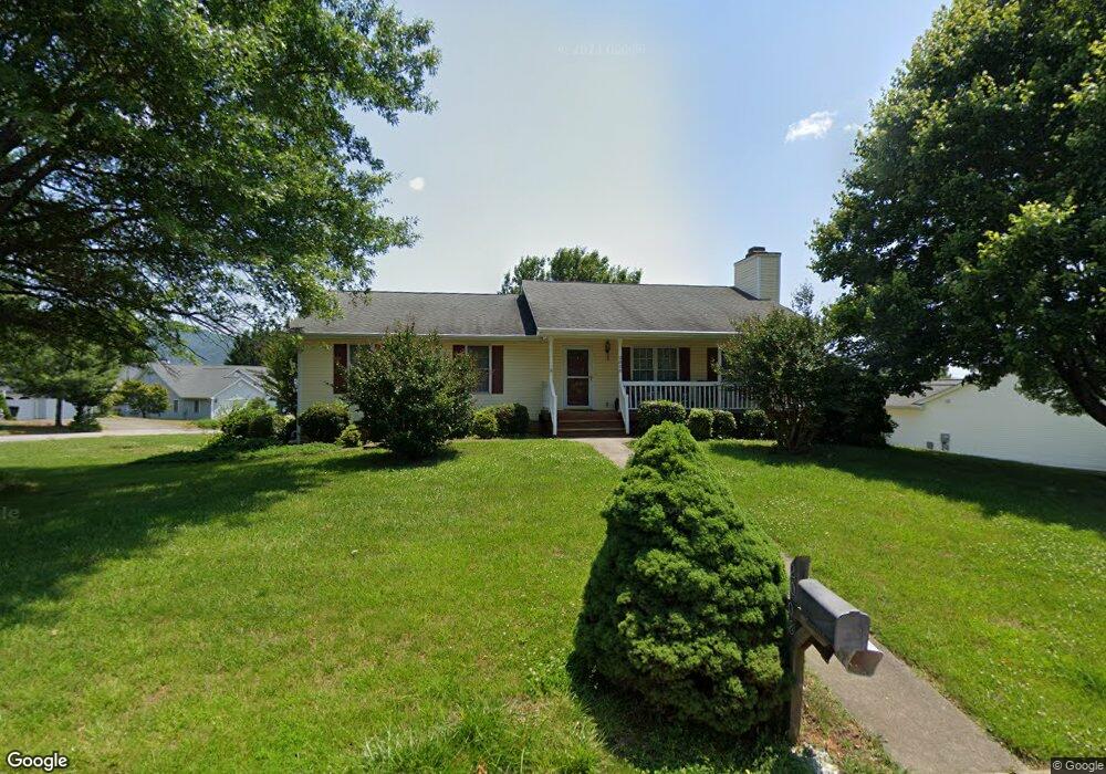
2008 Bloomfield Ave Roanoke, VA 24012
Estimated Value: $370,000 - $397,000
4
Beds
3
Baths
1,438
Sq Ft
$265/Sq Ft
Est. Value
About This Home
This home is located at 2008 Bloomfield Ave, Roanoke, VA 24012 and is currently estimated at $381,122, approximately $265 per square foot. 2008 Bloomfield Ave is a home located in Roanoke County with nearby schools including Bonsack Elementary School, William Byrd Middle School, and William Byrd High School.
Ownership History
Date
Name
Owned For
Owner Type
Purchase Details
Closed on
Mar 24, 2008
Sold by
Boehling John F and Boehling Patricia M
Bought by
Farrier Carrol W and Farrier Robert F
Current Estimated Value
Home Financials for this Owner
Home Financials are based on the most recent Mortgage that was taken out on this home.
Original Mortgage
$170,800
Outstanding Balance
$106,520
Interest Rate
5.76%
Mortgage Type
New Conventional
Estimated Equity
$274,602
Create a Home Valuation Report for This Property
The Home Valuation Report is an in-depth analysis detailing your home's value as well as a comparison with similar homes in the area
Home Values in the Area
Average Home Value in this Area
Purchase History
| Date | Buyer | Sale Price | Title Company |
|---|---|---|---|
| Farrier Carrol W | $213,500 | None Available |
Source: Public Records
Mortgage History
| Date | Status | Borrower | Loan Amount |
|---|---|---|---|
| Open | Farrier Carrol W | $170,800 |
Source: Public Records
Tax History Compared to Growth
Tax History
| Year | Tax Paid | Tax Assessment Tax Assessment Total Assessment is a certain percentage of the fair market value that is determined by local assessors to be the total taxable value of land and additions on the property. | Land | Improvement |
|---|---|---|---|---|
| 2025 | $3,264 | $316,900 | $59,000 | $257,900 |
| 2024 | $3,132 | $301,200 | $54,000 | $247,200 |
| 2023 | $3,090 | $291,500 | $54,000 | $237,500 |
| 2022 | $2,651 | $243,200 | $49,000 | $194,200 |
| 2021 | $2,431 | $223,000 | $45,000 | $178,000 |
| 2020 | $2,284 | $209,500 | $40,000 | $169,500 |
| 2019 | $2,213 | $203,000 | $39,000 | $164,000 |
| 2018 | $2,115 | $199,400 | $39,000 | $160,400 |
| 2017 | $2,115 | $194,000 | $39,000 | $155,000 |
| 2016 | $2,066 | $189,500 | $38,000 | $151,500 |
| 2015 | $2,027 | $186,000 | $38,000 | $148,000 |
| 2014 | $2,005 | $183,900 | $36,000 | $147,900 |
Source: Public Records
Map
Nearby Homes
- 2414 Carlsbad Cir
- 1802 W Ruritan Rd
- 1713 Ashbury Ct
- 1944 W Ruritan Rd
- 1525 W Ruritan Rd
- 0 E Ruritan Rd
- 4127 Mockingbird Hill Rd
- 1971 W Ruritan Rd
- 2020 Ruritan Rd
- 2054 Ruritan Rd
- 2910 Mystique Ct
- 2206 Coachman Dr
- 5018 Carter Grove Ln
- 5114 Huntridge Rd
- 2826 Greggin Dr
- 6110 Wisteria Place Ct
- 3516 Springtree Cir NE
- 4933 Pine Glen Rd NE
- 4964 Pine Glen Rd NE
- 5508 Rome Dr
- 2021 Bridgeport Ln
- 2020 Bloomfield Ave
- 2013 Bloomfield Ave
- 2014 Bridgeport Ln
- 2030 Bloomfield Ave
- 2020 Bridgeport Ln
- 1938 Bloomfield Ave
- 2029 Bridgeport Ln
- 1945 Bloomfield Ave
- 2019 Bloomfield Ave
- 2026 Bridgeport Ln
- 2110 Bloomfield Ave
- 1939 Bloomfield Ave
- 1935 High Crest Ct
- 2027 Bloomfield Ave
- 2033 Bridgeport Ln
- 1932 Bloomfield Ave
- 2035 Bloomfield Ave
- 1939 High Crest Ct
- 2122 Bloomfield Ave