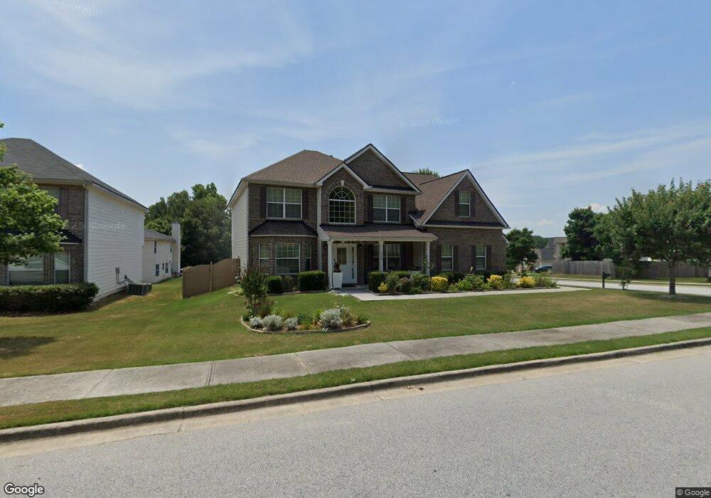
2008 Bridgestone Cir Conyers, GA 30012
Estimated Value: $343,363 - $390,000
5
Beds
3
Baths
3,213
Sq Ft
$113/Sq Ft
Est. Value
About This Home
This home is located at 2008 Bridgestone Cir, Conyers, GA 30012 and is currently estimated at $362,841, approximately $112 per square foot. 2008 Bridgestone Cir is a home located in Rockdale County with nearby schools including Hicks Elementary School, Conyers Middle School, and Rockdale County High School.
Ownership History
Date
Name
Owned For
Owner Type
Purchase Details
Closed on
Apr 18, 2024
Sold by
Martin Adina
Bought by
Martin Howard Dean and Martin Adina
Current Estimated Value
Purchase Details
Closed on
Jan 30, 2012
Sold by
Federal National Mortgage Association
Bought by
Martin Adina
Home Financials for this Owner
Home Financials are based on the most recent Mortgage that was taken out on this home.
Original Mortgage
$104,287
Interest Rate
4.37%
Mortgage Type
FHA
Purchase Details
Closed on
Aug 2, 2011
Sold by
Bank Of America Na
Bought by
Federal National Mtg Associati
Purchase Details
Closed on
Aug 9, 2006
Sold by
Legacy Communities Of Bridgest
Bought by
Hurst Aldwin
Home Financials for this Owner
Home Financials are based on the most recent Mortgage that was taken out on this home.
Original Mortgage
$44,559
Interest Rate
6.52%
Mortgage Type
New Conventional
Create a Home Valuation Report for This Property
The Home Valuation Report is an in-depth analysis detailing your home's value as well as a comparison with similar homes in the area
Home Values in the Area
Average Home Value in this Area
Purchase History
| Date | Buyer | Sale Price | Title Company |
|---|---|---|---|
| Martin Howard Dean | -- | -- | |
| Martin Adina | $107,000 | -- | |
| Federal National Mtg Associati | $81,500 | -- | |
| Bank Of America Na | $81,500 | -- | |
| Hurst Aldwin | $222,800 | -- |
Source: Public Records
Mortgage History
| Date | Status | Borrower | Loan Amount |
|---|---|---|---|
| Previous Owner | Martin Adina | $104,287 | |
| Previous Owner | Hurst Aldwin | $44,559 | |
| Previous Owner | Hurst Aldwin | $178,236 |
Source: Public Records
Tax History Compared to Growth
Tax History
| Year | Tax Paid | Tax Assessment Tax Assessment Total Assessment is a certain percentage of the fair market value that is determined by local assessors to be the total taxable value of land and additions on the property. | Land | Improvement |
|---|---|---|---|---|
| 2024 | $5,416 | $139,760 | $27,720 | $112,040 |
| 2023 | $5,213 | $135,560 | $26,800 | $108,760 |
| 2022 | $4,342 | $113,440 | $20,960 | $92,480 |
| 2021 | $3,960 | $98,760 | $18,800 | $79,960 |
| 2020 | $3,756 | $89,160 | $16,000 | $73,160 |
| 2019 | $2,707 | $65,640 | $8,800 | $56,840 |
| 2018 | $1,568 | $65,640 | $8,800 | $56,840 |
| 2017 | $1,941 | $52,040 | $10,400 | $41,640 |
| 2016 | $1,800 | $50,600 | $7,200 | $43,400 |
| 2015 | $2,305 | $50,600 | $7,200 | $43,400 |
| 2014 | $784 | $45,160 | $6,400 | $38,760 |
| 2013 | -- | $54,480 | $8,800 | $45,680 |
Source: Public Records
Map
Nearby Homes
- 1954 Bridgestone Cir
- 1962 Bridgestone Cir
- 2131 Bridgestone Business Pkwy
- 1666 E Brook Dr
- 1915 Cornerstone Pass
- 1903 Cobblestone Ct
- 1669 E Brook Dr
- 1526 Battle Brook Dr
- 1469 Cliff View Terrace
- 1260 Brookstone Cir
- 1640 Andalusian Way
- 1262 Brookstone Cir
- 1270 Pine Knoll Ln NE
- 2173 Tanglewood Trail NE
- 1217 Brookstone Cir
- 1288 Lakewood Dr NE
- 2184 Pine Knoll Cir NE
- 1735 Hill St NE
- 1794 Spring St NE
- 1722 River Mill Trail NE
- 1941 Bridgestone Cir
- 2006 Bridgestone Cir
- 1939 Bridgestone Cir
- 2007 Bridgestone Cir
- 1950 Bridgestone Cir
- 2004 Bridgestone Cir
- 1948 Bridgestone Cir
- 1952 Bridgestone Cir
- 2005 Bridgestone Cir
- 1954 Bridgestone Cir Unit 40
- 2002 Bridgestone Cir
- 1942 Bridgestone Cir
- 1944 Bridgestone Cir
- 1953 Bridgestone Cir
- 2003 Bridgestone Cir
- 1940 Bridgestone Cir
- 1946 Bridgestone Cir
- 1956 Bridgestone Cir
- 1961 Bridgestone Cir
- 2000 Bridgestone Cir