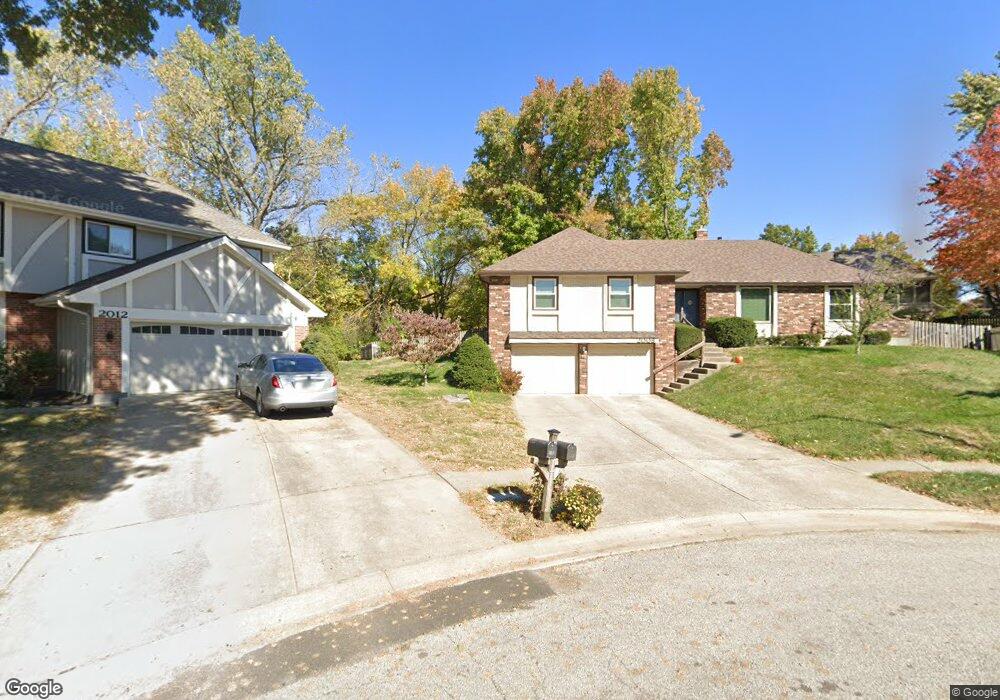
2008 Clay Ct Liberty, MO 64068
Estimated Value: $367,000 - $395,273
3
Beds
4
Baths
1,921
Sq Ft
$199/Sq Ft
Est. Value
About This Home
This home is located at 2008 Clay Ct, Liberty, MO 64068 and is currently estimated at $382,818, approximately $199 per square foot. 2008 Clay Ct is a home located in Clay County with nearby schools including Alexander Doniphan Elementary School, Discovery Middle School, and Liberty High School.
Ownership History
Date
Name
Owned For
Owner Type
Purchase Details
Closed on
Jun 27, 2008
Sold by
Shinn Wanda L and Shinn Wanda Louise
Bought by
Laffoon Timothy and Laffoon Kathryn
Current Estimated Value
Home Financials for this Owner
Home Financials are based on the most recent Mortgage that was taken out on this home.
Original Mortgage
$121,600
Interest Rate
5.99%
Mortgage Type
Purchase Money Mortgage
Purchase Details
Closed on
Nov 17, 2000
Sold by
Shinn Denzil K and Shinn Wanda
Bought by
Shinn Wanda Louise
Create a Home Valuation Report for This Property
The Home Valuation Report is an in-depth analysis detailing your home's value as well as a comparison with similar homes in the area
Home Values in the Area
Average Home Value in this Area
Purchase History
| Date | Buyer | Sale Price | Title Company |
|---|---|---|---|
| Laffoon Timothy | -- | Kansas City Title | |
| Shinn Wanda Louise | -- | -- |
Source: Public Records
Mortgage History
| Date | Status | Borrower | Loan Amount |
|---|---|---|---|
| Closed | Laffoon Timothy | $121,600 |
Source: Public Records
Tax History Compared to Growth
Tax History
| Year | Tax Paid | Tax Assessment Tax Assessment Total Assessment is a certain percentage of the fair market value that is determined by local assessors to be the total taxable value of land and additions on the property. | Land | Improvement |
|---|---|---|---|---|
| 2025 | $4,233 | $63,250 | -- | -- |
| 2024 | $4,233 | $55,040 | -- | -- |
| 2023 | $4,305 | $55,040 | $0 | $0 |
| 2022 | $3,945 | $49,800 | $0 | $0 |
| 2021 | $3,914 | $49,799 | $7,220 | $42,579 |
| 2020 | $3,780 | $45,160 | $0 | $0 |
| 2019 | $3,779 | $45,163 | $6,840 | $38,323 |
| 2018 | $3,334 | $39,120 | $0 | $0 |
| 2017 | $2,371 | $39,120 | $4,180 | $34,940 |
| 2016 | $2,371 | $28,080 | $4,180 | $23,900 |
| 2015 | $2,371 | $28,080 | $4,180 | $23,900 |
| 2014 | $2,321 | $27,270 | $4,750 | $22,520 |
Source: Public Records
Map
Nearby Homes
- 509 Belmont St
- 420 Belmont St
- 1507 Amesbury Ave
- 415 Monterey Ave
- 1323 Amesbury Ave
- 1733 Welleslay Ln
- 1124 Amesbury Ave
- 1218 Canterbury Ln
- 1537 Canterbury Ln
- 2116 Winding Woods Dr
- Lot 2 Bent Oaks Dr
- Lot 2A Oak Crest Dr
- 918 Amesbury Ave
- 862 Amesbury Ave
- 11852 N Kentucky Ave
- 1327 Easton Ct
- 1304 Wellington Way
- 716 Bristol Ct
- 1331 Park Ln
- 1317 Park Ln