Estimated Value: $244,116 - $269,000
--
Bed
--
Bath
1,612
Sq Ft
$159/Sq Ft
Est. Value
About This Home
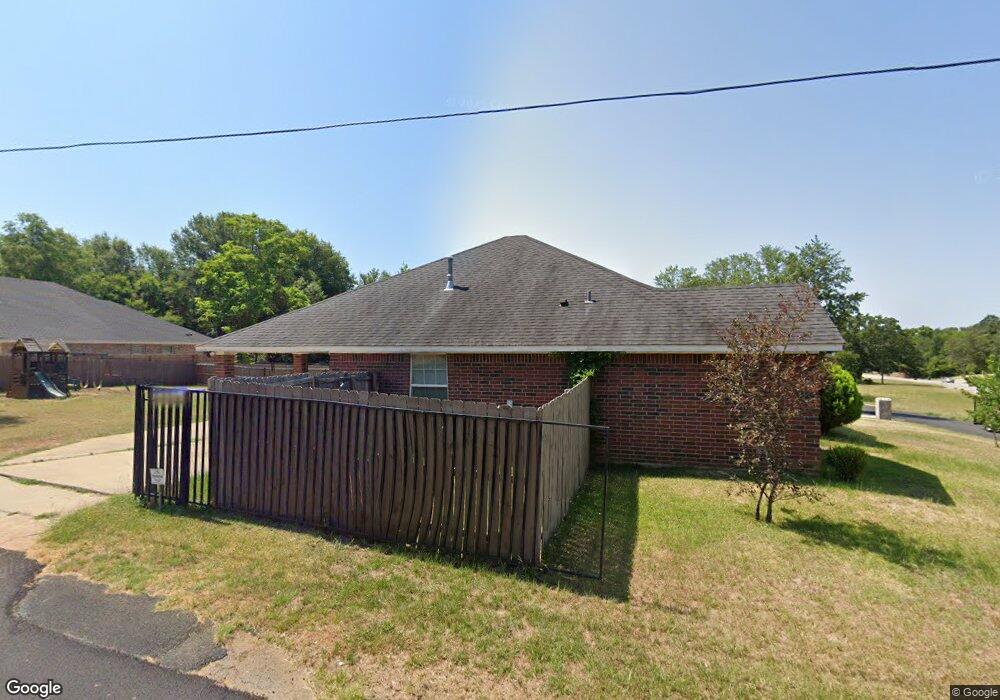
This home is located at 2008 Foster St, Tyler, TX 75701 and is currently estimated at $256,279, approximately $158 per square foot. 2008 Foster St is a home with nearby schools including Birdwell Dual Language Immersion School, Hogg Middle School, and Tyler Legacy High School.
Ownership History
Date
Name
Owned For
Owner Type
Purchase Details
Closed on
Jan 13, 2021
Sold by
Leandro Luis D and Leandro Ruby
Bought by
Leandro Properties Llc
Current Estimated Value
Home Financials for this Owner
Home Financials are based on the most recent Mortgage that was taken out on this home.
Original Mortgage
$146,400
Interest Rate
2.71%
Mortgage Type
Credit Line Revolving
Purchase Details
Closed on
Sep 10, 2013
Sold by
Leandro Luis H
Bought by
Leandro Luis D and Leandro Ruby
Home Financials for this Owner
Home Financials are based on the most recent Mortgage that was taken out on this home.
Original Mortgage
$82,000
Interest Rate
4.36%
Mortgage Type
Purchase Money Mortgage
Create a Home Valuation Report for This Property
The Home Valuation Report is an in-depth analysis detailing your home's value as well as a comparison with similar homes in the area
Home Values in the Area
Average Home Value in this Area
Purchase History
| Date | Buyer | Sale Price | Title Company |
|---|---|---|---|
| Leandro Properties Llc | -- | None Available | |
| Leandro Luis D | -- | None Available |
Source: Public Records
Mortgage History
| Date | Status | Borrower | Loan Amount |
|---|---|---|---|
| Closed | Leandro Properties Llc | $146,400 | |
| Closed | Leandro Luis D | $82,000 |
Source: Public Records
Tax History Compared to Growth
Tax History
| Year | Tax Paid | Tax Assessment Tax Assessment Total Assessment is a certain percentage of the fair market value that is determined by local assessors to be the total taxable value of land and additions on the property. | Land | Improvement |
|---|---|---|---|---|
| 2025 | $4,673 | $292,857 | $29,630 | $263,227 |
| 2024 | $4,673 | $274,664 | $16,515 | $279,302 |
| 2023 | $3,990 | $228,887 | $16,515 | $212,372 |
| 2022 | $4,092 | $208,860 | $16,515 | $192,345 |
| 2021 | $3,886 | $185,204 | $34,682 | $150,522 |
| 2020 | $3,682 | $172,090 | $23,581 | $148,509 |
| 2019 | $3,332 | $152,356 | $11,229 | $141,127 |
Source: Public Records
Map
Nearby Homes
- 1408 Old Noonday Rd
- 2922 Frankston Hwy
- 1672 Alamo Crossing
- 3012 Frankston Hwy
- 2322 Walton Rd
- 3016 Frankston Hwy
- 1506 Bowie Dr
- 1209 Terre Haute Dr
- 2319 Luther St
- 2940 Frankston Hwy
- 2986 Frankston Hwy
- 3004 Frankston Hwy
- 2950 Frankston Hwy
- 3008 Frankston Hwy
- 2954 Frankston Hwy
- 2928 Frankston Hwy
- 2934 Frankston Hwy
- 2922 W Azalea Dr
- 2529 S Vine Ave
- 2525 S Vine Ave
- 2850 Barnes St
- 2004 Foster St
- 2005 Foster St
- 2860 Barnes St
- 2900 2900 Barnes
- 2900 Barnes St
- 1921 Foster St
- 2904 Barnes St
- 1940 Walton Rd
- 2007 2007 Roy St
- 2007 Roy St
- 1914 Walton Rd
- 2731 Frankston Hwy
- 2739 Old Noonday Rd
- 2725 Frankston Hwy
- 2734 Criss St
- 2736 Walker St
- 2004 Roy St
- 2012 Roy St
- 2730 Walker St