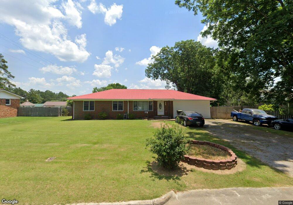
2008 Mack Ave SW Cullman, AL 35055
Estimated Value: $175,000 - $276,000
--
Bed
1
Bath
1,935
Sq Ft
$118/Sq Ft
Est. Value
About This Home
This home is located at 2008 Mack Ave SW, Cullman, AL 35055 and is currently estimated at $227,550, approximately $117 per square foot. 2008 Mack Ave SW is a home located in Cullman County with nearby schools including Cullman City Primary School, Cullman Middle School, and Cullman High School.
Ownership History
Date
Name
Owned For
Owner Type
Purchase Details
Closed on
Apr 5, 2021
Sold by
Jacobs Stanley D and Jacobs Betty A
Bought by
Foshee Robert
Current Estimated Value
Home Financials for this Owner
Home Financials are based on the most recent Mortgage that was taken out on this home.
Original Mortgage
$150,000
Outstanding Balance
$134,389
Interest Rate
2.8%
Mortgage Type
New Conventional
Estimated Equity
$93,161
Purchase Details
Closed on
Mar 24, 2021
Sold by
Jacobs Stanley D and Jacobs Betty A
Bought by
Foshee Robert
Home Financials for this Owner
Home Financials are based on the most recent Mortgage that was taken out on this home.
Original Mortgage
$150,000
Outstanding Balance
$134,389
Interest Rate
2.8%
Mortgage Type
New Conventional
Estimated Equity
$93,161
Create a Home Valuation Report for This Property
The Home Valuation Report is an in-depth analysis detailing your home's value as well as a comparison with similar homes in the area
Home Values in the Area
Average Home Value in this Area
Purchase History
| Date | Buyer | Sale Price | Title Company |
|---|---|---|---|
| Foshee Robert | $120,000 | Tbx Title | |
| Foshee Robert | $120,000 | Tbx Title |
Source: Public Records
Mortgage History
| Date | Status | Borrower | Loan Amount |
|---|---|---|---|
| Open | Foshee Robert | $150,000 | |
| Closed | Foshee Robert | $150,000 |
Source: Public Records
Tax History Compared to Growth
Tax History
| Year | Tax Paid | Tax Assessment Tax Assessment Total Assessment is a certain percentage of the fair market value that is determined by local assessors to be the total taxable value of land and additions on the property. | Land | Improvement |
|---|---|---|---|---|
| 2025 | $727 | $20,060 | $0 | $0 |
| 2024 | $689 | $19,060 | $0 | $0 |
| 2023 | $689 | $18,140 | $0 | $0 |
| 2022 | $565 | $15,840 | $0 | $0 |
| 2021 | $523 | $14,760 | $0 | $0 |
| 2020 | $493 | $13,980 | $0 | $0 |
| 2019 | $466 | $13,260 | $0 | $0 |
| 2018 | $439 | $12,580 | $0 | $0 |
| 2017 | $408 | $11,760 | $0 | $0 |
| 2016 | $408 | $11,760 | $0 | $0 |
| 2014 | $410 | $11,820 | $0 | $0 |
Source: Public Records
Map
Nearby Homes
- 4701 County Road 437 Unit Lot 3
- 4701 County Road 437 Unit Lot 2
- 4701 County Road 437
- 4701 County Road 437 Unit Lot 1
- 4701 County Road 437 Unit Lot 4
- 2036 Larry Ave SW
- .5 Acres County Road 437
- 1941 Dialsdale Dr SW
- 1109 Swafford Rd SW
- 0 Miller St SW
- 2106 Dialsdale Dr SW
- 1113 James St SW
- 2007 Adelshiem Cir SW
- 911 Olive St SW
- 2113 Wren Ave SW
- 1203 Morningside Dr SW
- 2122 Addison Way SW
- 2124 Addison Way SW
- The Freeport Plan at Ellsworth
- The Aldridge Plan at Ellsworth
- 2004 Mack Ave SW
- 2012 Mack Ave SW
- 2007 Sandy Ave SW
- 2011 Sandy Ave SW
- 2003 Sandy Ave SW
- 2002 Mack Ave SW
- 2009 Mack Ave SW
- 2011 Mack Ave SW
- 2003 Mack Ave SW
- 2015 Sandy Ave SW
- 2001 Sandy Ave SW
- 2020 Mack Ave SW
- 0 Mack Ave SW Unit 381891
- 0 Mack Ave SW
- 2019 Sandy Ave SW
- 2008 Sandy Ave SW
- 2019 Mack Ave SW
- 2012 Sandy Ave SW
- 2004 Sandy Ave SW
- 2016 Sandy Ave SW