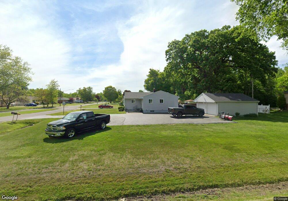
2008 Maplecrest Dr Carleton, MI 48117
Estimated Value: $215,000 - $266,000
3
Beds
2
Baths
1,200
Sq Ft
$201/Sq Ft
Est. Value
About This Home
This home is located at 2008 Maplecrest Dr, Carleton, MI 48117 and is currently estimated at $241,089, approximately $200 per square foot. 2008 Maplecrest Dr is a home located in Monroe County with nearby schools including Airport Senior High School and Carleton Community Baptist.
Ownership History
Date
Name
Owned For
Owner Type
Purchase Details
Closed on
Dec 20, 2000
Sold by
Pauley Gracie
Bought by
O'Leary-Mccomas Lonnie Mccomas Deborah
Current Estimated Value
Home Financials for this Owner
Home Financials are based on the most recent Mortgage that was taken out on this home.
Original Mortgage
$127,415
Outstanding Balance
$1,021
Interest Rate
8.5%
Mortgage Type
New Conventional
Estimated Equity
$240,068
Purchase Details
Closed on
Apr 22, 1998
Sold by
Raymo Michael W
Bought by
Pauley Gracie
Create a Home Valuation Report for This Property
The Home Valuation Report is an in-depth analysis detailing your home's value as well as a comparison with similar homes in the area
Home Values in the Area
Average Home Value in this Area
Purchase History
| Date | Buyer | Sale Price | Title Company |
|---|---|---|---|
| O'Leary-Mccomas Lonnie Mccomas Deborah | $149,900 | -- | |
| Pauley Gracie | $122,000 | -- |
Source: Public Records
Mortgage History
| Date | Status | Borrower | Loan Amount |
|---|---|---|---|
| Open | O'Leary-Mccomas Lonnie Mccomas Deborah | $127,415 |
Source: Public Records
Tax History Compared to Growth
Tax History
| Year | Tax Paid | Tax Assessment Tax Assessment Total Assessment is a certain percentage of the fair market value that is determined by local assessors to be the total taxable value of land and additions on the property. | Land | Improvement |
|---|---|---|---|---|
| 2025 | $601 | $90,300 | $90,300 | $0 |
| 2024 | $583 | $83,900 | $0 | $0 |
| 2023 | $555 | $62,200 | $0 | $0 |
| 2022 | $1,231 | $62,200 | $0 | $0 |
| 2021 | $1,188 | $68,800 | $0 | $0 |
| 2020 | $1,110 | $57,100 | $0 | $0 |
| 2019 | $1,095 | $57,100 | $0 | $0 |
| 2018 | $1,080 | $51,400 | $0 | $0 |
| 2017 | $1,020 | $51,400 | $0 | $0 |
| 2016 | $998 | $47,500 | $0 | $0 |
| 2015 | $960 | $40,800 | $0 | $0 |
| 2014 | $963 | $40,800 | $0 | $0 |
| 2013 | -- | $41,800 | $0 | $0 |
Source: Public Records
Map
Nearby Homes
- 12464 Maxwell Rd
- 12259 Eldora St
- 12237 Hannah Ln
- 1405 Cedarcrest Dr
- 12336 Hannah Ln
- 12850 Crane St
- 49 James Dr
- 0 Oakville Waltz Rd Unit G50038710
- 1980 Oakville Waltz Rd
- 28503 Margaret Ln Unit 1
- VACANT Oakville Waltz Rd
- 12995 Sweitzer Rd
- 36505 Bismark Rd
- 28264 Waltz Rd
- 9601 Exeter Rd
- 0000 Carleton Rockwood Rd
- 27750 Bell Rd
- 13680 Martinsville Rd
- 26744 Canterbury Cir Unit 4
- 26742 Canterbury Cir Unit 5
- 2005 Maplecrest Dr
- 2023 Maplecrest Dr
- 2026 Maplecrest Dr
- Vacant Maxwell Rd
- 12511 Maxwell Rd
- 12482 Maxwell Rd
- 2039 Maplecrest Dr
- 12474 Maxwell Rd
- 12519 Maxwell Rd
- 12620 Maxwell Rd
- 12512 Maxwell Rd
- 12450 Maxwell Rd
- 2050 Maplecrest Dr
- 2055 Maplecrest Dr
- 1843 Center St
- 0 Maplecrest Unit 21480981
- 0 Maplecrest Unit 4923739
- 0 Maplecrest Unit 212040086
- 1844 Center St
- 2072 Maplecrest Dr