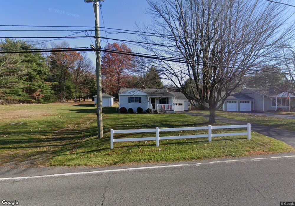
2008 State Route 29 Hwy Hunlock Creek, PA 18621
Estimated Value: $157,660 - $225,000
--
Bed
--
Bath
1,440
Sq Ft
$136/Sq Ft
Est. Value
About This Home
This home is located at 2008 State Route 29 Hwy, Hunlock Creek, PA 18621 and is currently estimated at $195,165, approximately $135 per square foot. 2008 State Route 29 Hwy is a home.
Ownership History
Date
Name
Owned For
Owner Type
Purchase Details
Closed on
Sep 1, 2014
Sold by
Peterson Nathan M and Peterson Christa Marie
Bought by
Lickers Sean and Lickers Lorraine
Current Estimated Value
Home Financials for this Owner
Home Financials are based on the most recent Mortgage that was taken out on this home.
Original Mortgage
$147,283
Interest Rate
3.77%
Mortgage Type
FHA
Purchase Details
Closed on
Sep 6, 2012
Sold by
Peterson Nathan and Peterson Christa Marie
Bought by
Peterson Nathan M and Peterson Christa Marie
Home Financials for this Owner
Home Financials are based on the most recent Mortgage that was taken out on this home.
Original Mortgage
$93,000
Interest Rate
3.57%
Mortgage Type
New Conventional
Create a Home Valuation Report for This Property
The Home Valuation Report is an in-depth analysis detailing your home's value as well as a comparison with similar homes in the area
Home Values in the Area
Average Home Value in this Area
Purchase History
| Date | Buyer | Sale Price | Title Company |
|---|---|---|---|
| Lickers Sean | $150,000 | None Available | |
| Peterson Nathan M | -- | None Available |
Source: Public Records
Mortgage History
| Date | Status | Borrower | Loan Amount |
|---|---|---|---|
| Previous Owner | Lickers Sean | $147,283 | |
| Previous Owner | Peterson Nathan M | $93,000 |
Source: Public Records
Tax History Compared to Growth
Tax History
| Year | Tax Paid | Tax Assessment Tax Assessment Total Assessment is a certain percentage of the fair market value that is determined by local assessors to be the total taxable value of land and additions on the property. | Land | Improvement |
|---|---|---|---|---|
| 2025 | $1,995 | $90,300 | $30,000 | $60,300 |
| 2024 | $1,984 | $90,300 | $30,000 | $60,300 |
| 2023 | $1,975 | $90,300 | $30,000 | $60,300 |
| 2022 | $1,868 | $90,300 | $30,000 | $60,300 |
| 2021 | $1,792 | $90,300 | $30,000 | $60,300 |
| 2020 | $1,792 | $90,300 | $30,000 | $60,300 |
| 2019 | $1,726 | $90,300 | $30,000 | $60,300 |
| 2018 | $1,655 | $90,300 | $30,000 | $60,300 |
| 2017 | $1,626 | $90,300 | $30,000 | $60,300 |
| 2016 | -- | $90,300 | $30,000 | $60,300 |
| 2015 | -- | $90,300 | $30,000 | $60,300 |
| 2014 | -- | $90,300 | $30,000 | $60,300 |
Source: Public Records
Map
Nearby Homes
- 46 Country Crest Ln
- 15 Pearl St
- 32 Lake Ave
- 983 Swamp Rd
- 641 Sorbertown Hill Rd
- 0 Moon Lake Rd
- 127 White Oak Dr
- 107 White Oak Dr
- 73 Adams Dr
- 85 Sorbertown Hill Rd
- 0 Hunlock-Harveyville Rd
- 4B, C, & D Hayfield Rd
- 1B & C Hayfield Rd
- 609 Main Rd
- 0 Sweet Valley Rd
- Lot 54 Garden Dr
- 106 N N Mill St
- 198 Indian Cave Rd
- 1011 Mill St
- 205 Post Office Rd
- 2012 State Route 29 Hwy
- 2012 Pennsylvania 29
- 2008 Pennsylvania 29
- 2020 Pennsylvania 29
- 2020 State Route 29 Hwy
- 2016 State Route 29 Hwy
- 2025 State Route 29 Hwy
- 9 Summit St
- 5 Summit St
- 2031 Pennsylvania 29
- 2031 State Route 29 Hwy
- Lot 97 Sayre Rd
- LOT #97 Sayre Rd
- 102 Sayre Rd
- 15 Summit St
- 126 Sayre Rd
- 100 Sayre Rd
- 130 Sayre Rd
- 8 Summit St
- 27 Cedar St