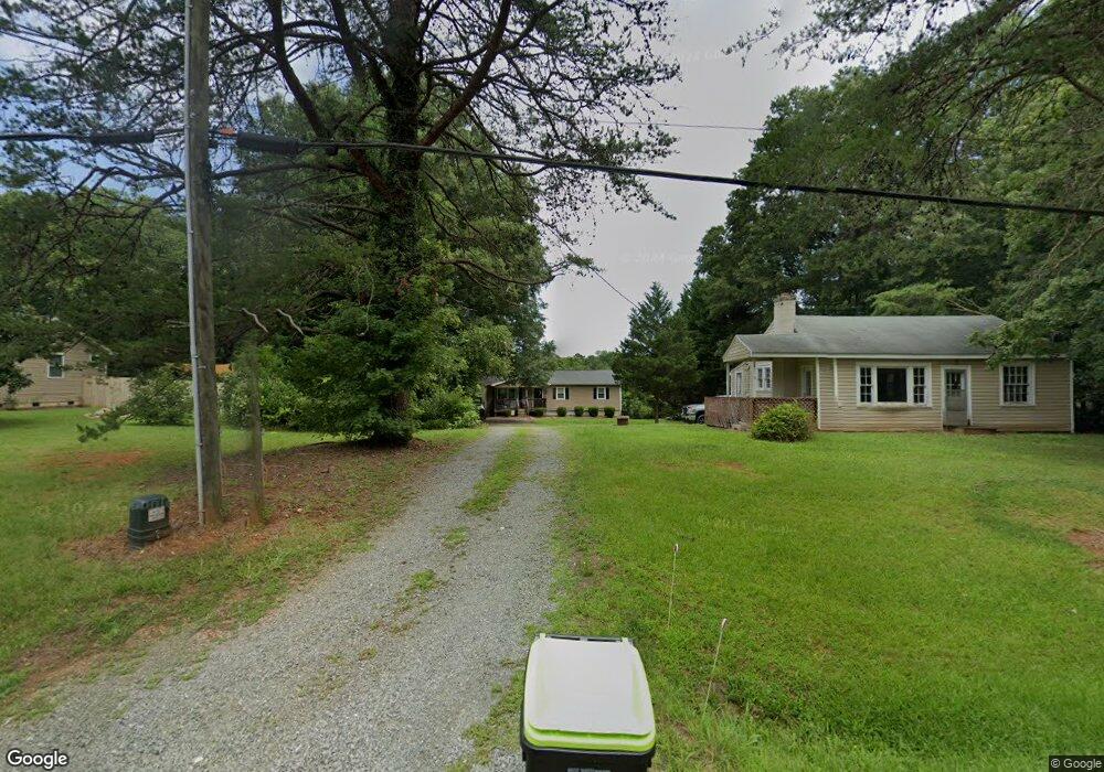
2008 Swepsonville Rd Graham, NC 27253
Estimated Value: $139,000 - $295,000
3
Beds
2
Baths
1,344
Sq Ft
$185/Sq Ft
Est. Value
About This Home
This home is located at 2008 Swepsonville Rd, Graham, NC 27253 and is currently estimated at $248,107, approximately $184 per square foot. 2008 Swepsonville Rd is a home located in Alamance County with nearby schools including South Graham Elementary School, Southern Alamance Middle School, and Southern Alamance High School.
Ownership History
Date
Name
Owned For
Owner Type
Purchase Details
Closed on
Mar 16, 2012
Sold by
Bccw Inc
Bought by
Cates Ryan
Current Estimated Value
Home Financials for this Owner
Home Financials are based on the most recent Mortgage that was taken out on this home.
Original Mortgage
$118,291
Outstanding Balance
$81,374
Interest Rate
3.9%
Mortgage Type
New Conventional
Estimated Equity
$166,733
Purchase Details
Closed on
Aug 4, 2011
Sold by
Cooper Tonya T
Bought by
Bccw Inc
Home Financials for this Owner
Home Financials are based on the most recent Mortgage that was taken out on this home.
Original Mortgage
$60,000
Interest Rate
4.52%
Mortgage Type
New Conventional
Create a Home Valuation Report for This Property
The Home Valuation Report is an in-depth analysis detailing your home's value as well as a comparison with similar homes in the area
Home Values in the Area
Average Home Value in this Area
Purchase History
| Date | Buyer | Sale Price | Title Company |
|---|---|---|---|
| Cates Ryan | $120,000 | -- | |
| Bccw Inc | $48,000 | -- |
Source: Public Records
Mortgage History
| Date | Status | Borrower | Loan Amount |
|---|---|---|---|
| Open | Cates Ryan | $118,291 | |
| Previous Owner | Bccw Inc | $60,000 | |
| Previous Owner | Bccw Inc | $4,479 |
Source: Public Records
Tax History Compared to Growth
Tax History
| Year | Tax Paid | Tax Assessment Tax Assessment Total Assessment is a certain percentage of the fair market value that is determined by local assessors to be the total taxable value of land and additions on the property. | Land | Improvement |
|---|---|---|---|---|
| 2025 | $1,475 | $266,162 | $42,655 | $223,507 |
| 2024 | $1,408 | $266,162 | $42,655 | $223,507 |
| 2023 | $1,303 | $266,162 | $42,655 | $223,507 |
| 2022 | $1,058 | $143,698 | $30,747 | $112,951 |
| 2021 | $1,072 | $143,698 | $30,747 | $112,951 |
| 2020 | $1,087 | $143,698 | $30,747 | $112,951 |
| 2019 | $1,092 | $143,698 | $30,747 | $112,951 |
| 2018 | $0 | $143,698 | $30,747 | $112,951 |
| 2017 | $963 | $143,698 | $30,747 | $112,951 |
| 2016 | $976 | $145,719 | $30,747 | $114,972 |
| 2015 | $971 | $145,719 | $30,747 | $114,972 |
| 2014 | -- | $145,719 | $30,747 | $114,972 |
Source: Public Records
Map
Nearby Homes
- 2923 Cullens Dr
- 2164 Hathaway Ln
- 948 Martin Ave
- 101 Kingston Ln
- 2114 Willow Glen Dr
- 2112 Willow Glen Dr
- 2146 Willow Glen Dr
- 208 Mallard Creek Dr
- 208B Mallard Creek Dr
- 1798 Parham Dr
- 1787 Parham Dr
- 1811 Parham Dr
- 1811 Parham Dr Unit 89
- 1350 Geneva Albright Rd
- 1819 Parham Dr Unit Lot 87
- 1819 Parham Dr
- 511 Valentine Ct
- 511 Valentine Ct Unit Lot 106
- 1823 Parham Dr
- 1823 Parham Dr Unit Lot 86
- 2008 Swepsonville Rd
- 2030 Swepsonville Rd
- 2006 Swepsonville Rd
- 2132 Neese Rd
- 2009 Swepsonville Rd
- 2038 Swepsonville Rd
- 1982 Swepsonville Rd
- 2127 Neese Rd
- 2046 Swepsonville Rd
- 1974 Swepsonville Rd
- 1977 Swepsonville Rd
- 2049 Swepsonville Rd
- 1968 Swepsonville Rd
- 2116 Neese Rd
- 2056 Swepsonville Rd
- 1991 Swepsonville Rd
- 2111 Neese Rd
- 1961 Swepsonville Rd
- 1956 Swepsonville Rd
- 0 Walter Andrews Rd