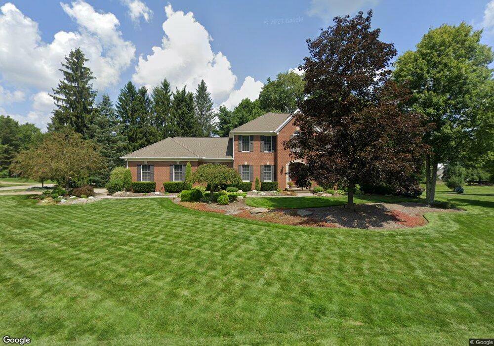
2009 Abner Ln Hudson, OH 44236
Estimated Value: $590,592 - $683,000
4
Beds
3
Baths
2,908
Sq Ft
$220/Sq Ft
Est. Value
About This Home
This home is located at 2009 Abner Ln, Hudson, OH 44236 and is currently estimated at $639,398, approximately $219 per square foot. 2009 Abner Ln is a home located in Summit County with nearby schools including Ellsworth Hill Elementary School, East Woods Intermediate School, and Hudson Middle School.
Ownership History
Date
Name
Owned For
Owner Type
Purchase Details
Closed on
Jul 28, 2003
Sold by
Mast Robert P and Mast Patricia E
Bought by
Schultheis Michael Scott and Schultheis Arlene Denise
Current Estimated Value
Home Financials for this Owner
Home Financials are based on the most recent Mortgage that was taken out on this home.
Original Mortgage
$275,000
Outstanding Balance
$118,273
Interest Rate
5.3%
Mortgage Type
Purchase Money Mortgage
Estimated Equity
$521,125
Purchase Details
Closed on
Sep 2, 1994
Sold by
Gustafson David P
Bought by
Mast Robert P and Mast Patricia E
Home Financials for this Owner
Home Financials are based on the most recent Mortgage that was taken out on this home.
Original Mortgage
$170,000
Interest Rate
8.59%
Mortgage Type
New Conventional
Create a Home Valuation Report for This Property
The Home Valuation Report is an in-depth analysis detailing your home's value as well as a comparison with similar homes in the area
Home Values in the Area
Average Home Value in this Area
Purchase History
| Date | Buyer | Sale Price | Title Company |
|---|---|---|---|
| Schultheis Michael Scott | $375,000 | Midland Commerce Group Stow | |
| Mast Robert P | $285,000 | -- |
Source: Public Records
Mortgage History
| Date | Status | Borrower | Loan Amount |
|---|---|---|---|
| Open | Schultheis Michael Scott | $275,000 | |
| Closed | Mast Robert P | $170,000 |
Source: Public Records
Tax History
| Year | Tax Paid | Tax Assessment Tax Assessment Total Assessment is a certain percentage of the fair market value that is determined by local assessors to be the total taxable value of land and additions on the property. | Land | Improvement |
|---|---|---|---|---|
| 2025 | $8,562 | $167,797 | $33,124 | $134,673 |
| 2024 | $8,562 | $167,797 | $33,124 | $134,673 |
| 2023 | $8,562 | $167,797 | $33,124 | $134,673 |
| 2022 | $7,562 | $132,125 | $26,082 | $106,043 |
| 2021 | $7,575 | $132,125 | $26,082 | $106,043 |
| 2020 | $7,441 | $132,120 | $26,080 | $106,040 |
| 2019 | $8,072 | $132,830 | $24,180 | $108,650 |
| 2018 | $8,043 | $132,830 | $24,180 | $108,650 |
| 2017 | $7,340 | $132,830 | $24,180 | $108,650 |
| 2016 | $7,392 | $117,710 | $23,020 | $94,690 |
| 2015 | $7,340 | $117,710 | $23,020 | $94,690 |
| 2014 | $7,360 | $117,710 | $23,020 | $94,690 |
| 2013 | $7,539 | $117,770 | $23,020 | $94,750 |
Source: Public Records
Map
Nearby Homes
- 7350 Herrick Park Dr
- 2396 Leeway Dr
- 2297 Olde Farm Ln
- 7590 Woodland Ave
- 24 Morning Song Ln
- 100 Blackberry Dr
- 2765 Blue Heron Dr
- 503 Cutler Ln
- 1440 E Hines Hill Rd
- 338 Simon Rd
- 2795 Stonebridge Ct
- 213 E Streetsboro St
- 7599 Estate Ave
- 8 Hudson Common Dr Unit 8
- 1772 Marwell Blvd
- 1752 Marwell Blvd
- 42 Fox Trace Ln
- 6740 Pinebrooke Dr
- 7365 Hayward Rd
- 7753 Red Fox Trail
- 7640 Herrick Park Dr
- 2031 Abner Ln
- 2010 Abner Ln
- 7618 Herrick Park Dr
- 2028 Abner Ln
- 7662 Herrick Park Dr
- 21 Highgate Dr
- 0 Highgate Dr
- 18 Highgate Dr
- 20 Highgate Dr
- 22 Highgate Dr
- 27 Highgate Dr
- 7631 Herrick Park Dr
- 2013 E Highgate Ct
- 7153 Darrow Rd
- 7159 Darrow Rd
- 2053 Abner Ln
- 2046 Abner Ln
- 7615 Herrick Park Dr
- 7600 Herrick Park Dr
Your Personal Tour Guide
Ask me questions while you tour the home.