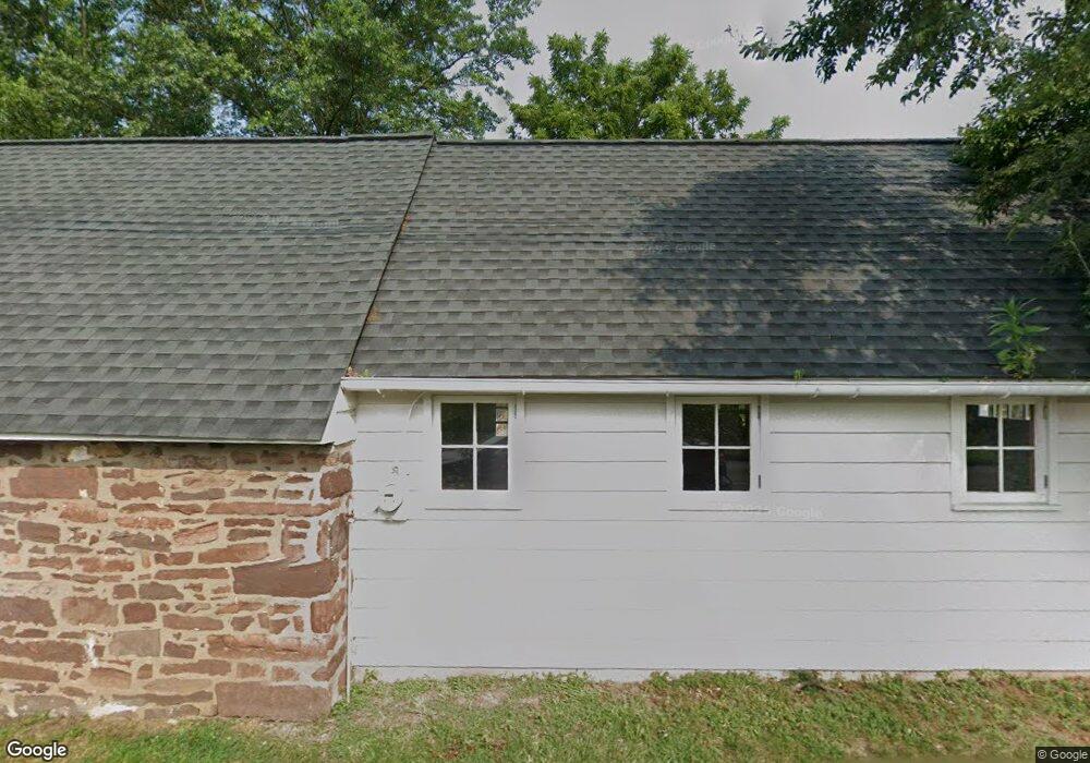
2009 Berks Rd Lansdale, PA 19446
Estimated Value: $730,000 - $1,669,000
4
Beds
5
Baths
5,018
Sq Ft
$247/Sq Ft
Est. Value
About This Home
This home is located at 2009 Berks Rd, Lansdale, PA 19446 and is currently estimated at $1,237,052, approximately $246 per square foot. 2009 Berks Rd is a home located in Montgomery County with nearby schools including Worcester Elementary School, Skyview Upper Elementary School, and Arcola Intermediate School.
Ownership History
Date
Name
Owned For
Owner Type
Purchase Details
Closed on
Aug 15, 2003
Sold by
Meitner Dale L
Bought by
Frost John S and Frost Patricia J
Current Estimated Value
Purchase Details
Closed on
Feb 18, 2000
Sold by
Meitner A Victor and Meitner Dale L
Bought by
Meitner Dale L
Purchase Details
Closed on
Dec 23, 1999
Sold by
The Meitner Family Partnership Lp and Meitner A Victor
Bought by
Meitner Dale L
Purchase Details
Closed on
Jun 30, 1998
Sold by
Santangelo Joseph A
Bought by
The Meltner Family Partnership Lp
Create a Home Valuation Report for This Property
The Home Valuation Report is an in-depth analysis detailing your home's value as well as a comparison with similar homes in the area
Home Values in the Area
Average Home Value in this Area
Purchase History
| Date | Buyer | Sale Price | Title Company |
|---|---|---|---|
| Frost John S | $865,000 | -- | |
| Meitner Dale L | -- | -- | |
| Meitner A Victor | -- | -- | |
| Meitner Dale L | -- | -- | |
| The Meltner Family Partnership Lp | $160,000 | -- |
Source: Public Records
Tax History Compared to Growth
Tax History
| Year | Tax Paid | Tax Assessment Tax Assessment Total Assessment is a certain percentage of the fair market value that is determined by local assessors to be the total taxable value of land and additions on the property. | Land | Improvement |
|---|---|---|---|---|
| 2025 | $14,597 | $385,400 | $74,620 | $310,780 |
| 2024 | $14,597 | $385,400 | $74,620 | $310,780 |
| 2023 | $14,001 | $385,400 | $74,620 | $310,780 |
| 2022 | $13,731 | $385,400 | $74,620 | $310,780 |
| 2021 | $13,460 | $385,400 | $74,620 | $310,780 |
| 2020 | $13,210 | $385,400 | $74,620 | $310,780 |
| 2019 | $13,081 | $385,400 | $74,620 | $310,780 |
| 2018 | $1,502 | $385,400 | $74,620 | $310,780 |
| 2017 | $12,579 | $385,400 | $74,620 | $310,780 |
| 2016 | $12,428 | $385,400 | $74,620 | $310,780 |
| 2015 | $12,105 | $385,400 | $74,620 | $310,780 |
| 2014 | $11,987 | $385,400 | $74,620 | $310,780 |
Source: Public Records
Map
Nearby Homes
- 2725 Skippack Pike
- 2 Capri Ln Unit KINSLEY
- 1921 Whitehall Rd
- 2624 Hawthorn Dr
- 2203 Weber Rd
- 2099 Deep Meadow Ln
- 2564 W Skippack Pike
- 1716 Landis Rd
- 1401 Oak Cir
- 4 Anglesey
- 2806 Morris Rd
- 2501 Pond View Dr
- 870 Reynards Run
- 3106 Lilac Ct
- 1534 N Trooper Rd
- 1307 Lilac Ct
- 4104 Lilac Ct
- 4103 Lilac Ct
- 4204 Lilac Ct
- 5403 Lilac Ct
- 2003 Berks Rd
- 2721 Skippack Pike
- 2721 Skippack Pike
- Lot 4 Berks Rd
- Lot 2 Berks Rd
- 2012 Berks Rd
- 2015 Berks Rd
- 2661 Skippack Pike
- 2700 Skippack Pike
- 2701 Applewood Dr
- 2703 Applewood Dr
- 0 Skippack Pike Unit KINGSWOOD
- 0 Skippack Pike Unit PAMC2013970
- 2705 Applewood Dr
- 2105 Applewood Dr
- 2699 Hawthorn Dr
- 1 Capri Ln Unit AVONLEA
- 2702 Applewood Dr
- 2697 Hawthorn Dr
- 2704 Applewood Dr