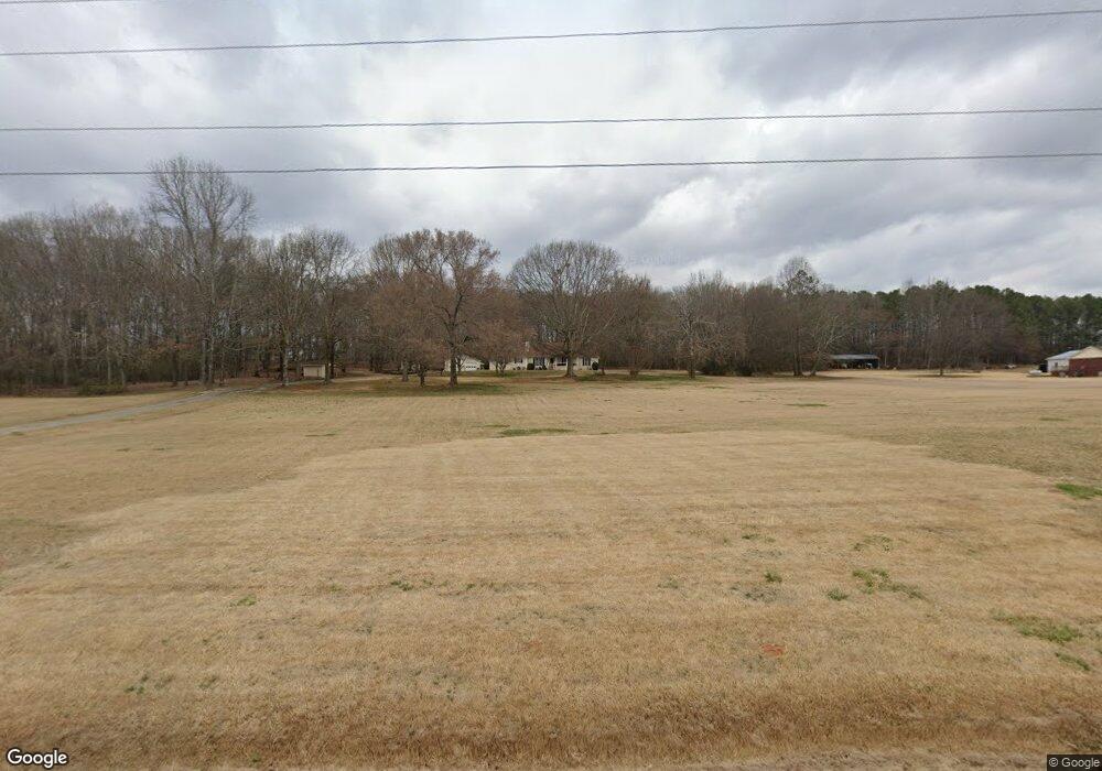
2009 Brockton Rd Jefferson, GA 30549
Estimated Value: $424,000 - $598,000
--
Bed
3
Baths
1,948
Sq Ft
$255/Sq Ft
Est. Value
About This Home
This home is located at 2009 Brockton Rd, Jefferson, GA 30549 and is currently estimated at $495,774, approximately $254 per square foot. 2009 Brockton Rd is a home located in Jackson County with nearby schools including Satilla Elementary School, East Jackson Elementary School, and East Jackson Middle School.
Ownership History
Date
Name
Owned For
Owner Type
Purchase Details
Closed on
Dec 20, 2019
Sold by
Mulkey Helen Copeland Whatle
Bought by
Bedingfield Mark A and Bedingfield Kimberly
Current Estimated Value
Home Financials for this Owner
Home Financials are based on the most recent Mortgage that was taken out on this home.
Original Mortgage
$186,000
Outstanding Balance
$163,986
Interest Rate
3.6%
Mortgage Type
New Conventional
Estimated Equity
$331,788
Purchase Details
Closed on
May 12, 2014
Sold by
Mulkey Archie Thomas
Bought by
Mulkey Helen Coleland Whatle
Create a Home Valuation Report for This Property
The Home Valuation Report is an in-depth analysis detailing your home's value as well as a comparison with similar homes in the area
Home Values in the Area
Average Home Value in this Area
Purchase History
| Date | Buyer | Sale Price | Title Company |
|---|---|---|---|
| Bedingfield Mark A | $310,000 | -- | |
| Mulkey Helen Coleland Whatle | -- | -- |
Source: Public Records
Mortgage History
| Date | Status | Borrower | Loan Amount |
|---|---|---|---|
| Open | Bedingfield Mark A | $186,000 |
Source: Public Records
Tax History Compared to Growth
Tax History
| Year | Tax Paid | Tax Assessment Tax Assessment Total Assessment is a certain percentage of the fair market value that is determined by local assessors to be the total taxable value of land and additions on the property. | Land | Improvement |
|---|---|---|---|---|
| 2024 | $4,945 | $197,296 | $91,720 | $105,576 |
| 2023 | $4,998 | $183,976 | $91,720 | $92,256 |
| 2022 | $3,485 | $121,656 | $45,840 | $75,816 |
| 2021 | $3,508 | $121,656 | $45,840 | $75,816 |
| 2020 | $3,507 | $109,456 | $45,840 | $63,616 |
| 2019 | $2,778 | $85,416 | $39,640 | $45,776 |
| 2018 | $1,725 | $85,184 | $39,640 | $45,544 |
| 2017 | $1,322 | $73,809 | $31,743 | $42,066 |
| 2016 | $1,334 | $73,809 | $31,743 | $42,066 |
| 2015 | $1,342 | $73,809 | $31,743 | $42,066 |
| 2014 | $1,189 | $69,017 | $31,743 | $37,274 |
| 2013 | -- | $72,984 | $35,711 | $37,273 |
Source: Public Records
Map
Nearby Homes
- 0 Brockton Loop Unit 10645336
- 00 Brockton Loop
- 51 Howington Rd
- 45 Hometown Ct
- 51 Howiington Rd
- 41 Hometown Ct
- 37 Hometown Ct
- 33 Hometown Ct
- 19 Redtail Rd
- 169 Grandview Dr
- 0 Curry Creek Rd
- 486 Glenside Dr
- 918 Brockton Loop
- 134 Oakdale Rd
- 134 Oakdale Rd Unit 31
- 480 Red Tail Rd
- 372 Glenside Dr
- 372 Glenside Dr Unit 76
- 150 Oakdale Rd Unit 32
- 150 Oakdale Rd
- 2085 Brockton Rd
- 0 Brockton Loop Unit 8422190
- 0 Brockton Loop Unit 8374360
- 0 Brockton Loop Unit 5993751
- 0 Brockton Loop Unit 8265942
- 0 Brockton Loop Unit 5914537
- 0 Brockton Loop Unit 8241926
- 0 Brockton Loop Unit TRACT 3 7184346
- 0 Brockton Loop Unit TRACT 3 7418921
- 0 Brockton Loop Unit 3 20169504
- 0 Brockton Loop Unit 7331073
- 0 Brockton Loop Unit 20151566
- 0 Brockton Loop Unit 3 20126878
- 0 Brockton Loop Unit 4 20126879
- 0 Brockton Loop Unit 1 20126875
- 0 Brockton Loop Unit 2 20126876
- 0 Brockton Loop Unit 7227571
- 0 Brockton Loop Unit 7227562
- 0 Brockton Loop Unit 7227553
- 0 Brockton Loop Unit 7227294