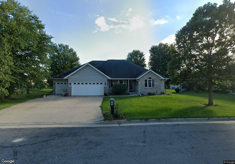
2009 Cherokee Dr Prairie Du Sac, WI 53578
Estimated Value: $430,587 - $497,000
--
Bed
--
Bath
--
Sq Ft
0.29
Acres
About This Home
This home is located at 2009 Cherokee Dr, Prairie Du Sac, WI 53578 and is currently estimated at $467,147. 2009 Cherokee Dr is a home located in Sauk County with nearby schools including Sauk Prairie Middle School and Sauk Prairie High School.
Ownership History
Date
Name
Owned For
Owner Type
Purchase Details
Closed on
Feb 8, 2005
Sold by
Schillo Michael J
Bought by
Shadewald Jerry K and Shadewald Laura I
Current Estimated Value
Home Financials for this Owner
Home Financials are based on the most recent Mortgage that was taken out on this home.
Original Mortgage
$206,160
Outstanding Balance
$105,339
Interest Rate
5.83%
Mortgage Type
New Conventional
Estimated Equity
$361,808
Create a Home Valuation Report for This Property
The Home Valuation Report is an in-depth analysis detailing your home's value as well as a comparison with similar homes in the area
Home Values in the Area
Average Home Value in this Area
Purchase History
| Date | Buyer | Sale Price | Title Company |
|---|---|---|---|
| Shadewald Jerry K | $260,000 | None Available |
Source: Public Records
Mortgage History
| Date | Status | Borrower | Loan Amount |
|---|---|---|---|
| Open | Shadewald Jerry K | $206,160 |
Source: Public Records
Tax History Compared to Growth
Tax History
| Year | Tax Paid | Tax Assessment Tax Assessment Total Assessment is a certain percentage of the fair market value that is determined by local assessors to be the total taxable value of land and additions on the property. | Land | Improvement |
|---|---|---|---|---|
| 2024 | $5,750 | $394,500 | $89,500 | $305,000 |
| 2023 | $5,760 | $259,000 | $52,600 | $206,400 |
| 2022 | $5,871 | $259,000 | $52,600 | $206,400 |
| 2021 | $5,606 | $259,000 | $52,600 | $206,400 |
| 2020 | $5,247 | $259,000 | $52,600 | $206,400 |
| 2019 | $5,068 | $259,000 | $52,600 | $206,400 |
| 2018 | $4,969 | $259,000 | $52,600 | $206,400 |
| 2017 | $4,634 | $218,100 | $53,000 | $165,100 |
| 2016 | $4,625 | $218,100 | $53,000 | $165,100 |
| 2015 | $4,718 | $218,100 | $53,000 | $165,100 |
| 2014 | $4,726 | $218,100 | $53,000 | $165,100 |
Source: Public Records
Map
Nearby Homes
- 1010 20th St
- 711 21st St
- 2028 Taylor Trail
- 1263 Jacob Dr
- 2210 Alban Ln
- 1232 Jacob Dr
- 470 Brigham Ln
- 1209 N Forest Ln Unit 1
- 901 Highland Trail
- 1103 Water St
- 1550 Locust Ln
- 207 15th St
- 140 Goldenrod Way
- 144 Goldenrod Way
- 130 Goldenrod Lot 17 Way
- 640 8th St
- 2415 Bluestem Crossing
- 150 Goldenrod Way
- 154 Goldenrod Way
- 134 Goldenrod Way
- 2005 Cherokee Dr
- 2013 Cherokee Dr
- 2012 Tumbleweed Dr
- 2008 Tumbleweed Dr
- 2004 Cherokee Dr
- 2016 Tumbleweed Dr
- 2008 Cherokee Dr
- 2004 Tumbleweed Dr
- 2017 Cherokee Dr
- 2001 Cherokee Dr
- 901 20th St
- 2012 Cherokee Dr
- 2000 Tumbleweed Dr
- 820 21st St
- 830 21st St Unit 832
- 2013 Tumbleweed Dr
- 2017 Tumbleweed Dr
- 905 20th St
- 2016 Cherokee Dr
- 2020 Cherokee Dr Unit 2022