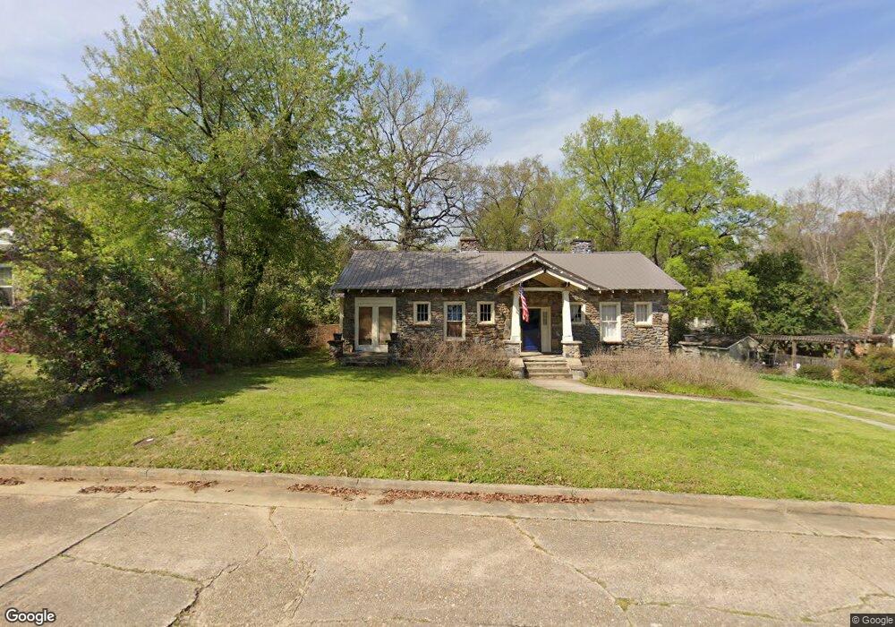
2009 Dimon St Columbus, GA 31906
Peacock Woods-Dimon Circle NeighborhoodEstimated Value: $435,000 - $481,000
3
Beds
5
Baths
2,792
Sq Ft
$162/Sq Ft
Est. Value
About This Home
This home is located at 2009 Dimon St, Columbus, GA 31906 and is currently estimated at $452,527, approximately $162 per square foot. 2009 Dimon St is a home located in Muscogee County with nearby schools including Richards Middle School, Hardaway High School, and Wynnton Elementary School.
Ownership History
Date
Name
Owned For
Owner Type
Purchase Details
Closed on
Nov 16, 2009
Sold by
Federal National Mortgage Association
Bought by
Porter Jonathan S and Porter Shoko M
Current Estimated Value
Home Financials for this Owner
Home Financials are based on the most recent Mortgage that was taken out on this home.
Original Mortgage
$229,735
Outstanding Balance
$149,393
Interest Rate
4.92%
Mortgage Type
VA
Estimated Equity
$303,134
Purchase Details
Closed on
Aug 4, 2009
Sold by
Us Bank Na
Bought by
Federal National Mortgage Association
Create a Home Valuation Report for This Property
The Home Valuation Report is an in-depth analysis detailing your home's value as well as a comparison with similar homes in the area
Home Values in the Area
Average Home Value in this Area
Purchase History
| Date | Buyer | Sale Price | Title Company |
|---|---|---|---|
| Porter Jonathan S | $224,900 | None Available | |
| Federal National Mortgage Association | -- | None Available |
Source: Public Records
Mortgage History
| Date | Status | Borrower | Loan Amount |
|---|---|---|---|
| Open | Porter Jonathan S | $229,735 |
Source: Public Records
Tax History Compared to Growth
Tax History
| Year | Tax Paid | Tax Assessment Tax Assessment Total Assessment is a certain percentage of the fair market value that is determined by local assessors to be the total taxable value of land and additions on the property. | Land | Improvement |
|---|---|---|---|---|
| 2025 | $5,612 | $143,352 | $17,560 | $125,792 |
| 2024 | $5,612 | $143,352 | $17,560 | $125,792 |
| 2023 | $5,647 | $143,352 | $17,560 | $125,792 |
| 2022 | $4,151 | $101,672 | $17,560 | $84,112 |
| 2021 | $4,309 | $105,536 | $17,560 | $87,976 |
| 2020 | $4,310 | $105,536 | $17,560 | $87,976 |
| 2019 | $4,324 | $105,536 | $17,560 | $87,976 |
| 2018 | $4,324 | $105,536 | $17,560 | $87,976 |
| 2017 | $4,338 | $105,536 | $17,560 | $87,976 |
| 2016 | $3,980 | $96,495 | $5,457 | $91,038 |
| 2015 | $3,985 | $96,495 | $5,457 | $91,038 |
| 2014 | $3,990 | $96,495 | $5,457 | $91,038 |
| 2013 | -- | $96,495 | $5,457 | $91,038 |
Source: Public Records
Map
Nearby Homes
- 1400 Eberhart Ave
- 2016 Poplar Dr
- 1917 Dimon St
- 2125 13th St Unit 12
- 2133 13th St
- 2227 15th St
- 1557 18th Ave
- 1227 Forest Ave Unit 4
- 1242 18th Ave
- 1226 18th Ave Unit A/B
- 1641 16th Ave
- 1809 Carter Ave
- 1717 Stark Ave
- 1319 Hilton Ave
- 1700 Stark Ave
- 1706 Stark Ave
- 1622 14th Ave
- 2551 Wynnton Rd
- 1806 Stark Ave
- 2312 Marion St
- 2001 Dimon St
- 2019 Dimon St
- 1425 Peacock Ave
- 2008 Dimon St
- 2002 Dimon St
- 2018 Dimon St
- 1342 Eberhart Ave
- 2000 Poplar Dr
- 1353 Peacock Ave
- 1347 Eberhart Ave
- 1338 Eberhart Ave
- 1406 Peacock Ave
- 1414 Peacock Ave
- 1420 Peacock Ave
- 2001 Poplar Dr
- 1400 Peacock Ave
- 1424 Peacock Ave
- 1341 Eberhart Ave
- 1334 Eberhart Ave
- 1358 Peacock Ave