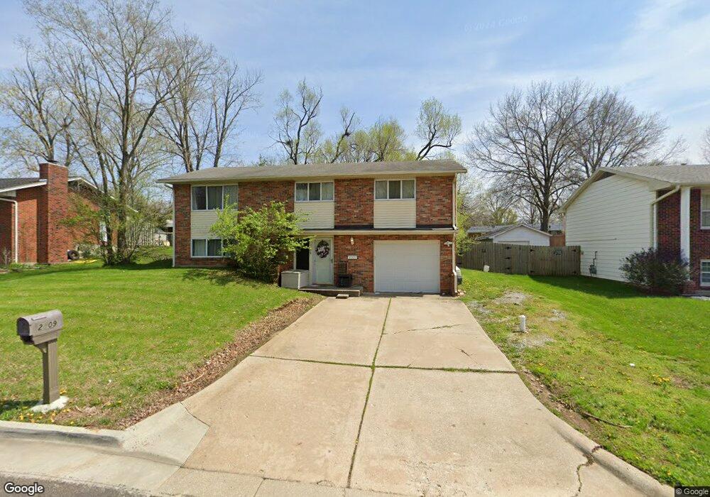
2009 Doris Dr Columbia, MO 65202
Parkade NeighborhoodEstimated Value: $239,000 - $254,000
3
Beds
2
Baths
1,750
Sq Ft
$140/Sq Ft
Est. Value
About This Home
This home is located at 2009 Doris Dr, Columbia, MO 65202 and is currently estimated at $245,298, approximately $140 per square foot. 2009 Doris Dr is a home located in Boone County with nearby schools including Parkade Elementary School, West Middle School, and David H. Hickman High School.
Ownership History
Date
Name
Owned For
Owner Type
Purchase Details
Closed on
Feb 10, 2023
Sold by
High Point Rental Llc
Bought by
Richard Jose Edward
Current Estimated Value
Home Financials for this Owner
Home Financials are based on the most recent Mortgage that was taken out on this home.
Original Mortgage
$164,000
Outstanding Balance
$158,656
Interest Rate
6.12%
Mortgage Type
Credit Line Revolving
Estimated Equity
$86,642
Purchase Details
Closed on
Dec 22, 2015
Sold by
Mcnabb John F and Mcnabb Betty L
Bought by
High Point Rental Llc
Home Financials for this Owner
Home Financials are based on the most recent Mortgage that was taken out on this home.
Original Mortgage
$80,000
Interest Rate
3.88%
Mortgage Type
Construction
Create a Home Valuation Report for This Property
The Home Valuation Report is an in-depth analysis detailing your home's value as well as a comparison with similar homes in the area
Home Values in the Area
Average Home Value in this Area
Purchase History
| Date | Buyer | Sale Price | Title Company |
|---|---|---|---|
| Richard Jose Edward | -- | -- | |
| High Point Rental Llc | -- | Boone Central Title Co | |
| High Point Rental Llc | -- | Boone Central Title Co |
Source: Public Records
Mortgage History
| Date | Status | Borrower | Loan Amount |
|---|---|---|---|
| Open | Richard Jose Edward | $164,000 | |
| Previous Owner | High Point Rental Llc | $80,000 |
Source: Public Records
Tax History
| Year | Tax Paid | Tax Assessment Tax Assessment Total Assessment is a certain percentage of the fair market value that is determined by local assessors to be the total taxable value of land and additions on the property. | Land | Improvement |
|---|---|---|---|---|
| 2025 | $1,767 | $26,980 | $3,154 | $23,826 |
| 2024 | $1,589 | $23,560 | $3,154 | $20,406 |
| 2023 | $1,576 | $23,560 | $3,154 | $20,406 |
| 2022 | $1,458 | $21,812 | $3,154 | $18,658 |
| 2021 | $1,461 | $21,812 | $3,154 | $18,658 |
| 2020 | $1,439 | $20,191 | $3,154 | $17,037 |
| 2019 | $1,439 | $20,191 | $3,154 | $17,037 |
| 2018 | $1,342 | $0 | $0 | $0 |
| 2017 | $1,325 | $18,696 | $3,154 | $15,542 |
| 2016 | $1,360 | $18,696 | $3,154 | $15,542 |
| 2015 | $1,255 | $18,696 | $3,154 | $15,542 |
| 2014 | $1,262 | $18,696 | $3,154 | $15,542 |
Source: Public Records
Map
Nearby Homes
- 1602 Doris Dr
- 2410 Bentley Ct
- 2512 Emery Dr
- 2502 Bear Bluff Dr
- 713 Ridgeway Ave
- 1905 Newton Dr
- 602 & 609 Pennant
- 807 Clinkscales Rd
- 1311 W Worley St
- 602 Clinkscales Rd
- 506 W Worley St
- 303 Caribou Dr
- 203 Caribou Dr
- 1301 W Ash St
- 407 Oak St
- 2004-2006 Rashid Ct
- 102 West Blvd N
- 708 N 4th St
- 509 N Providence Rd
- 600 N Providence Rd Unit 100
- 2005 Doris Dr
- 2013 Doris Dr
- 1809 Parklawn Dr
- 909 Sondra Ave
- 2001 Doris Dr
- 905 Sondra Ave
- 2101 Doris Dr
- 911 Sondra Ave
- 1807 Parklawn Dr
- 2008 Doris Dr
- 2004 Doris Dr
- 915 Sondra Ave
- 2105 Doris Dr
- 1801 Parklawn Dr
- 1930 Doris Dr
- 1925 Doris Dr
- 917 Sondra Ave
- 1808 Parklawn Dr
- 2108 Doris Dr Unit 2110
- 906 Sondra Ave
Your Personal Tour Guide
Ask me questions while you tour the home.