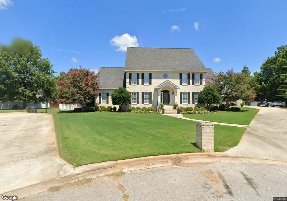
2009 Katie Dr SW Decatur, AL 35603
Estimated Value: $510,000 - $699,000
--
Bed
--
Bath
4,259
Sq Ft
$142/Sq Ft
Est. Value
About This Home
This home is located at 2009 Katie Dr SW, Decatur, AL 35603 and is currently estimated at $603,212, approximately $141 per square foot. 2009 Katie Dr SW is a home located in Morgan County with nearby schools including Chestnut Grove Elementary School, Cedar Ridge Middle School, and Austin High School.
Ownership History
Date
Name
Owned For
Owner Type
Purchase Details
Closed on
Nov 27, 2006
Sold by
Russell David W and Russell Teresa K
Bought by
Narmore Kimberly A and Narmore Terry J
Current Estimated Value
Home Financials for this Owner
Home Financials are based on the most recent Mortgage that was taken out on this home.
Original Mortgage
$336,000
Outstanding Balance
$200,887
Interest Rate
6.31%
Mortgage Type
New Conventional
Estimated Equity
$402,325
Create a Home Valuation Report for This Property
The Home Valuation Report is an in-depth analysis detailing your home's value as well as a comparison with similar homes in the area
Home Values in the Area
Average Home Value in this Area
Purchase History
| Date | Buyer | Sale Price | Title Company |
|---|---|---|---|
| Narmore Kimberly A | $420,000 | None Available |
Source: Public Records
Mortgage History
| Date | Status | Borrower | Loan Amount |
|---|---|---|---|
| Open | Narmore Kimberly A | $336,000 |
Source: Public Records
Tax History Compared to Growth
Tax History
| Year | Tax Paid | Tax Assessment Tax Assessment Total Assessment is a certain percentage of the fair market value that is determined by local assessors to be the total taxable value of land and additions on the property. | Land | Improvement |
|---|---|---|---|---|
| 2024 | $2,046 | $46,220 | $4,000 | $42,220 |
| 2023 | $2,046 | $47,330 | $4,000 | $43,330 |
| 2022 | $2,123 | $47,910 | $4,000 | $43,910 |
| 2021 | $1,925 | $45,300 | $4,000 | $41,300 |
| 2020 | $1,925 | $82,280 | $4,000 | $78,280 |
| 2019 | $1,925 | $43,540 | $0 | $0 |
| 2015 | $1,807 | $40,940 | $0 | $0 |
| 2014 | $1,807 | $40,940 | $0 | $0 |
| 2013 | -- | $42,040 | $0 | $0 |
Source: Public Records
Map
Nearby Homes
- 25 Acres Anna Dr
- 1669 Lake Cove Dr SW
- 3718 Timberlake Ct SW
- 3705 Timberlake Ct SW
- 1631 Lake Cove Dr SW
- 2108 Chapel Hill Rd SW
- 1618 Lake Cove Dr SW
- 2122 Chapel Hill Rd SW
- 1823 Vestavia Dr SW
- 1037 Vestavia Dr SW
- 2004 Vestavia Dr SW
- 3806 High Point Dr SW
- 3318 Cedarhurst Dr SW
- 3325 Danville Rd SW
- 3725 S Woodtrail Rd SW
- 3753 S Woodtrail Rd SW
- 3312 Cedar Cove SW
- 3401 Cedarhurst Dr
- 3412 Cedarhurst Dr
- 3410 Cedarhurst Dr
- 2016 Katie Dr SW
- 2007 Katie Dr SW
- 2014 Katie Dr SW
- 2001 Katie Dr SW
- 2005 Katie Dr SW
- 2003 Katie Dr SW
- 3727 Danville Rd SW
- 3725 Danville Rd SW
- 2012 Katie Dr SW
- 3706 Danville Rd SW
- 0 Anna Dr Unit 1089772
- 3702 Danville Rd SW
- 2002 Katie Dr SW
- 2008 Katie Dr SW
- 3739 Danville Rd SW
- 2006 Katie Dr SW
- 3805 Danville Rd SW
- 2004 Katie Dr SW
- 3806 Danville Rd SW
- 3809 Danville Rd SW