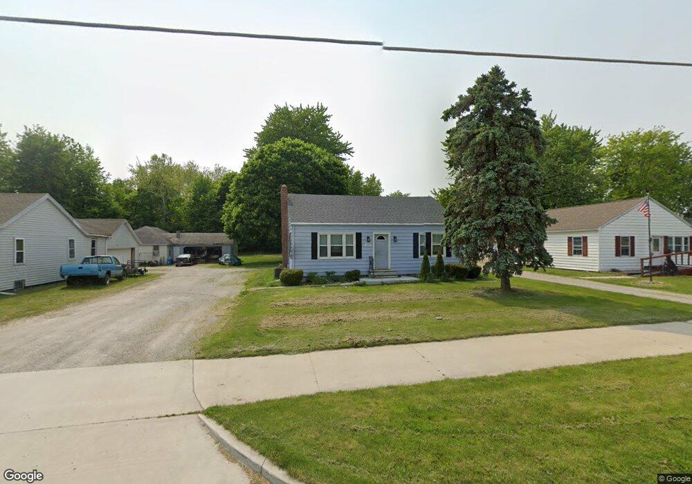
2009 Landin Rd New Haven, IN 46774
Estimated Value: $147,764 - $221,000
3
Beds
1
Bath
896
Sq Ft
$212/Sq Ft
Est. Value
About This Home
This home is located at 2009 Landin Rd, New Haven, IN 46774 and is currently estimated at $189,691, approximately $211 per square foot. 2009 Landin Rd is a home located in Allen County with nearby schools including J Wilbur Haley Elementary School, Blackhawk Middle School, and R Nelson Snider High School.
Ownership History
Date
Name
Owned For
Owner Type
Purchase Details
Closed on
Feb 5, 2016
Sold by
Vaughan Jennifer J
Bought by
Vaughan Development Inc
Current Estimated Value
Purchase Details
Closed on
Jul 12, 2013
Sold by
Vaughn Jennifer J and Vaughan Jennifer J
Bought by
City Of New Haven Indiana
Purchase Details
Closed on
Jun 2, 2006
Sold by
Seitz Florence E
Bought by
Vaughn Jennifer J
Home Financials for this Owner
Home Financials are based on the most recent Mortgage that was taken out on this home.
Original Mortgage
$49,500
Interest Rate
6.68%
Mortgage Type
Fannie Mae Freddie Mac
Create a Home Valuation Report for This Property
The Home Valuation Report is an in-depth analysis detailing your home's value as well as a comparison with similar homes in the area
Home Values in the Area
Average Home Value in this Area
Purchase History
| Date | Buyer | Sale Price | Title Company |
|---|---|---|---|
| Vaughan Development Inc | -- | None Available | |
| City Of New Haven Indiana | $16,424 | None Available | |
| Vaughn Jennifer J | -- | Metropolitan Title Of In |
Source: Public Records
Mortgage History
| Date | Status | Borrower | Loan Amount |
|---|---|---|---|
| Previous Owner | Vaughn Jennifer J | $49,500 |
Source: Public Records
Tax History Compared to Growth
Tax History
| Year | Tax Paid | Tax Assessment Tax Assessment Total Assessment is a certain percentage of the fair market value that is determined by local assessors to be the total taxable value of land and additions on the property. | Land | Improvement |
|---|---|---|---|---|
| 2024 | $1,727 | $76,900 | $10,700 | $66,200 |
| 2022 | $1,196 | $53,200 | $8,200 | $45,000 |
| 2021 | $941 | $42,000 | $8,000 | $34,000 |
| 2020 | $874 | $39,700 | $8,500 | $31,200 |
| 2019 | $782 | $35,700 | $8,500 | $27,200 |
| 2018 | $926 | $42,000 | $9,600 | $32,400 |
| 2017 | $925 | $41,600 | $10,200 | $31,400 |
| 2016 | $909 | $41,500 | $10,300 | $31,200 |
| 2014 | $858 | $41,300 | $11,000 | $30,300 |
| 2013 | $843 | $40,600 | $11,000 | $29,600 |
Source: Public Records
Map
Nearby Homes
- 1704 Pinelock Ct
- 1704 Savona Ct
- 1575 Pinelock Ct
- 9532 Bonham Ln
- 1634 White Fawn Dr
- 9175 Landin Pointe Blvd
- 8768 Grand Forest Dr
- 1025 Miller Woods Way
- 1011 Miller Woods Way
- 984 Rookery Way
- 967 Rookery Way
- 955 Rookery Way
- 966 Rookery Way
- Henley Plan at Riverwalk
- Aldridge Plan at Riverwalk
- Elder Plan at Riverwalk
- Elm Plan at Riverwalk
- Freeport Plan at Riverwalk
- Taylor Plan at Riverwalk
- Stamford Plan at Riverwalk
- 1961 Landin Rd
- 2023 Landin Rd
- 1963 Landin Rd
- 2039 Landin Rd
- 1951 Landin Rd
- 2107 Landin Rd
- 1870 Pinelock Ct
- 2145 Landin Rd
- 1854 Pinelock Ct
- 1873 Pinelock Ct
- 2219 Landin Rd
- 9000 Shordon Rd
- 1828 Pinelock Ct
- 1775 Landin Rd
- 9071 Wicklow Ln
- 1861 Pinelock Ct
- 1814 Pinelock Ct
- 1843 Pinelock Ct
- 9039 Wicklow Ln
- 9130 Shordon Rd