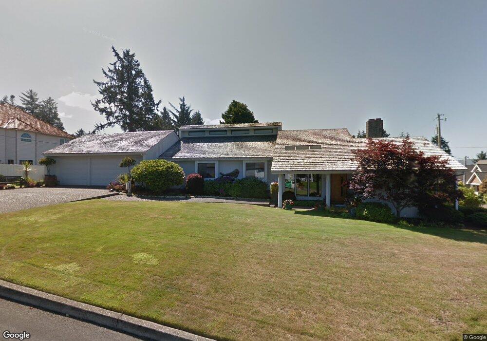
2009 Maple St Seaside, OR 97138
Estimated Value: $643,000 - $726,000
3
Beds
2
Baths
2,323
Sq Ft
$295/Sq Ft
Est. Value
About This Home
This home is located at 2009 Maple St, Seaside, OR 97138 and is currently estimated at $684,861, approximately $294 per square foot. 2009 Maple St is a home located in Clatsop County with nearby schools including Seaside High School.
Ownership History
Date
Name
Owned For
Owner Type
Purchase Details
Closed on
May 24, 2018
Sold by
Deshon Susan E
Bought by
Deshon Susan E and The Susan E Deshon Revocable L
Current Estimated Value
Purchase Details
Closed on
Feb 8, 2012
Sold by
Bennett Roy C and Bennett Cecilia J
Bought by
Paxton William H and Paxton Mary Jo
Purchase Details
Closed on
Aug 1, 2011
Sold by
Trevino Ana and Maxwell William S
Bought by
Deshon Susan
Create a Home Valuation Report for This Property
The Home Valuation Report is an in-depth analysis detailing your home's value as well as a comparison with similar homes in the area
Purchase History
| Date | Buyer | Sale Price | Title Company |
|---|---|---|---|
| Deshon Susan E | -- | None Available | |
| Paxton William H | -- | Pacific Title Company | |
| Deshon Susan | $5,000 | Accommodation |
Source: Public Records
Tax History
| Year | Tax Paid | Tax Assessment Tax Assessment Total Assessment is a certain percentage of the fair market value that is determined by local assessors to be the total taxable value of land and additions on the property. | Land | Improvement |
|---|---|---|---|---|
| 2025 | $7,079 | $492,639 | -- | -- |
| 2024 | $6,871 | $478,291 | -- | -- |
| 2023 | $6,668 | $464,361 | $0 | $0 |
| 2022 | $6,486 | $450,837 | $0 | $0 |
| 2021 | $6,348 | $437,707 | $0 | $0 |
| 2020 | $6,159 | $424,959 | $0 | $0 |
| 2019 | $6,006 | $412,582 | $0 | $0 |
Source: Public Records
Map
Nearby Homes
- 360 Hilltop Dr
- 343 Hemlock St
- 1659 Whispering Pines Dr
- Vacant Alpine St
- 0 Alpine St Unit 601537278
- 1295 Jeffrey Dr
- 1269 Avenue D
- 1265 Avenue D
- VL Spruce Dr
- 0 Spruce Dr Unit 682748764
- 1255 Avenue A Unit 1 and 2
- 1255 Avenue A
- 481 Hillside Loop
- 0 Way
- 1299 6th Ave
- 911 1st Ave
- 830 Oceanway St
- 1110 6th Ave
- 720 Avenue G
- 720 740 Avenue G
- 2025 Maple St
- 361 Hilltop Dr
- 2002 Maple St
- 340 Hilltop Dr
- 320 Hilltop Dr
- 2020 Maple St
- 1979 Broadway St
- 261 Hilltop Dr
- 2045 Maple St
- 2026 Fernwood St
- 2044 Maple St
- 1643 Whispering Pines Dr
- 2046 Fernwood St
- 1646 Whispering Pines Dr
- 380 Hilltop Dr
- 2007 Fernwood St
- 2065 Maple St
- 2003 Cedar St
- 1639 Whispering Pines Dr
- 2027 Fernwood St