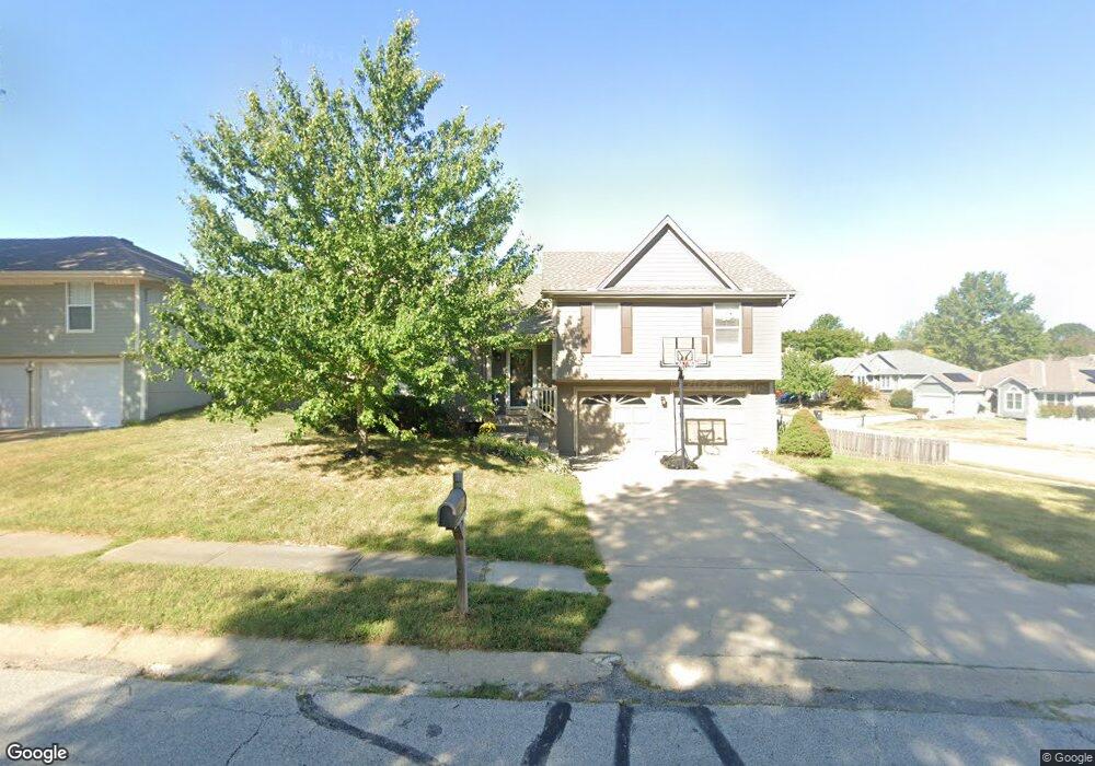
2009 NW Harbor Place Blue Springs, MO 64015
Estimated Value: $274,780 - $301,000
3
Beds
2
Baths
1,184
Sq Ft
$246/Sq Ft
Est. Value
About This Home
This home is located at 2009 NW Harbor Place, Blue Springs, MO 64015 and is currently estimated at $291,695, approximately $246 per square foot. 2009 NW Harbor Place is a home located in Jackson County with nearby schools including James Lewis Elementary School, Brittany Hill Middle School, and Blue Springs High School.
Ownership History
Date
Name
Owned For
Owner Type
Purchase Details
Closed on
Apr 16, 1996
Sold by
Hamilton Homes Inc
Bought by
Whittaker Kent W
Current Estimated Value
Home Financials for this Owner
Home Financials are based on the most recent Mortgage that was taken out on this home.
Original Mortgage
$79,900
Outstanding Balance
$4,089
Interest Rate
8.25%
Mortgage Type
Purchase Money Mortgage
Estimated Equity
$287,606
Create a Home Valuation Report for This Property
The Home Valuation Report is an in-depth analysis detailing your home's value as well as a comparison with similar homes in the area
Home Values in the Area
Average Home Value in this Area
Purchase History
| Date | Buyer | Sale Price | Title Company |
|---|---|---|---|
| Whittaker Kent W | -- | Security Land Title Company |
Source: Public Records
Mortgage History
| Date | Status | Borrower | Loan Amount |
|---|---|---|---|
| Open | Whittaker Kent W | $79,900 |
Source: Public Records
Tax History Compared to Growth
Tax History
| Year | Tax Paid | Tax Assessment Tax Assessment Total Assessment is a certain percentage of the fair market value that is determined by local assessors to be the total taxable value of land and additions on the property. | Land | Improvement |
|---|---|---|---|---|
| 2025 | $3,513 | $33,921 | $7,889 | $26,032 |
| 2024 | $3,445 | $43,056 | $6,232 | $36,824 |
| 2023 | $3,445 | $43,056 | $9,038 | $34,018 |
| 2022 | $2,322 | $25,650 | $3,596 | $22,054 |
| 2021 | $2,320 | $25,650 | $3,596 | $22,054 |
| 2020 | $2,169 | $24,389 | $3,596 | $20,793 |
| 2019 | $2,097 | $24,389 | $3,596 | $20,793 |
| 2018 | $1,896 | $21,226 | $3,129 | $18,097 |
| 2017 | $1,858 | $21,226 | $3,129 | $18,097 |
| 2016 | $1,858 | $20,862 | $3,363 | $17,499 |
| 2014 | $1,649 | $18,451 | $3,696 | $14,755 |
Source: Public Records
Map
Nearby Homes
- 3605 NW Pier Ct
- 22908 E 41st Terrace S
- 4013 NW Sol Dr
- 3501 NW Nautical Ct
- 2413 NW Sunnyvale Ct
- 4043 NW Eclipse Place
- 2433 NW Sunnyvale Ct
- 2437 NW Sunnyvale Ct
- The Kinley Plan at Sunny Pointe - Sunny Pointe Villas
- The Wynn Plan at Sunny Pointe - Sunny Pointe Villas
- 22513 E 43rd St Ct S
- 1618 NW Samantha Ct
- 1313 NW Covington Dr
- 4012 NW Delwood Ct
- 1604 NW Sunridge Dr
- 4508 NW Valley View Rd
- 3212 NW Canterbury Rd
- 4609 NW Pennington Ln
- 1029 NW Berkshire Dr
- 1701 NW Duncan Rd
- 2005 NW Harbor Place
- 3604 NW Light House Ct
- 3608 NW Light House Ct
- 2008 NW Harbor Place
- 2012 NW Harbor Place
- 2101 NW Harbor Place
- 3601 NW Pier Ct
- 2016 NW Harbor Place
- 3605 NW Light House Ct
- 2004 NW Harbor Place
- 3612 NW Light House Ct
- 2100 NW Harbor Place
- 2000 NW Harbor Place
- 3609 NW Pier Ct
- 3609 NW Light House Ct
- 2105 NW Harbor Place
- 3616 NW Light House Ct
- 1912 NW Harbor Place
- 3600 NW Pier Ct
- 3613 NW Light House Ct