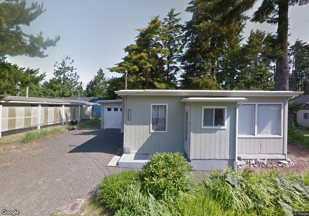
2009 SE 5th St Lincoln City, OR 97367
Estimated Value: $298,000 - $356,000
2
Beds
1
Bath
900
Sq Ft
$359/Sq Ft
Est. Value
About This Home
This home is located at 2009 SE 5th St, Lincoln City, OR 97367 and is currently estimated at $323,072, approximately $358 per square foot. 2009 SE 5th St is a home located in Lincoln County with nearby schools including Oceanlake Elementary School, Taft Elementary School, and Taft High School.
Ownership History
Date
Name
Owned For
Owner Type
Purchase Details
Closed on
Aug 9, 2005
Sold by
Rundstrom John C and Rundstrom Elaine A
Bought by
Anderson Chris D and Anderson Jennifer L
Current Estimated Value
Home Financials for this Owner
Home Financials are based on the most recent Mortgage that was taken out on this home.
Original Mortgage
$65,600
Interest Rate
5.48%
Mortgage Type
Fannie Mae Freddie Mac
Create a Home Valuation Report for This Property
The Home Valuation Report is an in-depth analysis detailing your home's value as well as a comparison with similar homes in the area
Home Values in the Area
Average Home Value in this Area
Purchase History
| Date | Buyer | Sale Price | Title Company |
|---|---|---|---|
| Anderson Chris D | $82,000 | Wte |
Source: Public Records
Mortgage History
| Date | Status | Borrower | Loan Amount |
|---|---|---|---|
| Previous Owner | Anderson Chris D | $65,600 |
Source: Public Records
Tax History Compared to Growth
Tax History
| Year | Tax Paid | Tax Assessment Tax Assessment Total Assessment is a certain percentage of the fair market value that is determined by local assessors to be the total taxable value of land and additions on the property. | Land | Improvement |
|---|---|---|---|---|
| 2024 | $2,425 | $141,250 | -- | -- |
| 2023 | $2,358 | $137,140 | $0 | $0 |
| 2022 | $2,293 | $133,150 | $0 | $0 |
| 2021 | $2,184 | $129,280 | $0 | $0 |
| 2020 | $2,134 | $125,520 | $0 | $0 |
| 2019 | $2,062 | $121,870 | $0 | $0 |
| 2018 | $2,015 | $118,330 | $0 | $0 |
| 2017 | $1,929 | $114,890 | $0 | $0 |
| 2016 | $1,810 | $111,550 | $0 | $0 |
| 2015 | $1,769 | $108,310 | $0 | $0 |
| 2014 | $1,724 | $105,160 | $0 | $0 |
| 2013 | -- | $102,100 | $0 | $0 |
Source: Public Records
Map
Nearby Homes
- 520 SE Quay Ave
- 720 SE Quay Ave
- 541 SE Oar Ave
- 2016 SE 8th St
- 380 SE Quay Ave
- TL1508 + NE East Devils Lake Rd
- 333 SE Oar Ave
- 313 SE Oar Ave
- 302 SE Neptune Ave
- 203 SE Surf Ave
- 210 SE Surf Ave
- 1219 SE Oar Ave
- 691 SE Jetty Ave
- T/L 500 SE 14th St
- 331 SE Jetty Ave
- 305 SE Jetty Ave Unit B
- 305 SE Jetty Ave Unit A
- 305 SE Jetty Ave
- Lot 6 SE Marine Ave
- 1455 SE Marine Ave
- 452 SE Port Ave
- 455 SE Quay Ave
- 710 & 720 SE Quay Ave
- 700 block SE Quay Ave
- 700Blk SE Quay Ave
- [200-299] SE Quay Ave
- 550 Blk SE Quay Ave
- 700 blk SE Quay Ave
- 527 SE Quay Ave
- 527 & 535 SE Quay Ave
- 200 SE Quay Ave
- 5900 SE Quay Ave
- 446 SE Port Ave
- 6000 Quay SE
- 456 SE Quay Ave
- 460 SE Quay Ave
- 430 Port SE
- 7 Port (Lt)
- 5100 SE Port Ave Unit 5100
- 511 SE Quay Ave