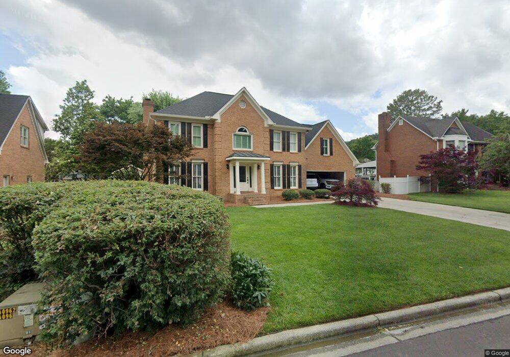
2009 Sheffield Place Dalton, GA 30720
Estimated Value: $491,643 - $578,000
--
Bed
3
Baths
3,443
Sq Ft
$155/Sq Ft
Est. Value
About This Home
This home is located at 2009 Sheffield Place, Dalton, GA 30720 and is currently estimated at $533,161, approximately $154 per square foot. 2009 Sheffield Place is a home located in Whitfield County with nearby schools including Brookwood Elementary School, Dalton Middle School, and Dalton High School.
Ownership History
Date
Name
Owned For
Owner Type
Purchase Details
Closed on
Aug 5, 2003
Sold by
Pool Thomas B
Bought by
Pool Thomas B and Mary Beth P
Current Estimated Value
Purchase Details
Closed on
Jul 30, 2003
Sold by
Sarvis Michael M and Sarvis Andrea A
Bought by
Pool Thomas B
Purchase Details
Closed on
May 21, 2001
Sold by
Parks Meredith B
Bought by
Sarvis Michael M and Sarvis Andrea A
Purchase Details
Closed on
Mar 1, 1998
Bought by
Parks Meredith B
Create a Home Valuation Report for This Property
The Home Valuation Report is an in-depth analysis detailing your home's value as well as a comparison with similar homes in the area
Home Values in the Area
Average Home Value in this Area
Purchase History
| Date | Buyer | Sale Price | Title Company |
|---|---|---|---|
| Pool Thomas B | -- | -- | |
| Pool Thomas B | $232,000 | -- | |
| Sarvis Michael M | $218,500 | -- | |
| Parks Meredith B | $207,000 | -- |
Source: Public Records
Tax History Compared to Growth
Tax History
| Year | Tax Paid | Tax Assessment Tax Assessment Total Assessment is a certain percentage of the fair market value that is determined by local assessors to be the total taxable value of land and additions on the property. | Land | Improvement |
|---|---|---|---|---|
| 2024 | $5,479 | $209,762 | $22,000 | $187,762 |
| 2023 | $5,479 | $154,192 | $20,000 | $134,192 |
| 2022 | $3,797 | $117,621 | $18,400 | $99,221 |
| 2021 | $3,802 | $117,621 | $18,400 | $99,221 |
| 2020 | $3,528 | $106,172 | $18,400 | $87,772 |
| 2019 | $3,633 | $106,172 | $18,400 | $87,772 |
| 2018 | $3,682 | $106,172 | $18,400 | $87,772 |
| 2017 | $3,539 | $106,172 | $18,400 | $87,772 |
| 2016 | $3,059 | $92,430 | $12,600 | $79,830 |
| 2014 | $2,822 | $92,430 | $12,600 | $79,830 |
| 2013 | -- | $92,429 | $12,600 | $79,829 |
Source: Public Records
Map
Nearby Homes
- 1913 Tara Place
- 1709 Dug Gap Rd
- 1922 Fairfield Dr
- 1506 Summer Gate Way
- 1506 Summer Gate Way Unit 8
- 1498 Mineral Springs Rd
- 1482 Mineral Springs Rd
- 1704 Southmont Dr
- 0 Horizon Ct Unit 130497
- 0 Horizon Ct Unit 130499
- 0 Horizon Ct Unit 130479
- 0 Horizon Ct Unit 130477
- 0 Horizon Ct Unit 130478
- 0 Horizon Ct Unit 130496
- 0 Horizon Ct Unit 130498
- 1608 Ryman Ridge Rd
- 1908 Valley Brook Dr
- 1934 Spring Chase Way
- 0 Courtland Ln Unit 131551
- 1902 W Brookhaven Cir
- 2007 Sheffield Place
- 2011 Sheffield Place
- 2006 Kingsridge Dr
- 2008 Kingsridge Dr
- 2004 Kingsridge Dr Unit 35
- 2004 Kingsridge Dr
- 2005 Sheffield Place
- 2016 Sheffield Place
- 2014 Sheffield Place
- 2002 Kingsridge Dr
- 2018 Sheffield Place
- 2013 Sheffield Place
- 2010 Kingsridge Dr
- 2012 Sheffield Place
- 2007 Kingsridge Dr
- 2003 Sheffield Place
- 2009 Kingsridge Dr
- 2005 Kingsridge Dr
- 2015 Sheffield Place
- 2010 Sheffield Place