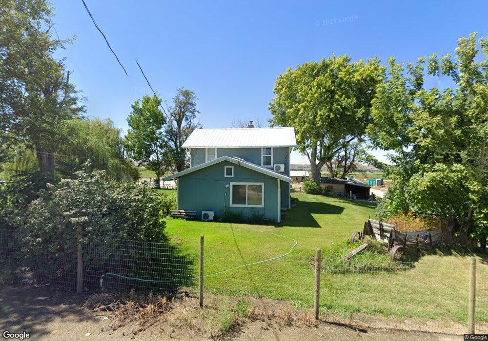
2009 Stateline Rd Adrian, OR 97901
Estimated Value: $725,701
4
Beds
2
Baths
1,198
Sq Ft
$606/Sq Ft
Est. Value
About This Home
This home is located at 2009 Stateline Rd, Adrian, OR 97901 and is currently estimated at $725,701, approximately $605 per square foot. 2009 Stateline Rd is a home located in Malheur County with nearby schools including Adrian Elementary School and Adrian High School.
Ownership History
Date
Name
Owned For
Owner Type
Purchase Details
Closed on
Sep 5, 2014
Sold by
Smith Nancy L
Bought by
Smith Michael Travis and Smith Amber Yvonne
Current Estimated Value
Home Financials for this Owner
Home Financials are based on the most recent Mortgage that was taken out on this home.
Original Mortgage
$265,000
Outstanding Balance
$198,626
Interest Rate
3.74%
Mortgage Type
USDA
Estimated Equity
$527,075
Purchase Details
Closed on
Jul 5, 2012
Sold by
Smith Nancy and Cleverly Sybil Nancy
Bought by
Cleverly Arlene and Smith Nancy L
Create a Home Valuation Report for This Property
The Home Valuation Report is an in-depth analysis detailing your home's value as well as a comparison with similar homes in the area
Purchase History
| Date | Buyer | Sale Price | Title Company |
|---|---|---|---|
| Smith Michael Travis | $176,666 | Malheur County Title Co Inc | |
| Smith Michael Travis | $88,333 | Malheur County Title Co Inc | |
| Wayman Lauretta May | -- | Malheur County Title Co Inc | |
| Cleverly Arlene | -- | None Available |
Source: Public Records
Mortgage History
| Date | Status | Borrower | Loan Amount |
|---|---|---|---|
| Open | Smith Michael Travis | $265,000 |
Source: Public Records
Tax History
| Year | Tax Paid | Tax Assessment Tax Assessment Total Assessment is a certain percentage of the fair market value that is determined by local assessors to be the total taxable value of land and additions on the property. | Land | Improvement |
|---|---|---|---|---|
| 2025 | $1,347 | $107,024 | $62,721 | $44,303 |
| 2024 | $1,364 | $104,124 | $61,111 | $43,013 |
| 2023 | $1,263 | $101,230 | $59,469 | $41,761 |
| 2022 | $1,155 | $98,420 | $57,875 | $40,545 |
| 2021 | $1,179 | $95,435 | $56,070 | $39,365 |
| 2020 | $1,121 | $92,839 | $54,620 | $38,219 |
| 2019 | $1,110 | $90,231 | $53,125 | $37,106 |
| 2018 | $1,053 | $84,227 | $51,757 | $32,470 |
| 2017 | $991 | $82,901 | $50,431 | $32,470 |
| 2016 | $1,014 | $81,613 | $49,143 | $32,470 |
| 2015 | $823 | $64,888 | $45,318 | $19,570 |
| 2014 | $852 | $66,246 | $46,676 | $19,570 |
Source: Public Records
Map
Nearby Homes
- Lot 2B Clydesdale Ln
- Lot 3B Drum Ln
- Lot 5A Drum Ln
- TBD Monte Rd
- 4.8acTBD Chips Ln
- 26635 Pioneer Ln
- 26915 Chips Ln
- 646 Overstreet Rd
- 23743 Stephen Ln
- 0 Tbd Stephen Ln
- 00 Peckham Rd
- 1964 River Rd
- 887 Overstreet Rd
- 933 Overstreet Rd
- 20383 Riverpoint Ln
- 0 Riverpoint Ln
- 0 Rodeo Ln
- 30327 Hexon Rd
- 0 Tbd Peckham Rd
- Rd
- 24448 Canal Rd
- 24232 State Line Rd
- 24474 Canal Rd
- 2077 Stateline Rd
- 24622 Canal Rd
- 23946 State Line Rd
- 23938 State Line Rd
- 24771 Canal Rd
- 561 Maulsing Rd
- 561 Maulsing Rd
- 000 Canal Rd
- 1998 Cassia Rd
- 2068 Cassia Rd
- 23770 State Line Rd
- 24648 Canal Rd
- 1950 Cassia Rd
- 2071 Cassia Rd
- 23742 State Line Rd
- 1999 Cassia Rd
- 24671 Canal Rd
Your Personal Tour Guide
Ask me questions while you tour the home.