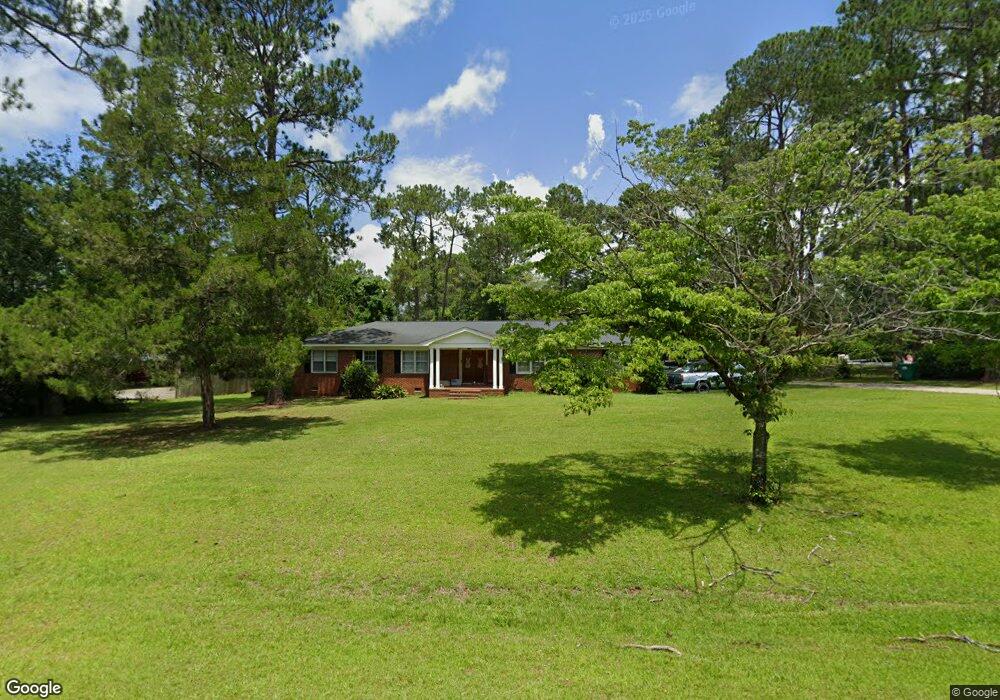
2009 Trowbridge Rd Albany, GA 31721
Estimated Value: $232,260 - $315,000
4
Beds
3
Baths
2,458
Sq Ft
$107/Sq Ft
Est. Value
About This Home
This home is located at 2009 Trowbridge Rd, Albany, GA 31721 and is currently estimated at $263,565, approximately $107 per square foot. 2009 Trowbridge Rd is a home located in Dougherty County with nearby schools including Lake Park Elementary School, Merry Acres Middle School, and Westover High School.
Ownership History
Date
Name
Owned For
Owner Type
Purchase Details
Closed on
Jun 11, 2007
Sold by
Swords Thomas Wayne
Bought by
Swords Lila Susan
Current Estimated Value
Purchase Details
Closed on
Jun 1, 2000
Sold by
Maclachlan Andrew C and Maclachlan Heidi M
Bought by
Swords Thomas W and Swords Swords
Purchase Details
Closed on
May 26, 1998
Sold by
Peterson Richard K and Peterson Martha W
Bought by
Maclachlan Andrew C and Maclachlan Heidi M
Purchase Details
Closed on
Apr 22, 1985
Sold by
Peterson Richard K
Bought by
Peterson Richard K and Peterson Martha W
Create a Home Valuation Report for This Property
The Home Valuation Report is an in-depth analysis detailing your home's value as well as a comparison with similar homes in the area
Home Values in the Area
Average Home Value in this Area
Purchase History
| Date | Buyer | Sale Price | Title Company |
|---|---|---|---|
| Swords Lila Susan | -- | -- | |
| Swords Thomas W | $128,800 | -- | |
| Maclachlan Andrew C | $120,000 | -- | |
| Peterson Richard K | -- | -- |
Source: Public Records
Tax History Compared to Growth
Tax History
| Year | Tax Paid | Tax Assessment Tax Assessment Total Assessment is a certain percentage of the fair market value that is determined by local assessors to be the total taxable value of land and additions on the property. | Land | Improvement |
|---|---|---|---|---|
| 2024 | $2,750 | $59,640 | $14,000 | $45,640 |
| 2023 | $1,847 | $59,640 | $14,000 | $45,640 |
| 2022 | $2,695 | $59,640 | $14,000 | $45,640 |
| 2021 | $2,499 | $59,640 | $14,000 | $45,640 |
| 2020 | $2,505 | $59,640 | $14,000 | $45,640 |
| 2019 | $2,469 | $58,600 | $14,000 | $44,600 |
| 2018 | $2,479 | $58,600 | $14,000 | $44,600 |
| 2017 | $2,310 | $58,600 | $14,000 | $44,600 |
| 2016 | $2,311 | $58,600 | $14,000 | $44,600 |
| 2015 | $2,317 | $58,600 | $14,000 | $44,600 |
| 2014 | $2,288 | $58,600 | $14,000 | $44,600 |
Source: Public Records
Map
Nearby Homes
- 2202 Trowbridge Rd
- 2212 Arrowwood Dr
- 2107 Cumberland Ln
- 2115 Cumberland Ln
- 1903 Devon Dr
- 3114 Westgate Dr
- 3422 Plantation Dr
- 2207 Vineyard Ct
- 3013 Ember Ct
- 1729 Dorchester Dr
- 2303 Saddlebrook Ct
- 1720 Whisperwood St
- 1800 Regalwood Dr
- 2813 Capers Ln
- 3424 Bellingham Ln
- 1627 Devon Dr
- 3108 Cane Mill Ct
- 2305 E Alberson Dr
- 1506 Westwood Dr
- 3203 Wexford Dr
- 2007 Trowbridge Rd
- 2201 Chatham Dr
- 2203 Chatham Dr
- 2010 Trowbridge Rd
- 2005 Trowbridge Rd
- 2012 Trowbridge Rd
- 2205 Chatham Dr
- 2008 Trowbridge Rd
- 2014 Trowbridge Rd
- 2006 Trowbridge Rd
- 2207 Chatham Dr
- 2003 Trowbridge Rd
- 2200 Chatham Dr
- 2202 Chatham Dr
- 2004 Trowbridge Rd
- 2112 Chatham Dr
- 2204 Chatham Dr
- 2209 Chatham Dr
- 2109 Chatham Dr
- 3310 Westgate Dr