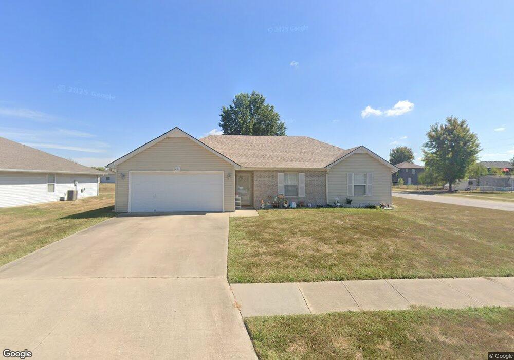
201 Aaron Ln Grain Valley, MO 64029
Estimated Value: $269,969 - $291,000
3
Beds
2
Baths
1,294
Sq Ft
$217/Sq Ft
Est. Value
About This Home
This home is located at 201 Aaron Ln, Grain Valley, MO 64029 and is currently estimated at $281,242, approximately $217 per square foot. 201 Aaron Ln is a home located in Jackson County with nearby schools including Grain Valley High School.
Ownership History
Date
Name
Owned For
Owner Type
Purchase Details
Closed on
Nov 25, 1996
Sold by
Mcbride Stephen E and Mcbride Teresa A
Bought by
Johnson Barbara A
Current Estimated Value
Home Financials for this Owner
Home Financials are based on the most recent Mortgage that was taken out on this home.
Original Mortgage
$17,650
Outstanding Balance
$1,710
Interest Rate
7.9%
Mortgage Type
Purchase Money Mortgage
Estimated Equity
$279,532
Purchase Details
Closed on
Dec 22, 1995
Sold by
Parker Ronnie J and Parker Gwenda A
Bought by
Mcbride Stephen E and Mcbride Teresa A
Home Financials for this Owner
Home Financials are based on the most recent Mortgage that was taken out on this home.
Original Mortgage
$64,000
Interest Rate
7.31%
Mortgage Type
Construction
Create a Home Valuation Report for This Property
The Home Valuation Report is an in-depth analysis detailing your home's value as well as a comparison with similar homes in the area
Home Values in the Area
Average Home Value in this Area
Purchase History
| Date | Buyer | Sale Price | Title Company |
|---|---|---|---|
| Johnson Barbara A | -- | Stewart Title | |
| Mcbride Stephen E | -- | -- |
Source: Public Records
Mortgage History
| Date | Status | Borrower | Loan Amount |
|---|---|---|---|
| Open | Johnson Barbara A | $17,650 | |
| Previous Owner | Mcbride Stephen E | $64,000 |
Source: Public Records
Tax History
| Year | Tax Paid | Tax Assessment Tax Assessment Total Assessment is a certain percentage of the fair market value that is determined by local assessors to be the total taxable value of land and additions on the property. | Land | Improvement |
|---|---|---|---|---|
| 2025 | $3,400 | $34,174 | $6,867 | $27,307 |
| 2024 | $3,273 | $41,278 | $5,482 | $35,796 |
| 2023 | $3,273 | $41,277 | $5,086 | $36,191 |
| 2022 | $2,342 | $25,840 | $6,508 | $19,332 |
| 2021 | $2,288 | $25,840 | $6,508 | $19,332 |
| 2020 | $2,325 | $25,901 | $6,508 | $19,393 |
| 2019 | $2,277 | $25,901 | $6,508 | $19,393 |
| 2018 | $2,270 | $24,127 | $3,293 | $20,834 |
| 2017 | $2,270 | $24,127 | $3,293 | $20,834 |
| 2016 | $2,212 | $23,522 | $4,389 | $19,133 |
Source: Public Records
Map
Nearby Homes
- 107 Rock Creek Dr
- 506 South St
- 211 SW Cross Creek Dr
- 1007 SW Blue Branch Dr
- 322 Front St
- 204 Young St
- 706 NW Green Dr
- 1105 NW Sawgrass Dr
- 604 SW Meadowood Dr
- 802 NW Green Dr
- 1123 Ephraim Dr
- 1121 SW Ephraim Dr
- 1232 NW Ashley Ln
- 518 SW Valley Dr
- 1302 NW Ashley Ln
- 600 SW Valley Dr
- 521 SW Lakeview Dr
- 507 SW Meadowood Dr
- 2 Ooida Dr
- TBD S Buckner Tarsney Rd
- 205 Aaron Ln
- 200 Amanda Ln
- 204 Amanda Ln
- 209 Aaron Ln
- 105 Aaron Ct
- 208 Amanda Ln
- 106 NW Amanda Ct
- 200 Aaron Ln
- 204 Aaron Ln
- 213 Aaron Ln
- 212 Amanda Ln
- 103 Aaron Ct
- 106 Aaron Ct
- 104 NW Amanda Ct
- 208 Aaron Ln
- 214 Aaron Ln
- 910 NW Crestwood Dr
- 1007 NW Crestwood Dr
- 906 NW Crestwood Dr
- 1000 NW Crestwood Dr
