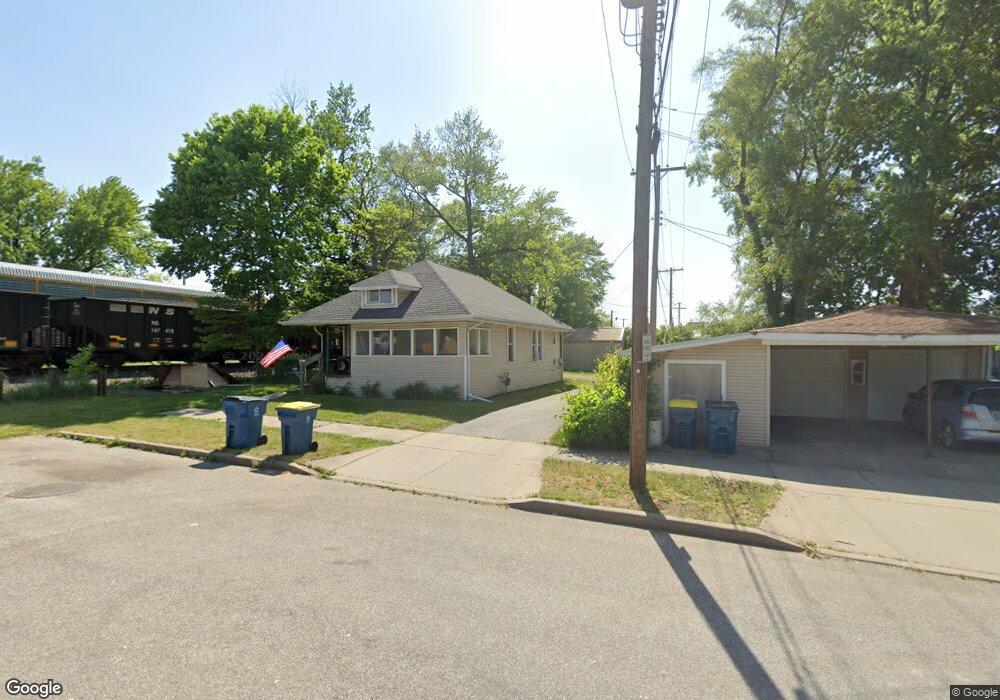
201 Alabama St Mishawaka, IN 46544
Estimated Value: $108,195 - $130,000
2
Beds
1
Bath
944
Sq Ft
$123/Sq Ft
Est. Value
About This Home
This home is located at 201 Alabama St, Mishawaka, IN 46544 and is currently estimated at $116,049, approximately $122 per square foot. 201 Alabama St is a home located in St. Joseph County with nearby schools including Lasalle Elementary School, John J. Young Middle School, and Mishawaka High School.
Ownership History
Date
Name
Owned For
Owner Type
Purchase Details
Closed on
Aug 27, 2010
Sold by
Weaver Cheryl A
Bought by
Weaver Steven E
Current Estimated Value
Purchase Details
Closed on
Jun 7, 2007
Sold by
Dillon Paul E
Bought by
The Bank Of New York Trust Co
Purchase Details
Closed on
Apr 26, 2005
Sold by
Dillon Paul E and Dillon Pamela L
Bought by
Dillon Paul E
Home Financials for this Owner
Home Financials are based on the most recent Mortgage that was taken out on this home.
Original Mortgage
$50,400
Interest Rate
6.06%
Mortgage Type
New Conventional
Create a Home Valuation Report for This Property
The Home Valuation Report is an in-depth analysis detailing your home's value as well as a comparison with similar homes in the area
Home Values in the Area
Average Home Value in this Area
Purchase History
| Date | Buyer | Sale Price | Title Company |
|---|---|---|---|
| Weaver Steven E | -- | None Available | |
| The Bank Of New York Trust Co | $56,299 | None Available | |
| Dillon Paul E | -- | None Available |
Source: Public Records
Mortgage History
| Date | Status | Borrower | Loan Amount |
|---|---|---|---|
| Previous Owner | Dillon Paul E | $50,400 |
Source: Public Records
Tax History Compared to Growth
Tax History
| Year | Tax Paid | Tax Assessment Tax Assessment Total Assessment is a certain percentage of the fair market value that is determined by local assessors to be the total taxable value of land and additions on the property. | Land | Improvement |
|---|---|---|---|---|
| 2024 | $916 | $39,000 | $7,000 | $32,000 |
| 2023 | $915 | $39,000 | $7,000 | $32,000 |
| 2022 | $915 | $42,200 | $7,000 | $35,200 |
| 2021 | $927 | $50,500 | $7,800 | $42,700 |
| 2020 | $835 | $35,300 | $9,900 | $25,400 |
| 2019 | $748 | $35,700 | $8,800 | $26,900 |
| 2018 | $941 | $31,700 | $7,800 | $23,900 |
| 2017 | $1,006 | $36,300 | $7,800 | $28,500 |
| 2016 | $1,111 | $49,800 | $7,800 | $42,000 |
| 2014 | $1,170 | $42,900 | $7,800 | $35,100 |
Source: Public Records
Map
Nearby Homes
- 510 Reddick St
- 1625 Lincolnway W
- 209 Hendricks St
- 519 Grand Blvd
- 1331 S 29th St
- 516 Somerset Ave
- 1229 S 34th St
- 3401 Northside Blvd
- 3413 Northside Blvd
- 2412 Milburn Blvd
- 912 Reddick St
- 909 Jackson St
- 1213 Lincolnway W
- 821 S Logan St
- 712 Geyer Ave
- 514 S Middleboro Ave
- 2710 Milburn Blvd
- 3312 Mishawaka Ave
- 1025 Lincolnway W
- 927 S 36th St
- 1931 Lincolnway W
- 1907 Lincolnway W
- 1907 Lincolnway W
- 1903 Lincolnway W
- 1906 W 6th St
- 1902 W 6th St
- 1914 W 6th St
- 1821 Lincolnway W
- 1918 W 6th St
- 1824 W 6th St
- 1922 W 6th St
- 1815 Lincolnway W
- 201 Carlton St
- 205 Reddick St
- 1809 Lincolnway W
- 2002 W 6th St
- 1802 W 6th St
- 2001 Lincolnway W
- 501 Alabama St
- 1805 Lincolnway W