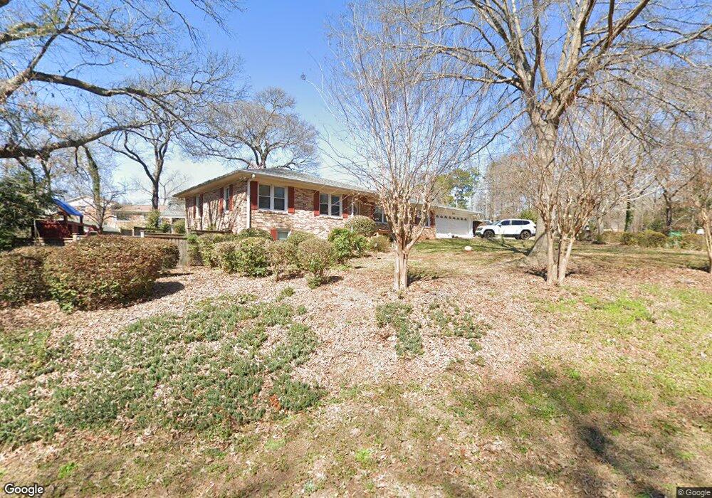
201 Alexander Dr Warner Robins, GA 31093
Estimated Value: $203,231 - $274,000
3
Beds
2
Baths
2,239
Sq Ft
$102/Sq Ft
Est. Value
About This Home
This home is located at 201 Alexander Dr, Warner Robins, GA 31093 and is currently estimated at $228,558, approximately $102 per square foot. 201 Alexander Dr is a home located in Houston County with nearby schools including Westside Elementary School, Northside Middle School, and Northside High School.
Ownership History
Date
Name
Owned For
Owner Type
Purchase Details
Closed on
May 31, 2017
Sold by
Denning Marsha Rowland
Bought by
Gillispie Thomas Ray
Current Estimated Value
Home Financials for this Owner
Home Financials are based on the most recent Mortgage that was taken out on this home.
Original Mortgage
$121,600
Outstanding Balance
$99,675
Interest Rate
4.02%
Mortgage Type
New Conventional
Estimated Equity
$128,883
Purchase Details
Closed on
Jul 16, 2016
Sold by
Lewis Earl
Bought by
Denning Marsha Rowland
Purchase Details
Closed on
Aug 9, 1965
Bought by
Rowland Earl L
Create a Home Valuation Report for This Property
The Home Valuation Report is an in-depth analysis detailing your home's value as well as a comparison with similar homes in the area
Home Values in the Area
Average Home Value in this Area
Purchase History
| Date | Buyer | Sale Price | Title Company |
|---|---|---|---|
| Gillispie Thomas Ray | $128,000 | None Available | |
| Denning Marsha Rowland | -- | -- | |
| Rowland Earl L | -- | -- |
Source: Public Records
Mortgage History
| Date | Status | Borrower | Loan Amount |
|---|---|---|---|
| Open | Gillispie Thomas Ray | $121,600 |
Source: Public Records
Tax History
| Year | Tax Paid | Tax Assessment Tax Assessment Total Assessment is a certain percentage of the fair market value that is determined by local assessors to be the total taxable value of land and additions on the property. | Land | Improvement |
|---|---|---|---|---|
| 2025 | $1,675 | $76,680 | $6,200 | $70,480 |
| 2024 | $1,700 | $71,080 | $6,200 | $64,880 |
| 2023 | $1,439 | $59,544 | $6,200 | $53,344 |
| 2022 | $1,274 | $52,704 | $5,000 | $47,704 |
| 2021 | $1,135 | $46,720 | $5,000 | $41,720 |
| 2020 | $1,135 | $46,520 | $5,000 | $41,520 |
| 2019 | $1,136 | $46,520 | $5,000 | $41,520 |
| 2018 | $1,136 | $46,520 | $5,000 | $41,520 |
| 2017 | $895 | $36,640 | $5,000 | $31,640 |
| 2016 | $897 | $36,640 | $5,000 | $31,640 |
| 2015 | $674 | $36,640 | $5,000 | $31,640 |
| 2014 | -- | $36,640 | $5,000 | $31,640 |
| 2013 | -- | $37,480 | $5,000 | $32,480 |
Source: Public Records
Map
Nearby Homes
- 209 Knodishall Dr
- 416 Knodishall Dr
- 221 Gilchrist Dr
- 111 Laurel Oak Ln
- 103 Westcliff Cir Unit A
- 103 Westcliff Cir Unit A
- 111 Hawthorne Rd
- 108 Madison Ave
- 102 Westcliff Center St Unit D
- 102 Hemlock St
- 110 Foxfire Dr
- 123 Tanglewood Dr
- 104 Heather St
- 102 Williams St
- 112 Peacock Dr
- 216 Ridgeland Dr
- 112 Holt Ave
- 316 Meadowridge Dr
- 141 Peacock Dr
- 857 Ola Dr
- 203 Alexander Dr
- 203 Taylor St
- 200 Taylor St
- 202 Stanford St
- 200 Alexander Dr
- 100 Taylor St
- 204 Alexander Dr
- 201 Stanford St
- 203 Stanford St
- 122 Flournoy Dr
- 120 Flournoy Dr
- 206 Alexander Dr
- 302 Taylor St
- 207 Stanford St
- 303 Taylor St
- 304 Taylor St
- 123 Flournoy Dr
- 121 Flournoy Dr
- 203 Meadow Glen Ct
- 119 Flournoy Dr
Your Personal Tour Guide
Ask me questions while you tour the home.