Estimated Value: $574,798 - $639,000
5
Beds
3
Baths
2,275
Sq Ft
$262/Sq Ft
Est. Value
About This Home
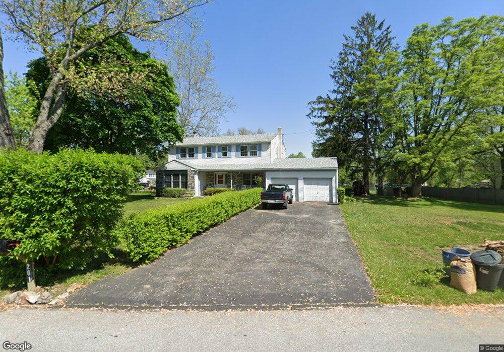
This home is located at 201 Allen Dr, Exton, PA 19341 and is currently estimated at $595,700, approximately $261 per square foot. 201 Allen Dr is a home located in Chester County with nearby schools including Lionville Elementary School, Lionville Middle School, and Downingtown High School East.
Ownership History
Date
Name
Owned For
Owner Type
Purchase Details
Closed on
Feb 11, 2005
Sold by
Hopkins Karl F and Hopkins Lois J
Bought by
Hopkins Lois J
Current Estimated Value
Purchase Details
Closed on
Feb 13, 2003
Sold by
Hopkins Lois Jean
Bought by
Hopkins Lois J and Hopkins Karl F
Home Financials for this Owner
Home Financials are based on the most recent Mortgage that was taken out on this home.
Original Mortgage
$85,000
Interest Rate
5.98%
Create a Home Valuation Report for This Property
The Home Valuation Report is an in-depth analysis detailing your home's value as well as a comparison with similar homes in the area
Home Values in the Area
Average Home Value in this Area
Purchase History
| Date | Buyer | Sale Price | Title Company |
|---|---|---|---|
| Hopkins Lois J | -- | -- | |
| Hopkins Lois J | -- | Lawyers Title Insurance Corp |
Source: Public Records
Mortgage History
| Date | Status | Borrower | Loan Amount |
|---|---|---|---|
| Closed | Hopkins Lois J | $85,000 |
Source: Public Records
Tax History Compared to Growth
Tax History
| Year | Tax Paid | Tax Assessment Tax Assessment Total Assessment is a certain percentage of the fair market value that is determined by local assessors to be the total taxable value of land and additions on the property. | Land | Improvement |
|---|---|---|---|---|
| 2025 | $5,239 | $153,060 | $38,490 | $114,570 |
| 2024 | $5,239 | $153,060 | $38,490 | $114,570 |
| 2023 | $5,086 | $153,060 | $38,490 | $114,570 |
| 2022 | $4,959 | $153,060 | $38,490 | $114,570 |
| 2021 | $4,875 | $153,060 | $38,490 | $114,570 |
| 2020 | $4,848 | $153,060 | $38,490 | $114,570 |
| 2019 | $4,848 | $153,060 | $38,490 | $114,570 |
| 2018 | $4,848 | $153,060 | $38,490 | $114,570 |
| 2017 | $4,848 | $153,060 | $38,490 | $114,570 |
| 2016 | $4,494 | $153,060 | $38,490 | $114,570 |
| 2015 | $4,494 | $153,060 | $38,490 | $114,570 |
| 2014 | $4,494 | $153,060 | $38,490 | $114,570 |
Source: Public Records
Map
Nearby Homes
- 109 Glendale Rd
- 208 Morris Rd
- 214 Louis Dr
- 30 S Village Ave
- 510 Woodview Dr
- 701 Worthington Dr Unit 701
- 324 Conner Dr
- 315 Oak Ln W
- 204 Mill Pond Dr
- 229 Cambridge Chase Unit 30
- 491 Orchard Cir
- 312 Green Cir
- Santorini Plan at Worthington Farm - Luxury Single-Family Homes
- Monaco Plan at Worthington Farm - Luxury Single-Family Homes
- Lisbon Plan at Worthington Farm - Luxury Single-Family Homes
- 420 Oakland Dr
- 100 Brookhollow Dr
- 464 E Radnor Ct
- 534 Pewter Dr
- 4506 Adams Ct Unit 4506