Estimated Value: $548,000 - $829,000
--
Bed
--
Bath
2,551
Sq Ft
$256/Sq Ft
Est. Value
About This Home
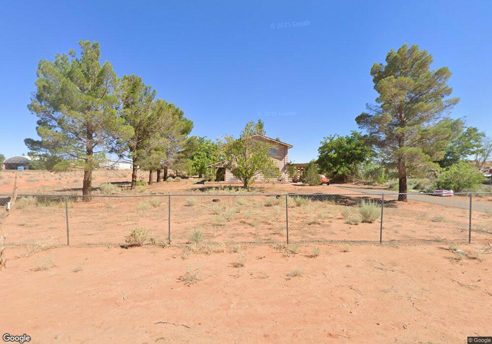
This home is located at 201 Appaloosa Rd, Page, AZ 86040 and is currently estimated at $653,132, approximately $256 per square foot. 201 Appaloosa Rd is a home with nearby schools including Desert View Elementary Intermediate School, Lake View Elementary Primary School, and Page Middle School.
Ownership History
Date
Name
Owned For
Owner Type
Purchase Details
Closed on
Aug 29, 2006
Sold by
Hollis Jack and Heath Claudia
Bought by
Ladd James L and Ladd Adrianna
Current Estimated Value
Home Financials for this Owner
Home Financials are based on the most recent Mortgage that was taken out on this home.
Original Mortgage
$270,000
Interest Rate
6.39%
Mortgage Type
New Conventional
Purchase Details
Closed on
Oct 25, 2002
Sold by
Tonkin Katherine L and Stromquist Erik
Bought by
Hollis Jack and Heath Claudia
Create a Home Valuation Report for This Property
The Home Valuation Report is an in-depth analysis detailing your home's value as well as a comparison with similar homes in the area
Home Values in the Area
Average Home Value in this Area
Purchase History
| Date | Buyer | Sale Price | Title Company |
|---|---|---|---|
| Ladd James L | $340,000 | First American Title Ins Co | |
| Hollis Jack | $285,000 | First American Title Ins Co |
Source: Public Records
Mortgage History
| Date | Status | Borrower | Loan Amount |
|---|---|---|---|
| Previous Owner | Ladd James L | $270,000 |
Source: Public Records
Tax History Compared to Growth
Tax History
| Year | Tax Paid | Tax Assessment Tax Assessment Total Assessment is a certain percentage of the fair market value that is determined by local assessors to be the total taxable value of land and additions on the property. | Land | Improvement |
|---|---|---|---|---|
| 2025 | $2,209 | $45,459 | -- | -- |
| 2024 | $2,209 | $42,623 | -- | -- |
| 2023 | $2,821 | $35,433 | $0 | $0 |
| 2022 | $2,009 | $30,869 | $0 | $0 |
| 2021 | $2,236 | $28,484 | $0 | $0 |
| 2020 | $1,805 | $27,749 | $0 | $0 |
| 2019 | $1,746 | $25,554 | $0 | $0 |
| 2018 | $1,733 | $22,286 | $0 | $0 |
| 2017 | $1,672 | $21,586 | $0 | $0 |
| 2016 | $1,585 | $21,028 | $0 | $0 |
| 2015 | $1,581 | $20,892 | $0 | $0 |
Source: Public Records
Map
Nearby Homes
- 22 Sunset St Unit 22
- 39 W Jerome St
- 2 Echo Ct
- 134 Calle Hermosa
- 57 Aero Ave
- 8.35 Acres S Parcel Rainbow Dr
- 265 Myrtle Dr
- 451 Ticaboo Canyon Dr Unit 33
- 461 Ticaboo Canyon Dr Unit 34
- 12 Sumner Cove
- 142 Bryce Canyon Dr
- 152 Bryce Canyon Dr
- 30 Tek Ct
- 130 Tek Ct Unit 95
- 665 N Anasazi Dr Unit Lot 19
- 142 Dunn Dr
- 1334 E Rock Ledge Ln
- 1260 Patrick Henry Ct
- 1140 Independence
- 1140 S Independence Dr
- 211 Appaloosa Rd
- 200 Appaloosa Rd
- 210 Appaloosa Rd
- 221 Appaloosa Rd
- 220 Appaloosa Rd
- 231 Appaloosa Rd
- 230 Appaloosa Rd
- 54-57 W Haul Rd
- 58-61 W Haul Rd
- 241 Appaloosa Rd
- 240 Appaloosa Rd
- 201 Elk Rd
- 113 Canyon Ct
- 250 Appaloosa Rd
- 221 Elk Rd
- 251 Appaloosa Rd
- 107 Canyon Ct
- 211 Elk Rd
- 106 Canyon Ct
- 241 Elk Rd