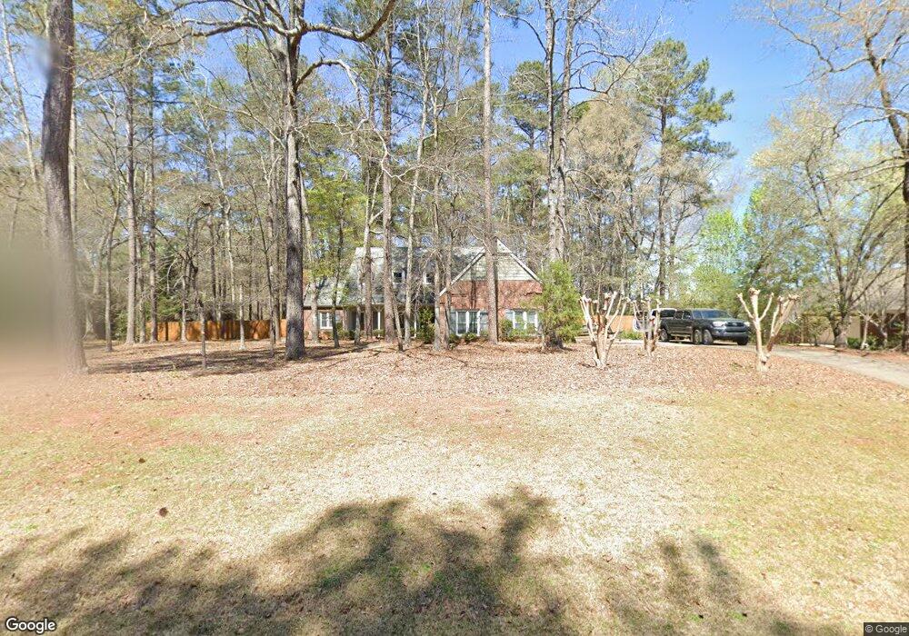
201 Ashford Cir Lagrange, GA 30240
Estimated Value: $371,135 - $473,000
4
Beds
3
Baths
3,002
Sq Ft
$140/Sq Ft
Est. Value
About This Home
This home is located at 201 Ashford Cir, Lagrange, GA 30240 and is currently estimated at $418,784, approximately $139 per square foot. 201 Ashford Cir is a home located in Troup County with nearby schools including Franklin Forest Elementary School, Hollis Hand Elementary School, and Ethel W. Kight Elementary School.
Ownership History
Date
Name
Owned For
Owner Type
Purchase Details
Closed on
Jun 3, 1987
Sold by
Shelia M Hadden
Bought by
Mcmillan John C and Mcmillan Beth W
Current Estimated Value
Purchase Details
Closed on
Sep 1, 1986
Sold by
Wendell J Hadden
Bought by
Shelia M Hadden
Purchase Details
Closed on
Jan 1, 1986
Sold by
West Ga Estates
Bought by
Wendell J Hadden
Create a Home Valuation Report for This Property
The Home Valuation Report is an in-depth analysis detailing your home's value as well as a comparison with similar homes in the area
Purchase History
| Date | Buyer | Sale Price | Title Company |
|---|---|---|---|
| Mcmillan John C | $158,000 | -- | |
| Shelia M Hadden | -- | -- | |
| Wendell J Hadden | -- | -- |
Source: Public Records
Tax History
| Year | Tax Paid | Tax Assessment Tax Assessment Total Assessment is a certain percentage of the fair market value that is determined by local assessors to be the total taxable value of land and additions on the property. | Land | Improvement |
|---|---|---|---|---|
| 2025 | $4,056 | $155,440 | $18,000 | $137,440 |
| 2024 | $3,823 | $142,160 | $18,000 | $124,160 |
| 2023 | $3,345 | $124,640 | $14,000 | $110,640 |
| 2022 | $3,229 | $117,680 | $14,000 | $103,680 |
| 2021 | $3,044 | $102,920 | $14,000 | $88,920 |
| 2020 | $3,044 | $102,920 | $14,000 | $88,920 |
| 2019 | $2,960 | $100,120 | $14,000 | $86,120 |
| 2018 | $2,960 | $100,120 | $14,000 | $86,120 |
| 2017 | $2,960 | $100,120 | $14,000 | $86,120 |
| 2016 | $3,067 | $103,682 | $14,000 | $89,682 |
| 2015 | $3,073 | $103,682 | $14,000 | $89,682 |
| 2014 | $3,022 | $101,833 | $14,000 | $87,833 |
| 2013 | -- | $99,264 | $14,000 | $85,264 |
Source: Public Records
Map
Nearby Homes
- 502 Ashford Cir
- 103 Woodchase
- 103 Windridge
- 107 Windridge
- 110 Pond View Point
- 109 Windridge
- 114 Red Oak Trail
- 209 River Oaks Dr
- 104 Englewood Dr
- 1784 Mooty Bridge Rd
- 91 Richmond Dr
- 104 Sweetgum Dr
- 115 Meadowland Trail
- 106 Highland Park
- 64 Waterview Ct
- 102 Beech Creek Dr
- 204 Dixie Creek Dr
- 203 S Chilton Crescent
- 201 S Chilton Crescent
- 0 Waterview Dr Unit 10558462
- 203 Ashford Cir
- 107 Ashford Cir
- 100 Moss Creek Dr Unit 45
- 202 Ashford Cir
- 102 Moss Creek Dr
- 205 Ashford Cir
- 105 Ashford Cir
- 204 Ashford Cir
- 104 Moss Creek Dr
- 110 Hunter Ridge Dr
- 500 Ashford Cir
- 104 Ashford Cir
- 207 Ashford Cir
- 112 Hunter Ridge Dr
- 103 Ashford Cir
- 111 Hunter Ridge Dr
- 101 Saint Clare Ct
- 206 Ashford Cir
- 503 Ashford Cir
- 106 Moss Creek Dr
Your Personal Tour Guide
Ask me questions while you tour the home.