Estimated Value: $177,000 - $200,945
--
Bed
--
Bath
1,092
Sq Ft
$173/Sq Ft
Est. Value
About This Home
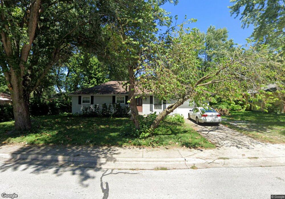
This home is located at 201 Aspen Dr, Nixa, MO 65714 and is currently estimated at $188,986, approximately $173 per square foot. 201 Aspen Dr is a home with nearby schools including P.S. 376, Hugh W. Gregg Elementary School, and Summit Intermediate School.
Ownership History
Date
Name
Owned For
Owner Type
Purchase Details
Closed on
Mar 6, 2006
Sold by
Bernet Robert and Bernet Lisa
Bought by
Last Light Llc
Current Estimated Value
Home Financials for this Owner
Home Financials are based on the most recent Mortgage that was taken out on this home.
Original Mortgage
$56,800
Outstanding Balance
$20,966
Interest Rate
6.5%
Mortgage Type
Adjustable Rate Mortgage/ARM
Estimated Equity
$168,020
Purchase Details
Closed on
Feb 15, 2006
Sold by
Fannie Mae
Bought by
Bernet Robert and Bernet Lisa
Home Financials for this Owner
Home Financials are based on the most recent Mortgage that was taken out on this home.
Original Mortgage
$56,800
Outstanding Balance
$20,966
Interest Rate
6.5%
Mortgage Type
Adjustable Rate Mortgage/ARM
Estimated Equity
$168,020
Create a Home Valuation Report for This Property
The Home Valuation Report is an in-depth analysis detailing your home's value as well as a comparison with similar homes in the area
Home Values in the Area
Average Home Value in this Area
Purchase History
| Date | Buyer | Sale Price | Title Company |
|---|---|---|---|
| Last Light Llc | -- | None Available | |
| Bernet Robert | -- | None Available |
Source: Public Records
Mortgage History
| Date | Status | Borrower | Loan Amount |
|---|---|---|---|
| Open | Bernet Robert | $56,800 |
Source: Public Records
Tax History Compared to Growth
Tax History
| Year | Tax Paid | Tax Assessment Tax Assessment Total Assessment is a certain percentage of the fair market value that is determined by local assessors to be the total taxable value of land and additions on the property. | Land | Improvement |
|---|---|---|---|---|
| 2024 | $1,102 | $17,690 | -- | -- |
| 2023 | $1,102 | $17,690 | $0 | $0 |
| 2022 | $985 | $15,790 | $0 | $0 |
| 2021 | $986 | $15,790 | $0 | $0 |
| 2020 | $854 | $13,050 | $0 | $0 |
| 2019 | $854 | $13,050 | $0 | $0 |
| 2018 | $740 | $12,140 | $0 | $0 |
| 2017 | $740 | $12,140 | $0 | $0 |
| 2016 | $728 | $12,140 | $0 | $0 |
| 2015 | $729 | $12,140 | $12,140 | $0 |
| 2014 | $710 | $12,120 | $0 | $0 |
| 2013 | $7 | $12,120 | $0 | $0 |
| 2011 | $7 | $24,520 | $0 | $0 |
Source: Public Records
Map
Nearby Homes
- 200 Aspen Dr
- 718 Evergreen Ave
- 101 W Lorene St
- 909 Erin Ct
- 734 N Bluegill St
- 102 W Bennett St
- 501 N Main St
- 211 W Hunter Dr
- 416 N Prospect St
- 1102 N Arlington
- 506 N Hightower Ave
- 711 E Striper Dr
- 1271 N Maxine Ave
- 910 Northview Dr
- 1343 N Maxine Ave
- 1281 N Maxine Ave
- Obsidian B Plan at Walker Estates
- 1383 N Maxine Ave
- Diamond Plan at Walker Estates
- Amber Plan at Walker Estates