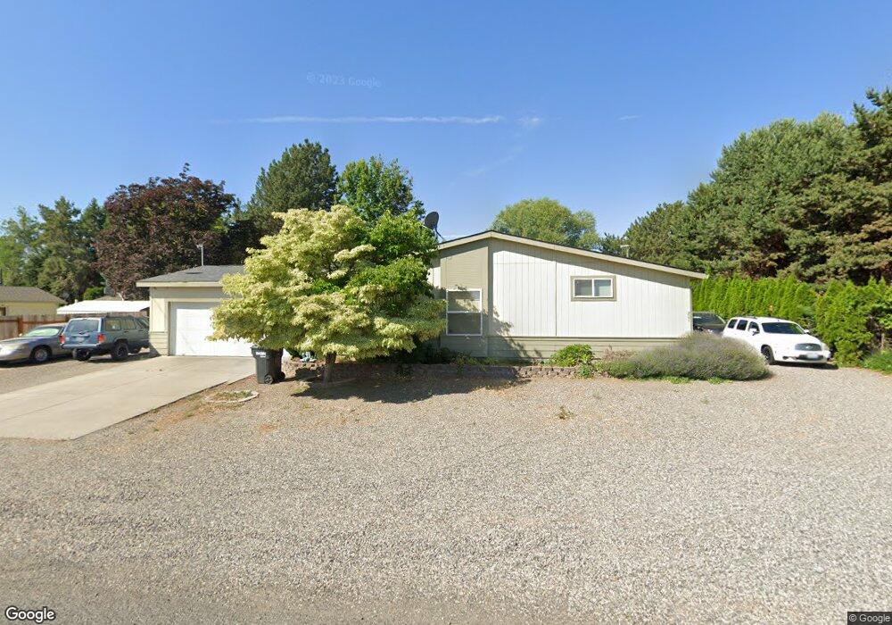
201 Austin Dr West Richland, WA 99353
Estimated Value: $418,000 - $524,000
3
Beds
--
Bath
2,400
Sq Ft
$197/Sq Ft
Est. Value
About This Home
This home is located at 201 Austin Dr, West Richland, WA 99353 and is currently estimated at $473,952, approximately $197 per square foot. 201 Austin Dr is a home with nearby schools including Tapteal Elementary School, Hanford High School, and Liberty Christian School of the Tri-Cities.
Ownership History
Date
Name
Owned For
Owner Type
Purchase Details
Closed on
Jul 29, 2020
Sold by
Brown Sharon M and Brown Richard
Bought by
Meeks Mark
Current Estimated Value
Home Financials for this Owner
Home Financials are based on the most recent Mortgage that was taken out on this home.
Original Mortgage
$281,486
Outstanding Balance
$250,159
Interest Rate
3.1%
Mortgage Type
VA
Estimated Equity
$223,793
Purchase Details
Closed on
Feb 2, 2005
Sold by
Compton Betty F
Bought by
Gest Earl E and Gest Sharon M
Home Financials for this Owner
Home Financials are based on the most recent Mortgage that was taken out on this home.
Original Mortgage
$141,501
Interest Rate
5.81%
Mortgage Type
FHA
Create a Home Valuation Report for This Property
The Home Valuation Report is an in-depth analysis detailing your home's value as well as a comparison with similar homes in the area
Home Values in the Area
Average Home Value in this Area
Purchase History
| Date | Buyer | Sale Price | Title Company |
|---|---|---|---|
| Meeks Mark | $347,000 | Chicago Title | |
| Gest Earl E | $143,500 | Chicago Title |
Source: Public Records
Mortgage History
| Date | Status | Borrower | Loan Amount |
|---|---|---|---|
| Open | Meeks Mark | $281,486 | |
| Previous Owner | Gest Earl E | $141,501 |
Source: Public Records
Tax History Compared to Growth
Tax History
| Year | Tax Paid | Tax Assessment Tax Assessment Total Assessment is a certain percentage of the fair market value that is determined by local assessors to be the total taxable value of land and additions on the property. | Land | Improvement |
|---|---|---|---|---|
| 2024 | $4,051 | $282,750 | $50,000 | $232,750 |
| 2023 | $4,051 | $354,370 | $50,000 | $304,370 |
| 2022 | $4,084 | $318,560 | $50,000 | $268,560 |
| 2021 | $3,539 | $312,590 | $50,000 | $262,590 |
| 2020 | $3,667 | $258,660 | $50,000 | $208,660 |
| 2019 | $2,558 | $258,660 | $50,000 | $208,660 |
| 2018 | $2,908 | $188,680 | $32,000 | $156,680 |
| 2017 | $2,595 | $188,680 | $32,000 | $156,680 |
| 2016 | $2,469 | $188,680 | $32,000 | $156,680 |
| 2015 | $2,503 | $188,680 | $32,000 | $156,680 |
| 2014 | -- | $188,680 | $32,000 | $156,680 |
| 2013 | -- | $188,680 | $32,000 | $156,680 |
Source: Public Records
Map
Nearby Homes
- 393 S 41st Ave
- 8 Crown Drive Private
- 8 Royal Crest Loop
- 526 S 40th Ave Unit A203
- 526 S 40th Ave Unit A102
- 526 S 40th Ave Unit D210
- 212 S 39th Ave
- 4417 King Dr
- 5404 Collins Rd
- 3706 Grant Loop
- 3738 Grant Loop
- 5433 Fern Loop
- 1336 S 50th Ave
- 1322 Kalani Ct
- 1313 Kalani Ct
- 1325 Kalani Ct
- 1334 Kalani Ct
- 1356 Kalani Ct
- 1374 Kalani Ct
- 1393 Kalani Ct
- 211 Austin Dr
- 108 Austin Dr
- 111 Austin Dr
- 210 Austin Dr
- 210 Bombing Range Rd
- 221 Austin Dr
- 222 Austin Dr
- 4365 W van Giesen St
- 307 Austin Dr
- 4600 Collins Rd
- 4430 W van Giesen St Unit 106
- 308 Austin Dr
- 319 Austin Dr
- 4390 W van Giesen St
- 4390 W van Giesen St Unit B
- 320 Bombing Range Rd
- 4330 W van Giesen St
- 4397 Fallon Dr
- 4381 Fallon Dr
- 10 N 46th Ave