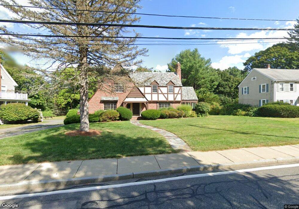
201 Bacon St Natick, MA 01760
Estimated Value: $1,179,715 - $1,311,000
3
Beds
3
Baths
2,495
Sq Ft
$497/Sq Ft
Est. Value
About This Home
This home is located at 201 Bacon St, Natick, MA 01760 and is currently estimated at $1,240,429, approximately $497 per square foot. 201 Bacon St is a home located in Middlesex County with nearby schools including Natick High School, Wilson Middle School, and Bennett-Hemenway (Ben-Hem) Elementary School.
Ownership History
Date
Name
Owned For
Owner Type
Purchase Details
Closed on
Jan 25, 2017
Sold by
Meisner Kenneth D
Bought by
Meisner Cynthia A
Current Estimated Value
Purchase Details
Closed on
Sep 30, 2015
Sold by
Meisner Kenneth D
Bought by
Meisner Cynthia A
Purchase Details
Closed on
Oct 26, 2012
Sold by
Meisner Cynthia A
Bought by
Meisner Kenneth D
Purchase Details
Closed on
Mar 29, 2007
Sold by
Meisner Kenneth D
Bought by
Meisner Cynthia A
Purchase Details
Closed on
Jan 13, 1995
Sold by
Fair Isabella F Est
Bought by
Meisner Kenneth D and Meisner Cynthia A
Home Financials for this Owner
Home Financials are based on the most recent Mortgage that was taken out on this home.
Original Mortgage
$198,000
Interest Rate
9.23%
Mortgage Type
Purchase Money Mortgage
Create a Home Valuation Report for This Property
The Home Valuation Report is an in-depth analysis detailing your home's value as well as a comparison with similar homes in the area
Home Values in the Area
Average Home Value in this Area
Purchase History
| Date | Buyer | Sale Price | Title Company |
|---|---|---|---|
| Meisner Cynthia A | -- | -- | |
| Meisner Cynthia A | -- | -- | |
| Meisner Kenneth D | -- | -- | |
| Meisner Cynthia A | -- | -- | |
| Meisner Kenneth D | $291,000 | -- |
Source: Public Records
Mortgage History
| Date | Status | Borrower | Loan Amount |
|---|---|---|---|
| Previous Owner | Meisner Kenneth D | $386,284 | |
| Previous Owner | Meisner Kenneth D | $193,500 | |
| Previous Owner | Meisner Kenneth D | $198,000 |
Source: Public Records
Tax History Compared to Growth
Tax History
| Year | Tax Paid | Tax Assessment Tax Assessment Total Assessment is a certain percentage of the fair market value that is determined by local assessors to be the total taxable value of land and additions on the property. | Land | Improvement |
|---|---|---|---|---|
| 2025 | $11,735 | $981,200 | $504,200 | $477,000 |
| 2024 | $11,337 | $924,700 | $477,600 | $447,100 |
| 2023 | $10,760 | $851,300 | $443,100 | $408,200 |
| 2022 | $10,298 | $772,000 | $398,600 | $373,400 |
| 2021 | $10,762 | $707,200 | $377,600 | $329,600 |
| 2020 | $9,198 | $675,800 | $346,200 | $329,600 |
| 2019 | $8,374 | $675,800 | $346,200 | $329,600 |
| 2018 | $7,968 | $610,600 | $314,700 | $295,900 |
| 2017 | $7,742 | $573,900 | $283,400 | $290,500 |
| 2016 | $7,546 | $556,100 | $268,400 | $287,700 |
| 2015 | $7,365 | $532,900 | $268,400 | $264,500 |
Source: Public Records
Map
Nearby Homes
- 12 Linden St
- 58 N Main St Unit 304
- 20 Florence St Unit B
- 7 Jackson Ct Unit B
- 4 Willow St
- 25 Sawin St
- 2 Yuba Place
- 16 Harvard St
- 26 Walnut St
- 34 N Main St Unit 2
- 287 Bacon St
- 3 Vale St Unit B
- 293 Bacon St Unit A
- 49 Summer St
- 31 Marion St
- 62 E Central St Unit 305
- 20 Marion St
- 3 Wilson St Unit 3B
- 8 Flynn St
- 4B Lincoln St Unit 4B