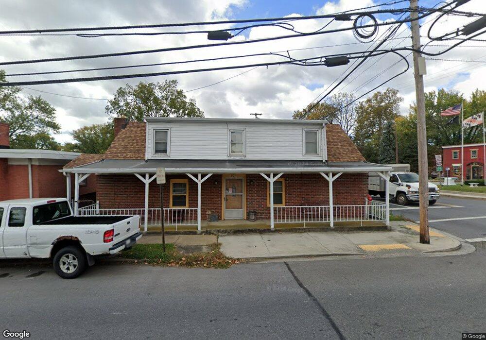
201 Baltimore St E Funkstown, MD 21734
Estimated Value: $284,000 - $322,000
4
Beds
1
Bath
2,460
Sq Ft
$123/Sq Ft
Est. Value
About This Home
This home is located at 201 Baltimore St E, Funkstown, MD 21734 and is currently estimated at $303,370, approximately $123 per square foot. 201 Baltimore St E is a home located in Washington County with nearby schools including Ruth Ann Monroe Primary School, Eastern Elementary School, and E. Russell Hicks Middle School.
Ownership History
Date
Name
Owned For
Owner Type
Purchase Details
Closed on
Aug 25, 2010
Sold by
Bank Us National Association
Bought by
Taylor Tammi
Current Estimated Value
Purchase Details
Closed on
Feb 16, 2010
Sold by
Linton Jason
Bought by
Bank Us National Association
Purchase Details
Closed on
Nov 10, 2004
Sold by
Rizer Walter H
Bought by
Linton Dana and Linton Jaosn
Create a Home Valuation Report for This Property
The Home Valuation Report is an in-depth analysis detailing your home's value as well as a comparison with similar homes in the area
Home Values in the Area
Average Home Value in this Area
Purchase History
| Date | Buyer | Sale Price | Title Company |
|---|---|---|---|
| Taylor Tammi | $74,500 | -- | |
| Bank Us National Association | -- | -- | |
| Linton Dana | $179,000 | -- |
Source: Public Records
Mortgage History
| Date | Status | Borrower | Loan Amount |
|---|---|---|---|
| Closed | Taylor Tammi | -- |
Source: Public Records
Tax History
| Year | Tax Paid | Tax Assessment Tax Assessment Total Assessment is a certain percentage of the fair market value that is determined by local assessors to be the total taxable value of land and additions on the property. | Land | Improvement |
|---|---|---|---|---|
| 2025 | $1,458 | $228,200 | $0 | $0 |
| 2024 | $1,458 | $202,900 | $45,900 | $157,000 |
| 2023 | $1,380 | $180,533 | $0 | $0 |
| 2022 | $1,307 | $158,167 | $0 | $0 |
| 2021 | $1,264 | $135,800 | $45,900 | $89,900 |
| 2020 | $1,264 | $135,800 | $45,900 | $89,900 |
| 2019 | $1,270 | $135,800 | $45,900 | $89,900 |
| 2018 | $1,324 | $141,600 | $52,600 | $89,000 |
| 2017 | $1,308 | $139,933 | $0 | $0 |
| 2016 | -- | $138,267 | $0 | $0 |
| 2015 | $1,308 | $136,600 | $0 | $0 |
| 2014 | $1,308 | $136,600 | $0 | $0 |
Source: Public Records
Map
Nearby Homes
- 414 Beaver Creek Rd
- 11 Funkstown Rd
- 2 Charlotte St
- 12.3 AC Southern Blvd
- 90 Charlotte St
- 104 Charlotte St
- 103 Charlotte St
- 104 S Edgewood Dr Unit 104
- 1619 Dual Hwy
- 329 Emmert Rd
- 1747 Edgewood Hill Cir Unit 201
- 628 Knightsbridge Dr
- 605 Knightsbridge Dr
- 0 Kenly Ave
- 920 Frederick St
- 925 Frederick St
- 202 S Fork Dr
- 1522 Dual Hwy
- 8 Brightwood Dr
- 10229 Mar Rock Dr
- 201 E Baltimore St
- 215 E Baltimore St
- 209 E Baltimore St
- 217 E Baltimore St
- 206 E Baltimore St
- 212 E Baltimore St
- 215 E Baltimore St
- 200 E Baltimore St
- 115 E Baltimore St
- 206 Baltimore St
- 8 Frederick Rd
- 40 Frederick Rd
- 114 E Baltimore St
- 217 E Baltimore St
- 108 Baltimore St
- 217 Baltimore St E
- 205 E Chestnut St
- 9 Frederick Rd
- 8 E Maple St
- 108 E Baltimore St
Your Personal Tour Guide
Ask me questions while you tour the home.